
Today has been a day of models shifting east meaning less snow. While this is the case, this storm still has historic potential especially near Boston.

Snow map adjusted for track shift.
All other aspects of the storm look to be about the same as last forecast.
-Jack
Daily Archives: February 8, 2013
Morning update
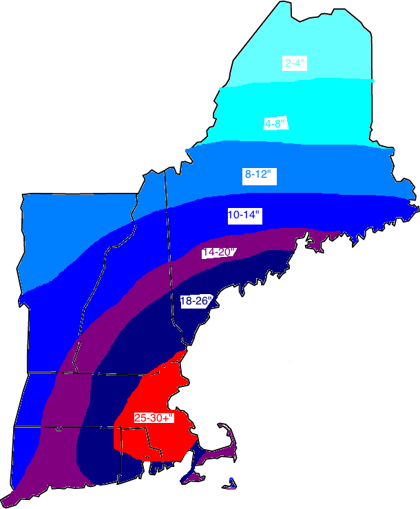
Updated snow map.
New models this morning show a stronger storm a little farther west which means, more snow. Also, this means winds will be slightly higher. We will see conditions deteriorate rapidly this afternoon/evening with blizzard conditions across much of New England by evening. Coastal flooding is also of concern with a 2-4′ surge forecasted to hit NYC/Boston. This round of flooding will not be damaging as of now. The main precip shield is moving north and the leading edge is past NYC. The snow across Maine now is from the clipper system which will merge or phase with the moisture laden southern low which is currently starting its rapid intensification.
-Jack
