Classic November Gale Arrives Today

Hello everyone!

A storm is on the way this afternoon and it’ll run the New England November Gale playbook to a tee.

Low pressure will pass to our west which means we’re on the warm side of the storm and winds will be picking up out of the southeast later this morning.

We had a beautiful sunrise here in Boothbay Harbor but mid/high clouds are quickly obscuring any early glimpses of the sun and overcast skies will be the rule for the rest of the day.

This forecast map shows expected conditions at noon today, by which point rain will be falling in southern NH as well as along the southeast-facing slopes of the mountains where upsloping will be at work with developing southeasterly flow. Temps will be considerably cooler inland (mid/upper 30s) than near the coast (low to mid 50s).

Winds during the morning hours will remain light as we need to wait for the heavier rain to mix down strong winds from aloft.

By the time this forecast map is valid at 5 PM, that process will be underway south of Portland where winds will be gusting over 30 mph. Steady/heavy rain will be falling across the entire area with a few isolated pockets of sleet/snow in the highest terrain.

The storm will peak overnight tonight as bands of very heavy rain with embedded thunderstorms move up the coast from Massachusetts. These showers and storms will tap into the energy of a low-level jet stream just above the surface packing hurricane force winds. Not all of that energy will make it to the ground, but coastal spots especially northeast of Portland are likely looking at 50-60 mph gusts beginning around 7 PM today and continuing through midday tomorrow.

This animation shows forecasted wind speeds from 1 PM today to 1 PM tomorrow. Note the extended period of strong SE winds along the coast starting this evening and continuing into tomorrow before a cold front slowly pushes east and winds shift around to the southwest.

Power outages are likely especially in the usually-prone areas so make sure you prepare today for that possibility.

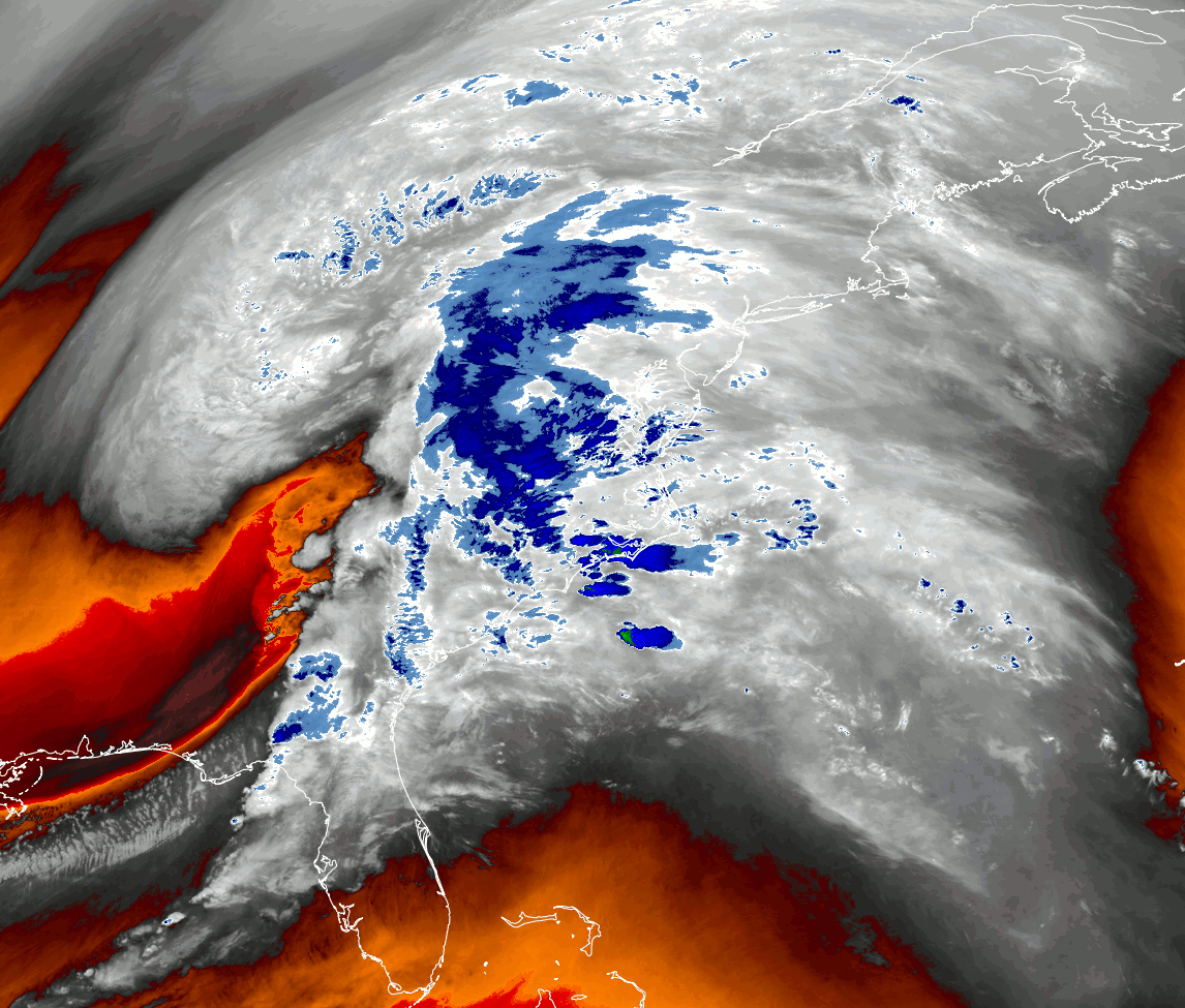
This forecast loop shows atmospheric moisture content and winds in that low-level jet I mentioned earlier. The strong southerly winds that we’re worried about causing power outages are also bringing a plume of moisture up from the deep tropics. It’s hard to overstate how unusual this airmass will be for our area for this time of year! That moisture will support very heavy rain tonight and tomorrow morning. The Midcoast and southeast-facing hills/mountains should expect 3-5″ of rain from this storm while most of the rest of Maine picks up 2-4″. New Hampshire won’t get the heavy rain for nearly as long tomorrow so will end up with a bit less (1-3″ outside the Whites).

This will provide a very helpful nail in the coffin of our drought, which should prevent substantial river flooding issues. That said, small streams will make a run at their banks tonight/tomorrow morning and the usual poor drainage spots will fill up with water. Keep an eye on that if you’re headed out and about tonight.

Heavy rain and wind will continue tomorrow morning before gradually tapering off from west to east tomorrow midday/afternoon.

-Jack

Nicer Weather Today

Hello everyone!

After several cloudy and showery days, we’re finally looking for some sun to arrive today as high pressure crosses the region ahead of our next storm system. Upslope clouds are still hanging on in the usual spots up north and a few clouds are lingering along the midcoast but otherwise, sunshine is the rule this morning. Most spots should be partly/mostly sunny until high clouds begin arriving from the west this evening. Sunshine and relatively mild air aloft will push temps into the upper 30s north and upper 40s south. Enjoy the nice weather today, the storm moving in tomorrow looks to be a fairly impressive one with high winds and torrential rain. It will linger through most of Tuesday too.

-Jack

Another Round Of Scattered Showers Today

Hello everyone!

A weak cold front will cross the region today and as it does, it will push ongoing upslope showers off the mountains and into the foothills/coastal plain. Expect showers to be most numerous around 1-4 PM. Outside the mountains, temps will rise into the 40s today so precipitation will fall as rain though some graupel (“soft hail” or “snow pellets”) wouldn’t surprise me given the cooler temps aloft. Abundant low-level moisture has blanketed the area with a thick cloud layer this morning, but we’ll see some breaks of sun develop this afternoon as westerly winds pick up and downsloping becomes a stronger influence on the weather along the foothills/coastal plain. The drier air associated with those winds will also bring a few sunny moments to the mountains, though they will generally be short-lived.

-Jack

Quiet But Cloudy Today

Hello everyone!

Today will feature generally quiet weather albeit with some fairly cloudy skies. Low/mid clouds are fairly widespread across the area this morning though slight downsloping has opened a corridor of clearing just southeast of the higher terrain. As the day goes on, some of the low cloudiness should try to lift along the coast but clouds will hang tough in the mountains. A weak front will approach from the west later today which will bring renewed overcast to the entire area. A few showers are possible as that front passes through after sunset. The best chance for a shower will be up in the mountains though I wouldn’t be surprised to see sprinkles drifting into the foothills too. Temps today will be on the milder side, ranging from 40 up north to 55 in southern NH.

-Jack

Cool and Unsettled Today

Hello everyone!

Cool temps and unsettled weather will be the story of today as warm air begins the process of dislodging the Canadian airmass that moved in yesterday. The first consequence of that process is abundant cloud cover which is already in place across the area. The second consequence is light precipitation which has begun to fall over northern parts of the area this morning. The robust cold airmass in place across the region currently is supportive of snow which will be the dominant precipitation type this morning.

This forecast map gives a pretty good idea of who will see the most persistent snow this morning: areas north of a Fryeburg-Richmond-Camden line. South of that, there’s just not enough upper-level support. The steadiest and heaviest (moderate vs light) snow will be found up in the mountains where upper-level support is maximized.

Morning snow will taper off and change to rain south of Route 2 by this afternoon as winds shift around to the south and warm air continues pushing into the region.

Up in the mountains, this renewed push of warm air will keep the snow going as cold air remains better-entrenched near the high terrain.

The colder temps and longer duration of precipitation/snow mean that parts of the mountains could pick up 2-4″ of snow today. 1-3″ is more likely in the foothills with a coating-2″ along the coastal plain north of Portland. York County and southern NH may not even see a single flake as low-level dry air evaporates whatever flurries are forming aloft.

High temps today will range from 30 up in the mountains to 40 near Portsmouth NH and perhaps also Rockland ME.

For those planning ahead to potential outdoor gatherings tomorrow, the forecast sadly isn’t looking great. A storm currently moving through Missouri will provide steady cold rain along the coast and a messy mix of cold rain and freezing rain inland.

-Jack

Classic Post-Cold Front Weather Today

Hello everyone!

Today will feature classic post-cold front weather as we welcome Canadian high pressure moving in behind yesterday’s storm. Northwesterly breezes are pushing cooler and drier air into the region this morning and though winds will slacken throughout the day, the upslope/downslope pattern they produce will remain more or less intact. Cooler temps (mid 20s) will be found up in the mountains under thick low clouds while sunshine and downsloping will boost temps into the low 40s along the coastal plain.

Our next opportunity for precip will arrive tomorrow in the form of light snow, and unfortunately Thanksgiving looks cold and wet with a mix of freezing rain and rain as another weak storm moves through.

-Jack

Windy and Rainy Today

Hello everyone!

Today will feature windy and rainy conditions as a cold front marches through the region from west to east. Winds will be strongest right along the coast while cold air near the surface inland prevents gusts aloft from making their way to the ground. Aside from a couple sheltered valleys in the far north, that near-surface cold air will not be chilly enough to support frozen precipitation today. Where it does, sleet and freezing rain are the most likely precipitation types. No substantial accretion is expected but slick spots on the roads will be worth watching out for.

A medley of available observational data this morning shows warm temps (upper 40s to low 50s) along the coast which is allowing southeast winds to gust 35-40 mph. You don’t have to go very far northwest though to find temps in the mid 30s and light east/northeast winds. In the sheltered valleys of Rangely and Fryeburg, temps are near freezing but should warm up just enough in the next few hours to avoid serious ice issues outside slick roads. Batches of moderate to heavy rain are moving through the area, and will continue to do so as the cold front approaches from New York.

By noon, the front will be moving through western Maine and any sleet/ice from this morning will have changed over to rain up in the mountains. Precip will linger behind the cold front and as cold air moves in, rain will change back over to snow first on the mountain summits and later in some of the mountain valleys. A dusting to 2″ of accumulation is possible before precip wraps up this evening.

Rain along and ahead of the front will be quite heavy at times and while our recent dry spell should preclude any river flooding issues, small streams might rise quickly and ponding on the roads might make for hazardous conditions in spots for those still doing the whole morning commute thing.

Rain will end from west to east during the mid/late afternoon as NW winds usher colder and drier air into the region. Those NW winds will be gustier than this morning’s SE winds for most areas.

High temps today will range from the mid 30s up north to the mid 50s along the coast. For folks inland currently in the 30s, temps will slowly warm this morning before spiking briefly this afternoon right after the cold front passes. So your high temp will technically be in the upper 40s or maybe even low 50s even though you’ll only experience that for an hour or two.

-Jack

Clouds Increase Today

Hello everyone!

Our next storm system is on the horizon this morning which means morning sunshine will give way to afternoon cloudiness today. Winds will shift from the northeast this morning around to the southeast by this evening. High temps will range from around 30 in the mountains to around 40 along the southern coastline as the airmass in place is pretty cold and less and less sunshine will make it through our thickening cloud layer as the day goes on. Precipitation from this storm won’t arrive until well after dark when flurries will begin in the mountains. Most of the area will see precipitation fall in the form of rain tomorrow.

-Jack

Cooler Air Begins Arriving Today

Hello everyone!

A Canadian cold front will bring an end to the unseasonably mild weather we saw yesterday, though it’ll still be pretty nice out today. Temps will start off in the mid 40s for most this morning (some will take a few hours to climb out of morning lows in the 30s) before getting up to the mid 50s in southeastern NH and far SW ME. Farther north, cold air will arrive in the mountains first and temps will actually be falling for most of the day. Winds will start off calm but eventually pick up out of the northwest as the day goes on. It looks like there won’t be quite enough moisture to support any precipitation as the front slides through, but mid-level clouds will obscure the sun from time to time, especially in the mountains.

-Jack

Quite Mild Today

Hello everyone!

Breezy southwesterly winds have continued to push warmer air into the region overnight, and that will set the stage for a mild day today. Just how warm we can get probably depends on the extent to which a deck of fairly thick mid/high clouds can break up this afternoon. As of right now, it looks like most of us will remain mostly cloudy for most of the day. That means that temps should top out around 50 in the north and around 60 in southern NH. If we can get a couple hours of sunshine midday, low 60s could spread across much of the Maine coast. Southwesterly breezes will continue today and could get a bit gusty along the coast (~30mph) but should stay below the threshold for any power outage worries.

Any time warm air is replacing cold air, we have to think a bit about precipitation but dry air near the surface today should keep any precip limited to widely scattered and brief flurries/sprinkles.

-Jack