
Hello everyone!
Active weather means evening posts and here we are with one crazy rain event in the rear view mirror and hurricane Joaquin looming in the distance. You will find a look back at how the forecast did for today and an objective, no hype look at some of the possible scenarios for Joaquin later this weekend and into next week.
Reflecting On Today’s Forecast

A look at the NWS preliminary rainfall map shows a pretty good soaking for much of Maine and New Hampshire. The forecast was for widespread 2-4″ (dark green and yellow) with isolated 3-6″ amounts (yellow, orange, and red). Overall, it wasn’t a terrible forecast. I mentioned the greatest likelihood for the heavier amounts would be near the coast which they were but the big surprise was just how much it rained in some spots. the purple areas reflect where I was too low in my forecast amounts. In Portland most notably and likely elsewhere too, those heftier totals caused some big problems. The lesson: never underestimate the power of insane moisture and a slow moving front (PWATS (available moisture) were approaching or hitting +4 Standard Deviations for those with a stats background). When looking at this forecast, I was reminded of rain events earlier this month where I busted too high twice and that thought was certainly in my mind as I was coming up with the forecast. It was good to be reminded sometimes more does fall than you expected.
Looking Ahead To Joaquin
Looking out towards Joaquin, the forecast is *surprise!* very uncertain. Instead of go into details here, I want to explain a few of the basic scenarios, why they could/could not happen, and what the impacts might be here in Maine and New Hampshire.
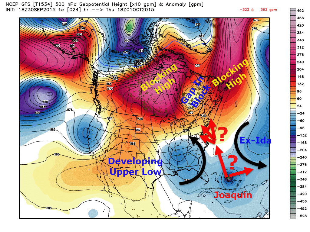
A look at the large scale pattern surrounding Joaquin shows a complex series of highs and lows each wanting to pull the storm in different directions. a strong upper low over the SE US wants Joaquin to move west while Ex-Ida (which could come back from the dead) wants Joaquin out to sea with it. Add to that tremendous blocking over Canada and you have what could be a nasty situation for those to our south.
Scenario 1: Mid Atlantic Landfall
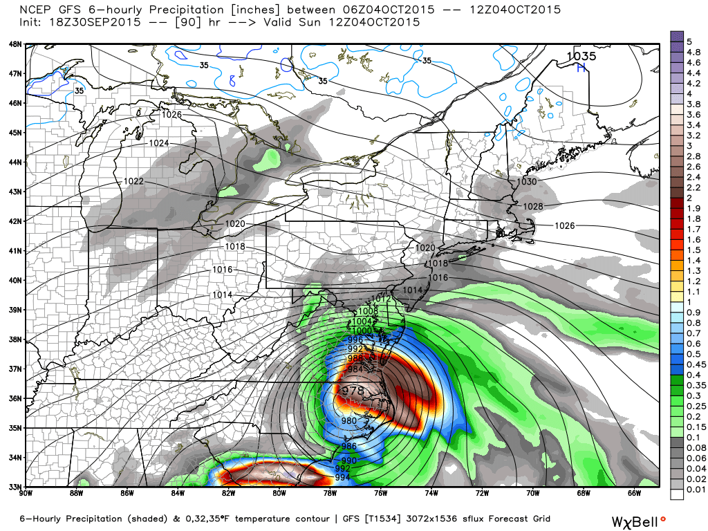
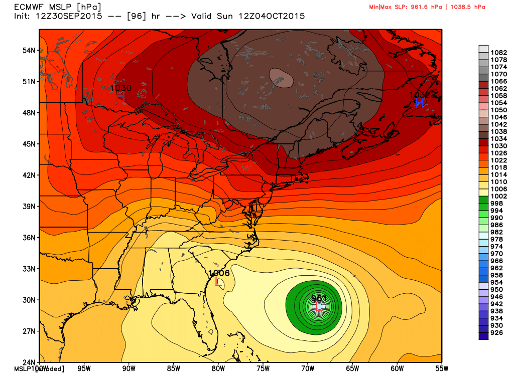
This is the most likely scenario based on an analysis of upper air features and is supported by every single model I can find except for the Euro and a few renegade ensembles. In this scenario, a developing upper low over AL and GA would suck Joaquin into its warm embrace causing it to turn sharply left into the coast. This would bring extreme impacts to the Mid Atlantic region and for those reading from Philly south to Charleston, check with your local NWS office or favorite local weatherperson for details. I will focus on possible impacts north and east of Boston.
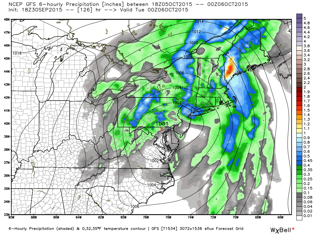
Impacts up here in Maine would likely be delayed until Monday afternoon/evening through Monday Night when a round of heavy rain would move through as the remnants moved north. Heavy rain and coastal flooding would be the biggest issues should this scenario pan out as indications are Joaquin’s tropical moisture could once again bring Precipitable Water values (available rain/moisture) to levels we saw today.
Scenario 2: Out to sea
There is only one model showing this solution at the moment and it is the #1 model, the euro. While this solution appears unlikely as the pattern and every other model out there supports a landfall, it can’t be 100% discounted yet as the Euro has a pretty good track record. In this scenario, there would be no impacts to New England.
The bottom line here is to watch and wait. For those who know folks in the Mid Atlantic, give them a heads up and tell them to listen to local NWS offices and to heed any orders from local officials. There is a strong indication that the storm does make landfall and bring us eventual impacts in the form of heavy rain. I’ll have more updates in the coming days as this develops.
One last note, please don’t believe for a minute any one model solution or doomsday graphic someone may post. Uncertainty is still high here. That being said, this does have the potential to be very serious for the Mid Atlantic. Comparisons to Sandy’s surge in terms of impacts are not unfounded for VA beach and DC. The Capitol Weather Gang has a good update to refer to for the Mid Atlantic threat and takes a similar path to my update outlining potential impacts and scenarios.
I’ll have another update on tomorrow’s weather in the morning and will likely be back tomorrow evening for another Joaquin update.
-Jack


