Hello everyone!
With the incoming holiday, this update will bring info on the forecast for both today and tomorrow. The dreams of kids across Maine and New Hampshire are about to come true as a rapidly developing Nor’easter brings a classic New England snowstorm just in time for Christmas morning. More on that in a minute.
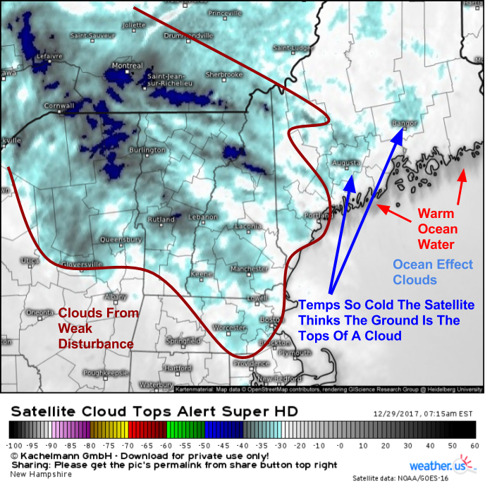
Before our storm arrives, we’ll enjoy a day of calm weather today. High pressure is building in between systems, and as a result we’ll see cool temps, dry weather, and at least a few breaks of sun before clouds from the Christmas storm begin to stream in this afternoon. Look for highs around 20 in the mountains and around 30 along the coastline.
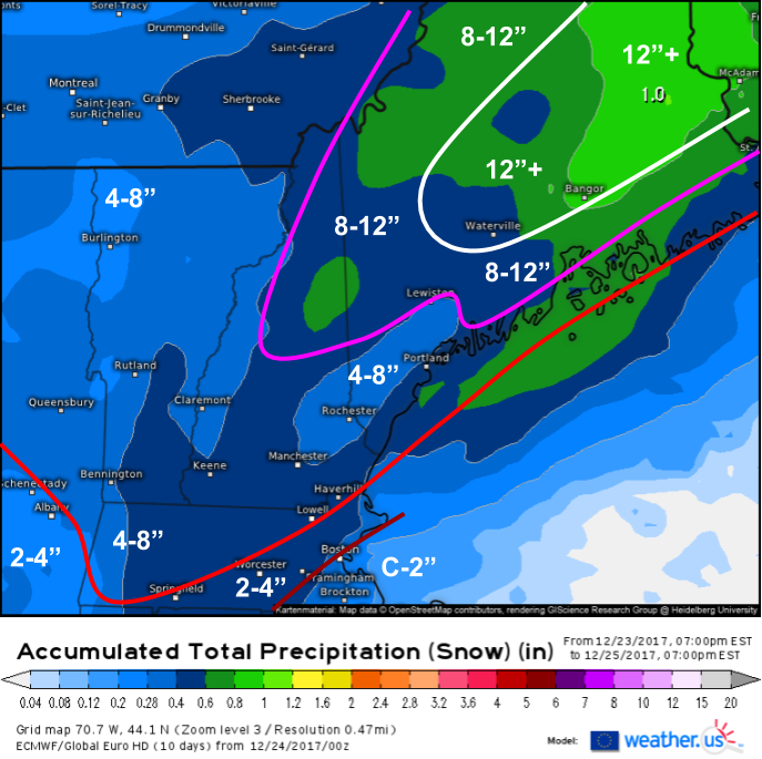
Tomorrow is the day that brings truly interesting weather. A Nor’easter will be getting its act together just to our southeast, and as it intensifies, heavy bands of snow will impact the entire region. Winds will also pick up out of the northeast, resulting in blowing and drifting snow.

Swiss Super HD model forecasts show bands of heavy snow moving onshore tomorrow morning as the storm intensifies east of Boston. Snow will fall at rates of 1-3″ per hour in these bands, which will be too much for plows to keep up with. Try not to be on the roads tomorrow morning if at all possible. Dynamics with this system will be strong enough that thundersnow can’t be ruled out along the coastal plain!
The storm will be a quick mover, and snow will taper off to flurries by early in the afternoon.

Here’s how much snow I’m expecting. The jackpot area will be found in the NE part of the region with areas NE of Augusta likely seeing around or a little over a foot of snow from this storm. Amounts will taper off to the southwest. There’s been a strong signal on model guidance for a region of mesoscale subsistence (sinking air) developing across parts of York and Cumberland counties. If this indeed develops, amounts will be lower there. Outside of that area, the immediate midcoast where snow could mix with sleet for a time, and the CT valley, 8-12″ is where we should come in for this event. It will be a fluffy snow due to the cold airmass and excellent snow growth dynamics.

The fluffy snow will be a nice reprieve for those tired of shoveling sloppy sludge, but it will also enhance visibility concerns as winds kick up tomorrow afternoon. Wind gusts of 30-40 mph are expected along the coastline, and these winds will have no problem blowing the fluffy snow around. As a result, expect low visibilities with areas of blizzard conditions tomorrow, even after the snow stops falling. This storm likely won’t meet the technical blizzard criteria, but if you take a look outside or try to drive around, it’ll be hard to tell the difference between this and an official blizzard, which needs to meet strict numerical criteria to be designated as such.
Winds will die down a bit tomorrow night, though gusty NW winds will be a recurring theme as we move into the middle part of the week and a deep Arctic airmass establishes control of the Northeast.
-Jack

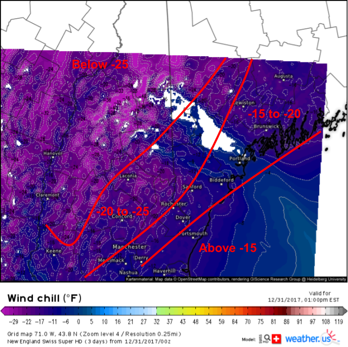 This map from the Swiss Super HD model shows wind chills bordering on dangerous this afternoon. Ignore the large swath of null values downwind of Mt. Washington where the model thinks that winds are calm or nearly calm due to the influence of the mountain. Wind chills in the Sebago region will be just as brutal as anywhere else, dropping below -20 for much of the day today.