Hello everyone!
This week will serve as exhibit A for the old saying “If you don’t like Maine weather, wait a few minutes”. Tomorrow, lazy spring breezes give way to summer showers and storms. By Sunday, the brisk winds of fall usher in the snows of winter which could drop several inches of snow come Tuesday morning. Not a fan of the snow? By late next week, temps in the 60’s are on the table once again along with rain.
Spring/Summer: Warm And Showery Tomorrow
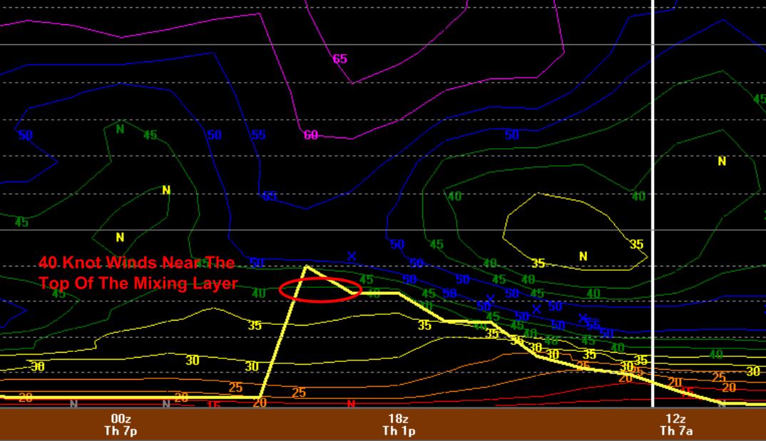
Today’s warm breezes continue tomorrow bringing in warmer and, believe it or not, humid air. Dewpoints will rise to near 60 tomorrow which will feel humid this time of year. Temps will range through the 60’s for most. The warm humid air will fuel afternoon showers and storms with the best chance for rumbles in the mountains where the atmosphere is a tad more juiced. No severe weather is expected tomorrow but when thunder roars, go indoors.
Fall: Brisk Winds Deliver Arctic Air Sunday
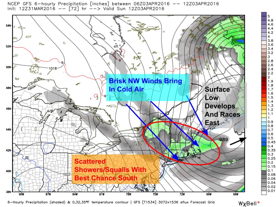
After getting Spring and Summer out of the way tomorrow, Fall takes over Sunday as a clipper moves through. Rain showers will change to snow squalls as low pressure develops offshore and races east. Winds will be quite gusty as well. On Monday, temps likely will stay near or below freezing as cold air pours in. This sets the stage for the more sizable snow threat on Tuesday.
Winter: Snow Threat Tuesday

Sunday’s cold front stalls offshore Monday as a clipper blasts SE from Alberta. The clipper will move offshore Monday night and a strengthening, negatively tilting upper level trough will help it to intensify. Uncertainty still remains as to the exact track of this storm and thus the exact impacts though some accumulating snow seems likely along the coast. Snow likely moves in Monday night and lasts through Tuesday afternoon. Guidance is fairly far offshore with this storm at the surface but the upper air pattern is giving strong indications that this is likely to drop at least a couple inches along the coast, perhaps a little more.
Spring Returns: Warming Up Late Next Week

As we head into the latter part of next week, the pattern is likely to modify a bit. The longwave trough in the east is likely to remain but looks to retrograde slightly west and weaken. A flatter pattern out west will allow for the Arctic connection to be cut off and ridging is likely to build over the area. All that jargon translates to a return to normal or above normal temps by the time next weekend rolls around. Current guidance is hinting at heavy rain accompanying this increase in temps but it is far too early to tell specifics. Just know warmer temps are on the way.
A Note On Spring Updates
It’s that time of year again, the sun is out, the birds singing, and the snow flying (sometimes). Spring is here and with it comes Outdoor Track season. Unfortunately, my practice schedule will not allow for evening updates beginning either next week or the week after. I’ll still have morning updates every morning but getting home at 6:30 doesn’t leave a lot of time for forecasting. While I’ve developed a solid system for time management, sometimes high school obligations get in the way.
Thank you all for your patience and continued support, it means a lot.
-Jack