With 10″ in Gorham, 8.5″ in Winslow and 7.3″ here in Yarmouth, this storm has surprised me tons. The forcing is great and a last minute track shift has required me to write this now. I have to update several of my maps to reflect the changing conditions. This will be the last post until tonight if that is even needed.

Updated snow map.
Power outage map.
Have a good evening!
-Jack
Upped snow totals a tiny bit due to the increased snow rates that are due to the strengthening of the low a little earlier than expected.
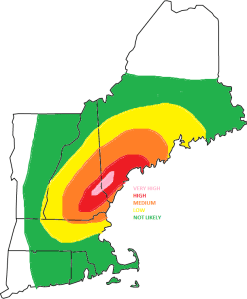
Other than the snow totals, expect the winds to be a little higher as well. Since this is a heavy snow, power outages are certainly in the cards.

Power outage map

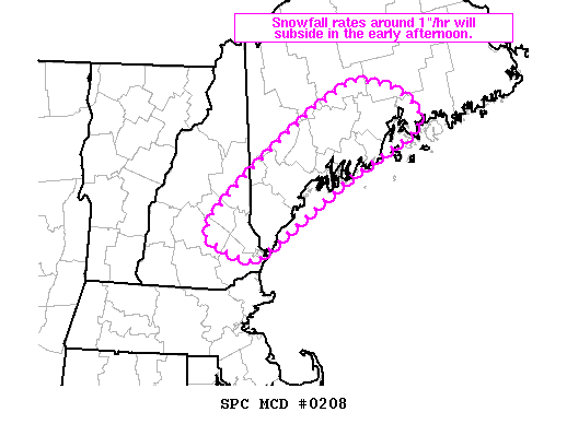
NWS snow rate alert

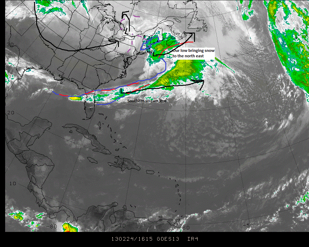
Satellite image w/ features

Surface weather map

Precipitation map

Special features map

Snow Map
-Jack
What a wild ride this has been in regards to amounts, source of amounts, low placement etc. We now have a low pressure center moving ENE that is located about 150 miles SE of the Cape. Regardless, its associated trough will bring snow. This trough will set up over the region today and sit there not moving until evening. Due to the non norlun nature of this trough (thank goodness!!), I am confident with my amountsthat have been upgraded and are shown below.

Snow Map.

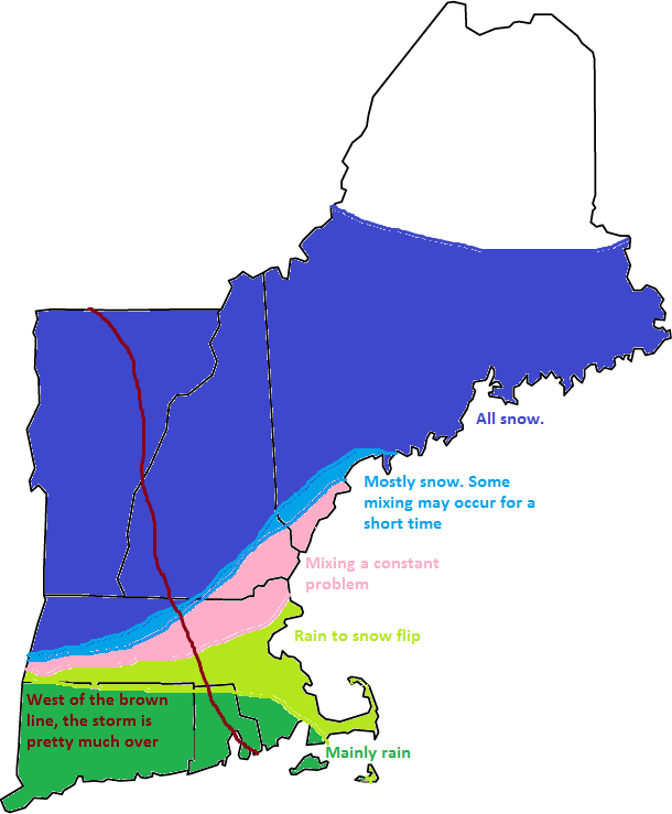
Precipitation type map.
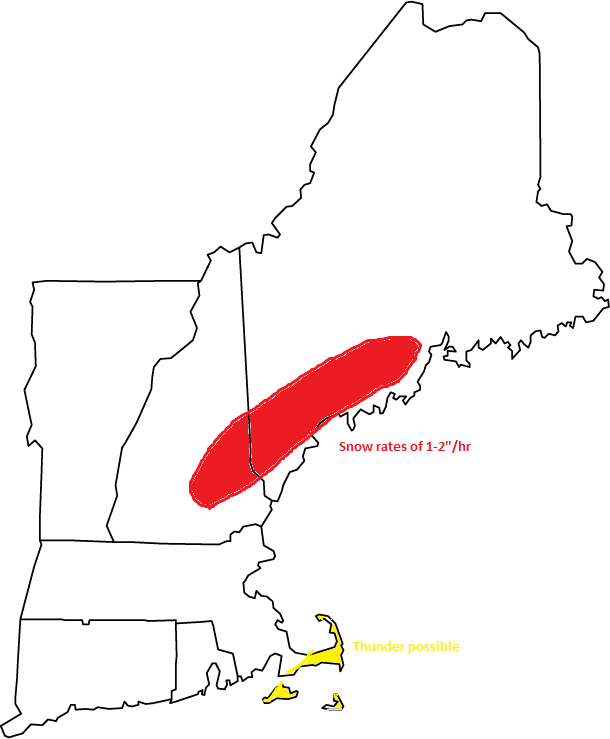
The upgrade in snow totals was due to the trough being slighly stronger than expected. As a result, the snow rates will also be higher than expected leading to reduced visibilities and slick roads.
-Jack
Reliably hype-free weather info for Western Maine and New Hampshire from amateur forecaster Jack Sillin