
This one will be tricky. Thats the one thing I’m certain about. Below is my thinking and analysis of the new data I’m receiving.
Precipitation will likely move in tomorrow morning. Snow will overspread the area tomorrow and could mix with rain along the immediate shoreline south of Portland. There will be a strong easterly wind that will bring in a marine airmass. This airmass will likely take over coastal and southern sections sometime wednesday night. The main low will be moving to the NNE through the Great Lakes while another low will develop and swing northwest across NYC. Then this low will stall as yet another low develops in the Gulf of Maine. This low will stall as it absorbs the low to the west. This transition will take place thursday and we will transition to all snow. The rain/snow line will be CRITICAL in determining the amount of snow one gets. It will probably come down to a few miles between the 12-14″ amounts and the 3-8″ amounts. I will do my best with a snow graphic but amounts will ultimately be determined by the exact rain/snow line location.
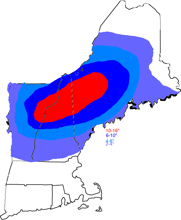
Snow map.
We will be watching a few things that will ultimately determine the location of the rain/snow line. One factor is mentioned above; the wind direction. If the wind is out of the north, cooler air from the north will stay in place. If the wind is out of the east, the warmer maritime airmass will infiltrate the region bringing a change/mix with rain. Another thing we will be watching is the placement of the low. The low placement will determine the wind direction. The low will move to the west on wednesday bringing an easterly wind to the region. Cold air will stay locked in place over inland areas due to a phenomenon called cold air damming. This is where the entire atmosphere is below freezing and the wind direction is out of the north in all levels of the atmosphere locking th ecold air in place effectively damming the warm air advance. This will be critical in determining the precipitation type and snowfall amounts.
Below I will give an approximate timing outline of the storm.
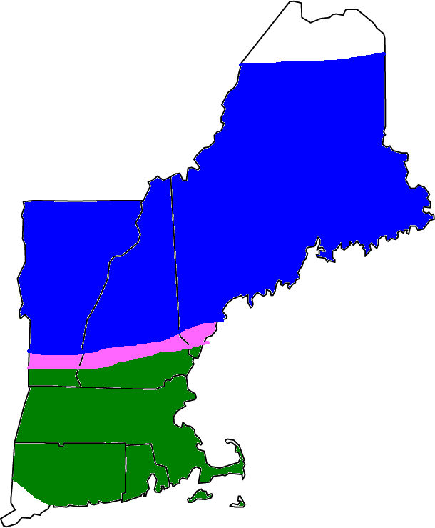
In the below images, blue indicates snow, pink indicates a rain/snow mix, dark green indicates rain and light rain indicates frequent rain showers.
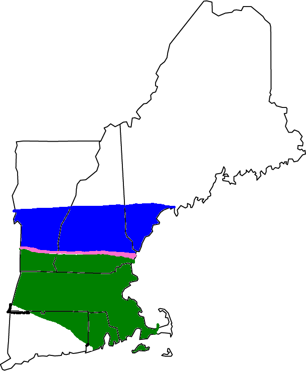
Tomorrow

Tomorrow night

Thursday

Thursday night
Friday

Friday night

Saturday
Winds will be a factor though mostly inland with the low level jet. An inversion at the coast will keep the winds from mixing down a ton. Look for power outages as this will be a wet, heavy snow.
-Jack
