
As we approach the peak of hurricane season, the Madden Julian oscillation is arriving over the Atlantic.

This Graphic highlights the GFS ensemble forecast for the MJO. Image credit Noaa/NWS.
This will bring increase rising air and instability which encourages thunderstorm growth. This will enhance convection-a necessary ingredient for tropical waves to develop into cyclones. No matter how much of a circulation a storm has, it will not be designated by the NHC until sufficient Convection, or heavy thunderstorms are present.
We now have a few areas to watch.

The red arrows indicate strong upper level winds/wind shear that can disrupt development. Wind shear disrupts development by pushing the storms thunderstorms to one side of the circulation.

This map shows exactly where the upper winds are and aren’t. I’ve highlighted the area of harsh upper winds that could impact our disturbances in the near future. Note: this map shows the Atlantic basin only to 35W and only 1 of our disturbances. Image credit CIMSS/SSEC.
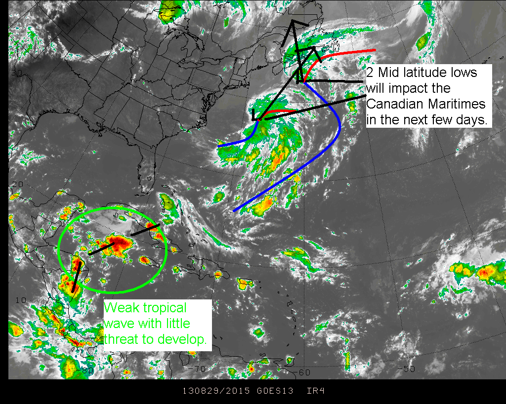
The disturbance closer to the Antilles Islands is the first one to watch. It will move westward in no particular hurry over the next few days and encounter harsh upper level winds in the next 2-3 days while in the eastern Caribbean. After that, it will enter the western Caribbean where more favorable conditions await. Below I will describe what some of the models think of the storm.
GFS-Keeps it as an open wave while it moves through the Caribbean.
NAVGEM-Generates a weak TS over the NE Antilles between hour 96 and 108 while moving NNW out to sea.
CMC-Generates strong TS around hour 72 moving on same track as NAVGEM
My forecast is for an open wave like the GFS suggests as it is the most credible of the 3 models listed here. Also, storms this season as well as last season have really struggled to make it through the eastern Caribbean. A TD or weak storm is possible one the wave gets into the Gulf of Mexico (GOM).

This graphic highlights my thoughts on this disturbance (Yellow circle) and its track. It also highlights the principal reason for not developing- an area of dry air and high shear to its north that is slowly sinking southward.
This disturbance is the one most likely to affect land bringing squally weather and occasionally gusty winds to parts of the Antilles in the next few days.
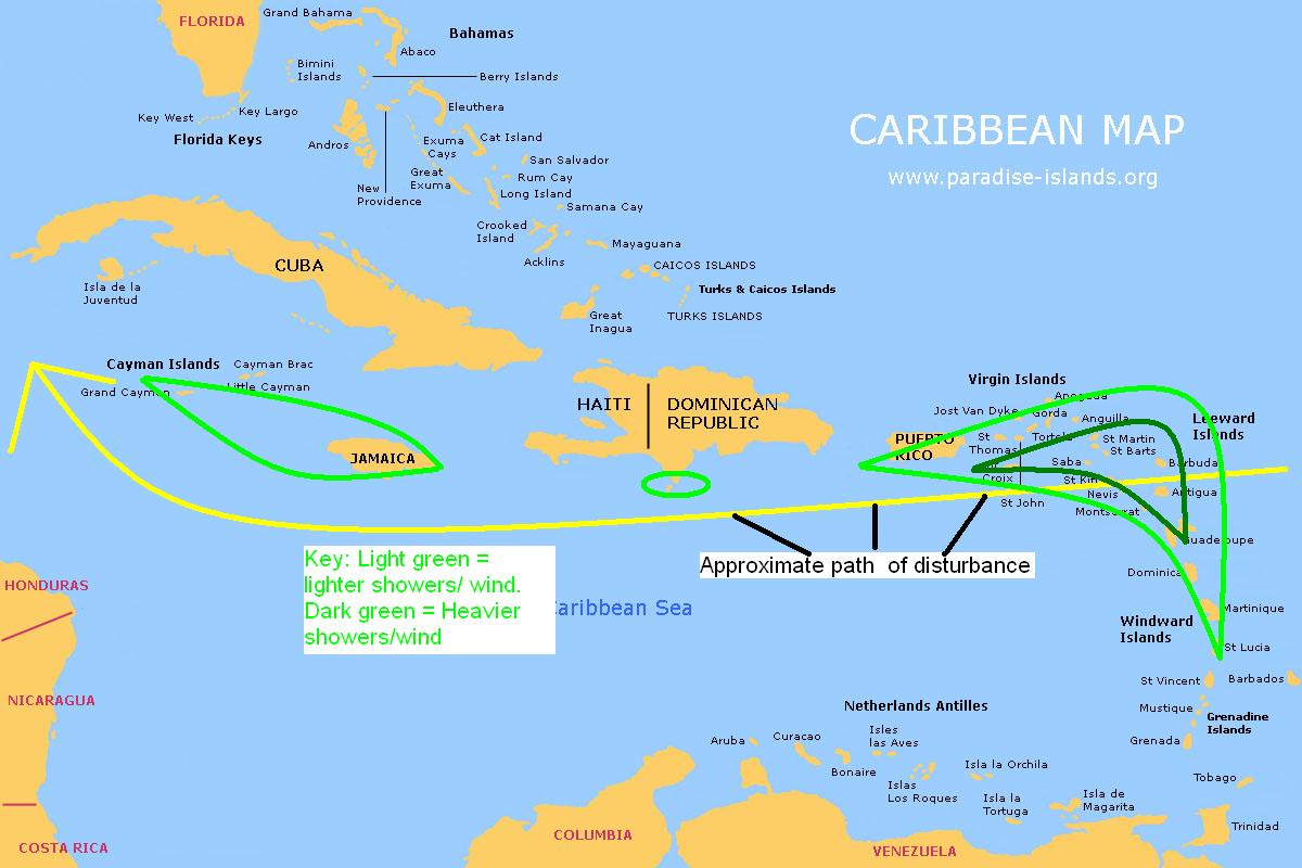
Map showing impacts on the Windward and Leeward Islands as well as impacts on the other Caribbean islands.
The second disturbance, just off Africa, has a much greater chance to develop. It will move NW into an area of harsh upper level winds. Despite this, model confidence is low with only the GFS generating a very weak TS or TD.
GFS- Weak TS with genesis occurring around hour 120 heading NNW out to sea (OTS)
NAVGEM- Open wave moving WNW
CMC- Open wave moving W

This graphic shows our second disturbance, my idea of track and where it will run into unfavorable conditions. I expect very little development with a TD at best. The reason being that by the time conditions in the upper air relax, the storm will likely be over cooler waters in the North Atlantic accelerating to the NNE. This storm could turn into a mid latitude low and help fuel an extra tropical cyclone that could impact Europe or Iceland or both.
Elsewhere in weather…
There will be a low developing over the Great lakes that will drag a cold front across the eastern US come Sunday/Monday. This feature will bring showers, and thunderstorms over Labor day weekend as well as some cooler air for the first week of school in many places.
Tropical storm Kong-Rey in the Western Pacific will hit Japan in the next 24 hours and swiftly move across the country into the northern Pacific. It will transition into a powerful extra tropical cyclone in the Bearing straits before impacting Alaska.
My next post will be in the next day or 2 or if one of our 2 disturbances develops further.
-Jack
