
We now down to 1 real disturbance that is a threat to develop. This is the one to the east of the Windwards. The one in the eastern Atlantic has lost a significant amount of its heavy thunderstorm activity as a result of the high shear mentioned yesterday.
By the numbers:
2 invests (97L and 96L)
1 TS (KIKO)
2 day probability of formation into TD/5 day probability of formation into a TD (in%)
96L: NHC 0/0
ME 0/0
97L: NHC 40/50
ME 50/70
KIKO: 60 mph, 996mb
—————————————————————————————————-
The disturbances we’ve been watching over the past few days have changed significantly over the past few days. Lets start with 97L, the one closer to the windward islands.

Evening satellite image of 97L.
There are 2 big changes:
1) Thunderstorm activity has increased substantially. Both in intensity and coverage.
2) The circulation and the disturbance as a whole have both elongated.
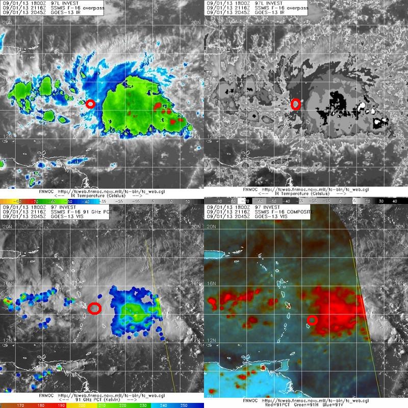
This map shows the main thing that inhibits development- it doesn’t have a real center. I’ve highlighted what looks to be a center according to the data presented by each square. As you can see, each location is different. You can tell because of discrepancies in the location from the islands. What I can tell is that the center is broad and elongated and located somewhere north of Barbados and east of the main island chain.

This shows where I estimate the center to be as well as some light shear affecting the storm.
The forecast:
Intensity-

This map shows what the models think of the intensity. Note the spread- this forecast will be tricky…
I expect this storm to reach weak TS strength this upcoming week.
Track-

This map shows the models’ idea of the storm’s track. I expect a track like the BAMM model.
I will have a much more detailed post about this system tomorrow.
-Jack
