Hello everyone!
Our storm is intensifying nicely down off the Mid Atlantic and we are certainly feeling its impacts here in Maine. Heavy snow bands are moving through the area with snow rates approaching 3″/hr in some locations with 1-2″/hr rates more common. At my location in Yarmouth, we have 6.5″ on the ground as of 5:45 and it continues to come down hard. Winds are picking up as well with many locations now reporting gusts up to 25 mph.
Conditions will continue to deteriorate over the next few hours as the storm strengthens and winds intensify. Blowing and drifting snow will become an issue as well as the evening progresses.
Confidence continues to be low as to where the mix line will set up but the storm is slightly east of the forecasted track, so the mix line may set up farther east than expected.
Temps will rise from the 20’s to the low 30’s as warm air moves in aloft and gets pushed down to the surface by heavy precipitation. Expect the snow to turn from dry and fluffy to heavy and wet as temps warm.
We may see a brief lull or break in the action in the next few hours as a dry slot tries to work its way into the area however its progress has slowed significantly so we may not have to worry about that.
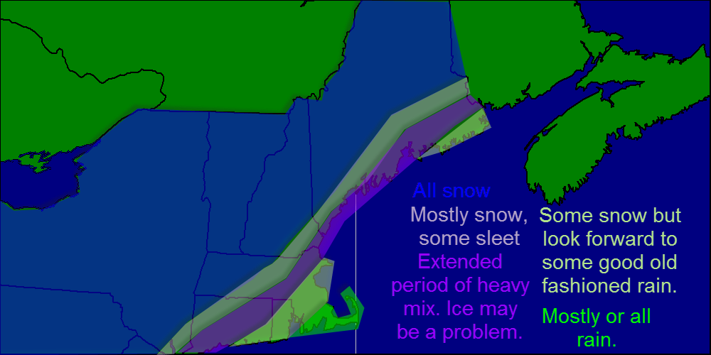
Overall, I still have confidence in my snow map from this morning although amounts may be a hint low at the coast especially Downeast Maine but the change to mix should occur there shortly.

Here is the snowfall map from this morning. I still have confidence in this map so no changes were made.
I’ll be back again tomorrow morning with the normal daily forecast as well as an update on a possible snow event Saturday. As of now, that looks to be minor however some models have shown a more robust solution. More on that tomorrow.
-Jack