
Hello everyone!
Today will feature more snow and possibly mix/rain at the coast. Precipitation should move in mid afternoon and will remain light/moderate over Southern Maine and New Hampshire. As the low deepens, snow will increase in intensity over Downeast sections.
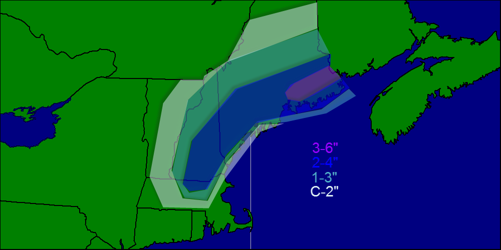
Snow map.
Temps today will be in the low 30’s inland and low to mid 30’s at the coast. Rain/snow will move out this evening into tonight.
Freezing rain will take hold of the area Thursday night into Friday morning before turning to all rain. This will make for a VERY slippery morning commute Friday especially with some towns dealing with a salt shortage.
Cold air returns with some light snow Sunday. Cold air will be firmly locked in next week and the threat of a coastal storm will be there all next week though there is no specific threat as of now.
-Jack
