
Hello everyone!
Today will feature a mixed bag of precip depending on location. The immediate coast will see rain while the coastal plain will see freezing rain and sleet and the mountains all snow.
Expect precip to start within the next 2 hours and become steady as the day goes on. Heavy precip arrives tonight. Expect things to wind down tomorrow morning as the storm pulls away.
Just a few tweaks to the accumulations map, models were a tad cool yesterday so adjusted totals down a tad at the coast. Also pulled the trigger on 2 feet+ for the mountains as high QPF and higher ratios will make for a heck of a storm up there.
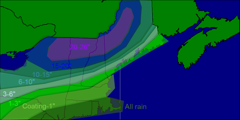
Snow map
I’m off skiing today so if anything changes I’ll have one last update tonight.
-Jack
