
Hello everyone!
Today will feature morning fog across most of the region especially at the coast and in the valleys. This should burn off to hazy sun and a quickly destabilizing airmass. As a result, we should experience some decent thunderstorms this afternoon in association with a cold front.
Rain chances will be increased in the Portland area due to the expected development and passage of a meso-low or small scale low pressure. The last time we had one of these, Portland got over 6″ of rain. Don’t worry, that is not expected this time around.
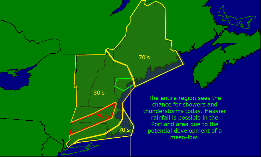
Showers and thunderstorms are expected today along with plenty of heat and humidity.
Looking ahead, the hot and humid pattern will return Thursday into Friday with another cold front finally pushing through over the weekend and bringing back a more seasonable airmass.
-Jack
