
Hello everyone!
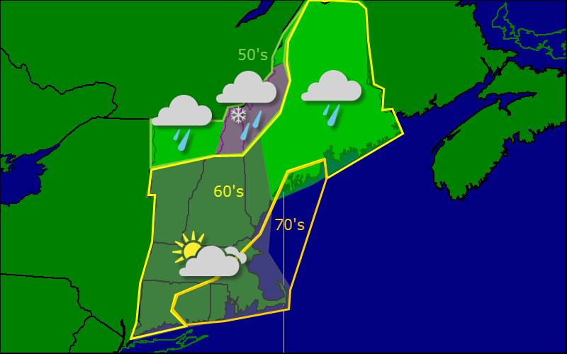
Today will feature mostly cloudy skies across the region as a cold front works its way offshore and an upper level trough moves in behind it. Expect a sprinkle or shower east of Brunswick/Farmington and in the higher terrain. It is with great excitement that I tell you that wet snow could mix in at the highest elevations. This afternoon should feature more clouds with the chance for a sunny break as well as increasing westerly winds. Reminder: Fall officially arrives at 10:29 PM tonight.
-Jack
