Very sorry I could not update yesterday; WordPress was having quite a few issues (i.e. not loading, crashing out, etc.) and despite a solid hour of trying, I could not get through.
Today will feature mostly cloudy skies with rain for pretty much everyone. Expect mostly light rain and drizzle although there could be a brief period of moderate rainfall. All shower activity should clear the coast tonight.
Very cool temps move in for the end of the week and into the weekend. Friday looks to be the coolest day when temps might not make it above 60.
Today will feature dry and almost chilly weather as highs won’t get out of the 60’s for most. Some spots in Southern New England will see 70 and in the wilds of NW Maine, high’s won’t even get to 60. A gusty wind will make this morning even colder. Winds subside in the afternoon but even under full sun, there will not be much warmth.
Cool and dry today. Bundle up as NW winds gusting over 20 mph will make it feel even colder. Winds relax in the afternoon.
Today will be not so nice as we have a cold front moving through. The word ‘raw’ comes to mind in association with today’s weather compared to what we’ve had the past 4 months. We will wake up this morning to areas of drizzle and fog and showly transition to rain showers and maybe a rumble of thunder. A wind off the water should keep us nice and cool with temps likely not getting above 70.
Another extended strech of nice weather looks to start tomorrow with an even bigger cooldown arriving sometime next week.
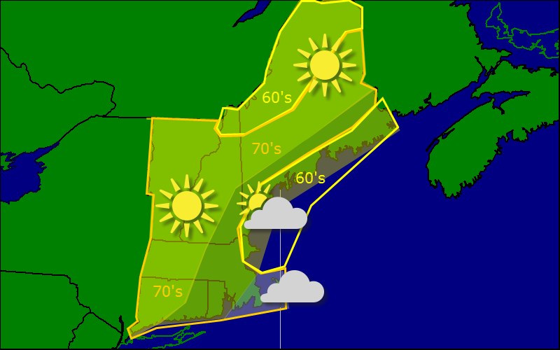
Today will feature a similar temperature scheme as the past few have (great for running intervals!) with highs in the 60’s along the coast of Maine and the mountains. everyone else is stuck with 70’s (still not bad!).
The one main difference between today and yesterday will be the increase in clouds. An unusually strong coastal low is churning well to the south of the region and moving up the coast (don’t worry, we have a strong ridge of high pressure in place to defend us). While the low will move offshore without any precip, it will bring some more clouds to the region.
There is some morning fog present both at the coast and in the valleys but that should burn off by midmorning.
Today will feature weather similar to yesterday with sunny skies and high temps in the 60’s and low 70’s. A few high clouds are possible at the coast and a shower is possible on the Cape. Otherwise, it’s another fine day in New England.
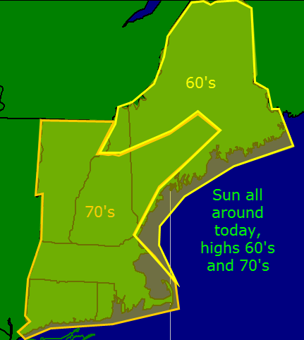
Today will feature lovely weather across the region with sunny skies and cool temps with highs only reaching into the 60’s and 70’s! This lovely weather will continue tomorrow as high pressure remains firmly in control of our weather.
Rain arrives Thursday along with a cold front. Cool and dry weather return in full force Friday.
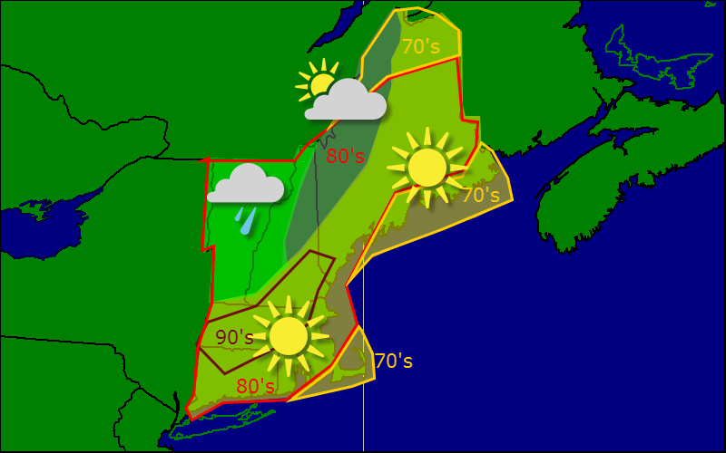
Today will be a busy one as a cold front approaches and brings the chance for showers and thunderstorms to the region. The day will be split in half with the 1st part featuring heat, humidity, and hazy sun. The second part begins around 2PM when storms should be firing aplenty. As of now, it looks like the best chance for severe weather would be along the coastal plain due to the fact that by the time the storms reach the coast, they should be organizing into a line capable of strong winds. As of now, strong winds remain the biggest threat today in terms of severe weather although flooding will be a concern if storms train due to very high PWATS (the amount of water that could fall from the sky if it wanted to) approaching 2″.
Today will feature hot temperatures and increasing humidity as upper level ridging moves into place. Highs today will soar well into the 80’s while dew-points will top 70. (Just beautiful weather to run an XC race in, right?).
All this humidity will become fuel for powerful storms on Saturday as the cold front nears. Expect widespread thunderstorms with very heavy rain and gusty winds tomorrow afternoon. The SPC has placed us under a slight risk for severe weather.
Busy weather map today as the front begins to approach the region from the NW. Right now, it looks like most areas stay dry but Vermont and western NH could see a shower or two later this evening. For most of us though, just hot and humid.
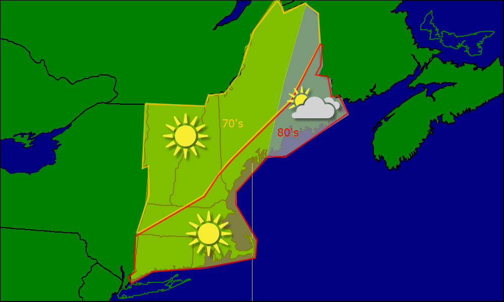
Today will feature another day of weather dominated by a large high pressure system that is slowly moving offshore. This means that sunny skies and warm temps can be expected region wide. A sea breeze will keep things a tad on the cool side for the coast but even so, everyone sees temps well into the 80’s.
Hot and humid weather will return in full force tomorrow as a cold front approaches from the west drawing warm air up from the south. The cold front crosses the area Saturday bringing cool and sensible weather back into the picture for the second half of the weekend and into early next week.
Last night featured the passage of a cold front which triggered some showers and also set the stage for a lovely day today. NW winds will bring in cooler drier air from Canada. Despite how lovely this sounds, don’t get too excited because it’s not that cooler or that drier but anything helps right?
Hot and humid weather returns tomorrow and lasts until Saturday when another cold front clears things out for a little longer (hopefully until June!).