
Hello everyone!
With relatively quiet weather this weekend, I would like to take a few moments to look ahead to the upcoming week. We have a few precip chances to examine over the next week. The first arrives tonight and will mainly affect the mountains with some light freezing rain tonight. This is a weak upper level disturbance and has nothing to do with our other storm threats.
Freezing rain advisories are up for the mountains as well as western NH. Details from the National Weather Service can be found here.
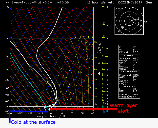
While the thermal profiles for this event are by no means fantastic, the ingredients are there for a period of light freezing rain. Little to no accumulations are expected but some slick sidewalks/untreated roads are possible. While the bulk of the activity should stay in the mountains, some isolated rain showers are possible for coastal areas as well. All activity should be done by tomorrow morning.
Our next chance for precip will come Sunday night into Monday. SW winds already in progress across the area will intensify tomorrow and bring much warmer air into the region. Highs tomorrow will be mainly in the 40’s with 30’s possible in the mountains of Maine and 50 possible on the Cape.
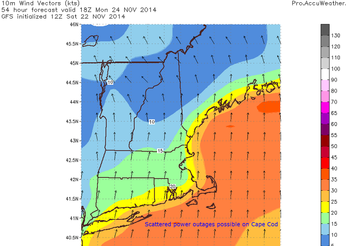
Clouds and showers move in tomorrow night with a windswept rain likely Monday. Expect gusts of up to 40 mph along the Cape with 30 mph along the Maine coast. Lighter winds are expected inland. Temps will skyrocket as warm air is blown in from the SW. Expect highs to make a run at 60 over NE CT and parts of interior SE MA. Temps in the 50’s for most of the rest of the area with the mountains of ME remaining stubborn in the 40’s.
Rain ends with the passage of the cold front Monday night into Tuesday. After that front hits, it’s back to the cold.
Wednesday is where things get really tricky. I will do my very best to keep things not too technical but some weather jargon will be thrown around in the next few paragraphs.
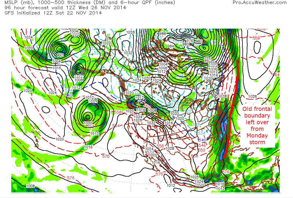
The setup: after our Monday storm leaves, the 500mb level is what will tell the tale in terms of if we get precip and if so, how much and of what type. Keep in mind that this storm is 4 days out right now so confidence is low but I want to emphasize that the threat is there and should be watched carefully. Below, I will follow the Canadian model from Monday night to Wednesday night. I have chosen the Canadian model to show here not because I like it particularly or think it is more accutate than all the others, but more because I think it shows well the variables at play. Remember, this is one model idea and things will change as time goes on.
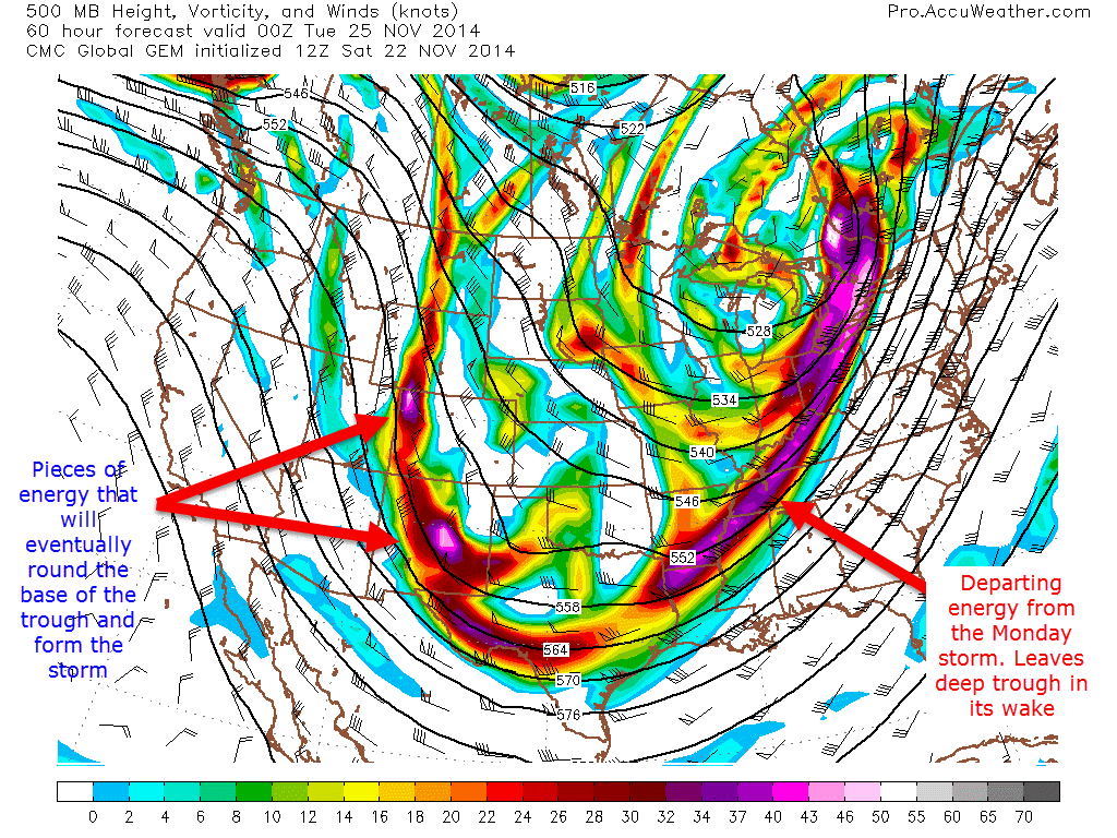
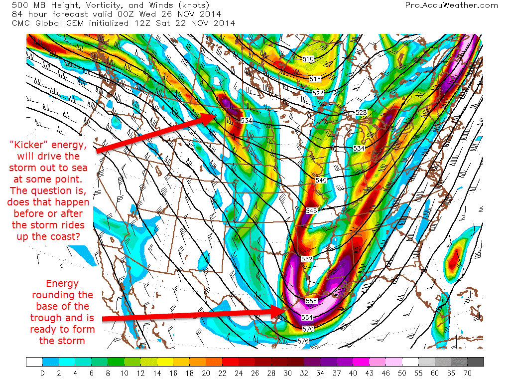
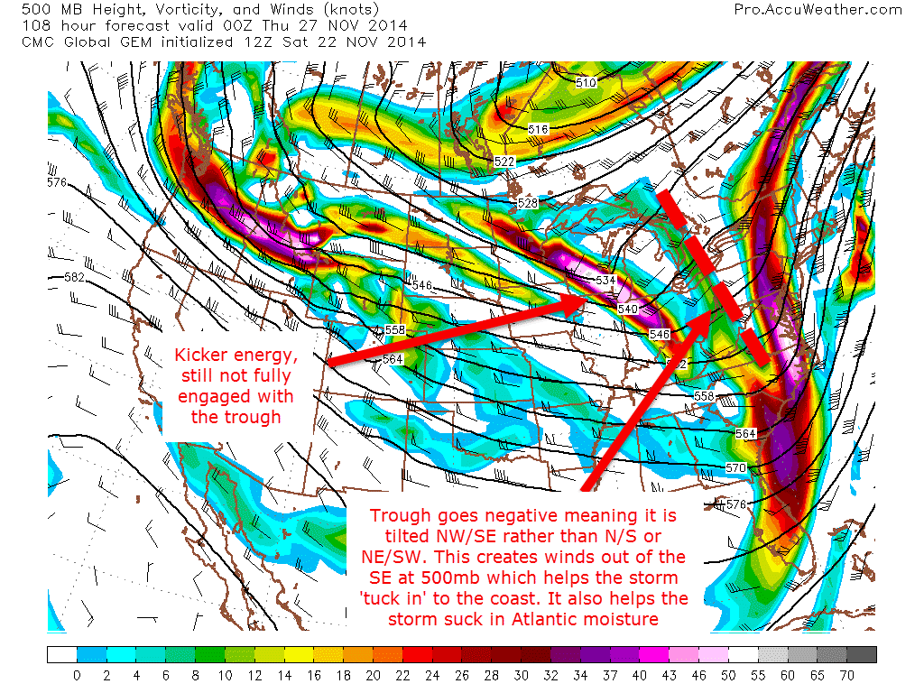
These three images show the path of the energy at the 500mb level (about 30,000 feet). The other important factor to consider especially regarding track is the frontal boundary that passes through the region on Monday will stall offshore and eventually end up helping both form the storm and then eventually help guide it up the coast or out to sea.
Bottom line is that while it is too far out to get into particular details/specifics, there are strong signals coming from the models as well as other variables like teleconnections (EPO looks to take a deep deep dive next week) and SST’s off the East Coast, which are rather warm compared to average right now and have a lot of energy stored up just waiting to be released.
After this storm threat, nothing stands out to me in terms of significant warm/cold/rain/snow. Lots on our hands this week though. I will be back tomorrow should any significant developments present themselves.
-Jack
