
Hello everyone!
For the sake of timeliness (today’s forecast won’t be so helpful this afternoon when I’m done with the storm forecast), I will be posting two updates on the blog today. A full update on the storm and its impacts should be out in a few hours.
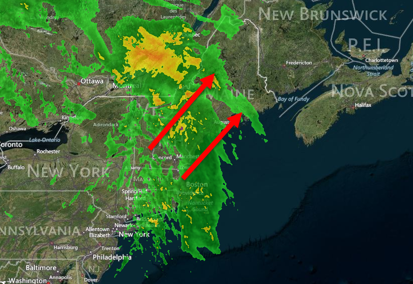
This morning’s radar shows widespread rain moving through the area this morning. The timing has shifted slightly, most of the activity is happening now as opposed to this afternoon but it’s wet morning out there nonetheless. Expect rain to be wrapping up midmorning but warm temps remain. Highs today will be in the 40’s north, 50’s south.
Tomorrow will be a warm and windy one with temps again in the 40’s and 50’s and a west wind. We have to wait until tomorrow night before high pressure builds in for temps to drop back down into the 20’s and 30’s. Sunnier skies should make a return as well when downsloping takes over in the afternoon.
I’ll have a full update on the storm including another video later on today.
-Jack
