
Hello everyone!
I’m sure there was some euphoria and some disappointment this morning after expecting to wake up to a raging blizzard and instead seeing some light snow and a little wind. To be fair, some areas are right on forecast with heavy snow and near zero visibility. A highly localized band of snow set up over Coastal York County who did pretty well for this storm. Eastern MA should do ok as well as 20″ reports are already streaming in from the North Shore.
This post will deal more with the widespread blizzard that wasn’t for Maine and New Hampshire. That being said, high winds will still whip around the snow we already have on the ground and cause reduced visibility and whatever new snow fell last night will add to that. Temps will still be cold and thus wind chills will continue to be a threat.
First Factor: Upper Level Low

Yesterday morning the blizzard forecast was on. Models predicted a strong and strengthening upper low off NYC with tons of energy off of Southern New England. All this energy would translate into a strong and rapidly strengthening storm and thus lots of snow was predicted.
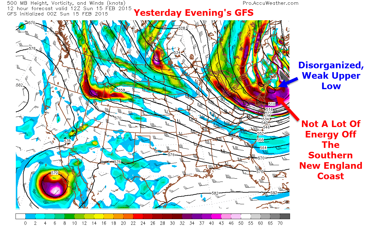
Yesterday evening’s models picked up on the weakness of the upper low and thus the forecast changed drastically. Notice the two weak upper low centers in the image above. This showed a lack of organization and thus prevented moisture from being wrapped in as easily and as quickly. Remember, this disturbance came directly from the Arctic which means lots of cold and no moisture. Basically the entire forecast hinged on the upper low being strong enough to wrap in Atlantic moisture which did not happen. We are now left with a strong surface low that has very little moisture, and thus very little heavy precip, on the NW side.
Second Factor: Lack Of Energy For Banding
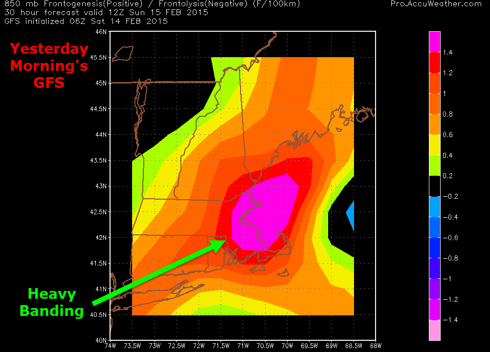
Here is yesterday morning’s GFS showing lots of frontogenesis across the area. Frontogenesis can basically be thought of as fuel for heavy snow bands. Lots of frontogenesis (shown above) creates lots of heavy bands. This was yet another factor that contributed to what was a high confidence forecast for blizzard conditions and lots of snow.
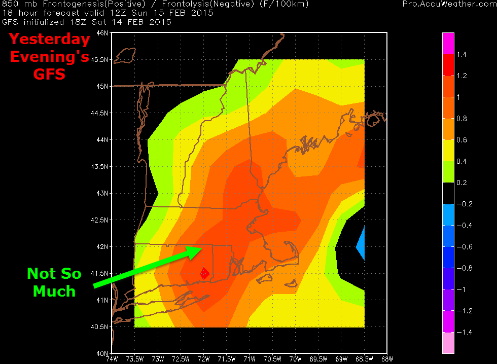
Once again, yesterday’s models changed their mind. Notice the lack of the pinks and reds in yesterday’s evening run. Without as much fuel, heavy bands were confined to very small areas (Boston and York County) while the rest of us saw flurries. Bands down in Boston even caused thundersnow however the tremendous amounts of energy that was used up by those bands came at the expense of other areas of heavy snow that were trying to form last night.
The Result: Less Snow

Now let’s look at the surface map from yesterday’s morning run. notice all the dark greens in the blue circle showing heavy snow. Without upper air support, those couldn’t happen. Yesterday’s evening run finally picked up on that and showed any dark green confined to Eastern MA.
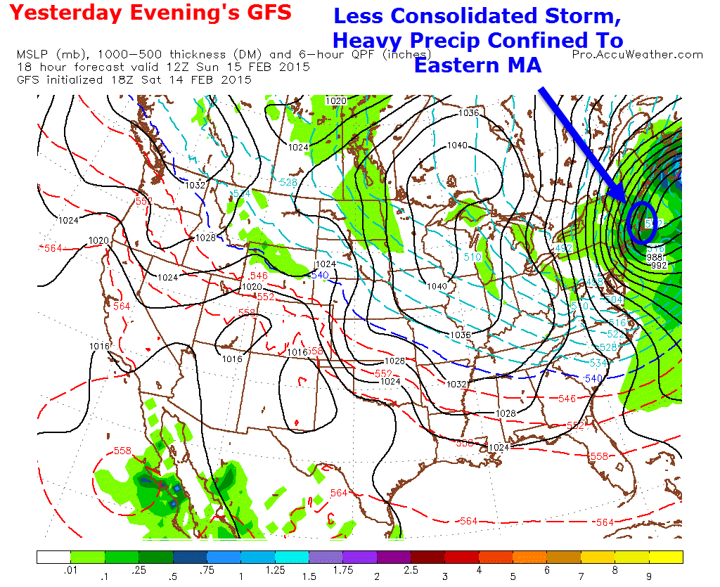
Here is yesterday’s evening run showing the dark green confined to eastern MA which matches what’s happening this morning very well.

Had the storm been about 100/150 miles NW of where it is now, those bands would have been over us and the forecast would have verified.
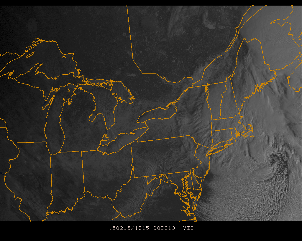
Regardless of how hard the forecast busted, the storm still looks really cool on the visible satellite this morning. See the eye?
Our next storm threats arrive Wednesday (probably light if anything) and next weekend (still very uncertain).
-Jack
