
Hello everyone!
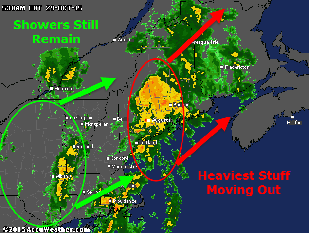
Our long-awaited storm is here and heavy rain is falling across the area with the expected strong winds as accompaniment. The heaviest of rain is north and east of Portland as of 5:15 this morning and this area of intense rain/wind will continue to move NE in the coming hours. Behind that lies a batch of very heavy rain over SE MA and lighter showers over eastern NY. The SE MA rain is moving NE and will likely impact the midcoast with another round of torrential rain and gusty winds. More showers lurk back in NY associated with cold front #1 today and expect one last shot at intense rain and driving winds as this moves through.

Behind those showers, which arrive 9-10 AM, expect clearing skies and warming temps. By mid/late afternoon, temps in the 70’s are likely under partly sunny skies. Another cold front moves through this evening which touches off some showers and possibly a few thunderstorms too. For a minute, it just may feel more like August than October. Temps drop a bit behind the front but a continued stretch of very mild weather looks to be on the way for the next week or so.
-Jack
