
Hello everyone!
I thought I’d take a minute this evening to go over the next week or so of weather taking a quick look at what to expect. This will be a tale of a classic New England winter with snow, bitter cold, and the potential for a sizeable storm. Let’s start with the light snow which arrives tomorrow.
Light Snow Tomorrow

A storm will pass well offshore tomorrow but an upper low still lurks to our west. Much like with our last storm, there will be a moisture transfer between the two storms. However, both storms will be weaker this time around especially the offshore storm (weak wave compared to powerful bomb). Therefore, the same concept applies but with less snow. Spotty snow showers will impact most but they will be hit or miss. The midcoast could get brushed with a bit of steadier light snow. A coating-2″ is forecast for everyone but 3″ is possible in the mountains and along the midcoast.
Bitter Cold For Valentines Day
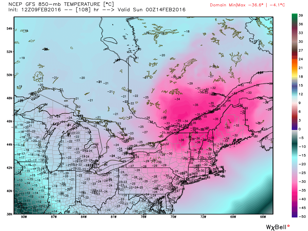
An Arctic front blasts south Saturday and frigid winds bring in very cold air behind it. Lows Sunday morning are likely to drop well below zero into the 20’s below up north and the 10’s below in the south. The map shows temps at 5,000 feet so don’t panic with the -30C temps across Maine but do realize this is the real deal with dangerous cold on Sunday. Highs on Sunday will struggle to get above zero across Maine and New Hampshire and probably won’t in the mountains. The coldest air arrives just in time for Valentines Day so plan accordingly. Thankfully, the brutal cold moves on heading into next week though it does leave us a parting gift in the form of a storm threat.
Snow Threat Returns Next Week

As the bitter cold retreats, a storm will likely try to form somewhere. At this point, all solutions are on the table from Rain to OTS though the general consensus is for some type of snow event. This is too far out for specifics but just know that at some point in the middle of next week, there could be a snow event.
I’ll have more updates tomorrow.
-Jack
