
Hello everyone!
Yet another storm has decided to cut west this week as our pattern continues to disappoint for skiers and other winter enthusiasts. This storm will be a lot like our last storm and will, as with most inland runners, feature front end frozen precip, heavy rain, and high winds. Precip moves in Wednesday afternoon and moves out Thursday evening.

The storm will, as these storms usually do, take place in two stages. The first stage will be Wednesday afternoon into Wednesday evening with light snow changing to ice and rain. During this time, the warm front will be lifting north and cold high pressure will still rule with some weak Cold Air Damming in the mix as well. Accumulations will be on the light side, probably remaining under 3″ of snow though exact amounts are still yet to be determined.
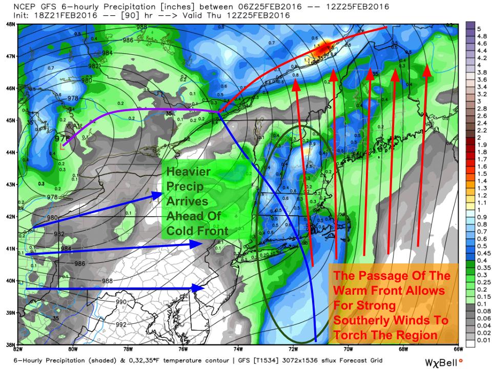
A lull will occur Thursday morning as the warm front passes north. Winds will become strong out of the S/SE which will blast out any of the last cold pockets. Heavy rain associated with the cold front will approach and move into the area Thursday afternoon/evening and will bring with it the standard high wind/heavy rain threats with localized flooding and power outages possible. Exact winds are still to be determined but will likely be just a click below those of our last event which would indicate gusts to or around 50 mph along the coast with lighter winds inland.
Colder air moves in for next weekend along with another shot of snow currently centered around Saturday.
-Jack
