An absolute mess is occurring across the region with surface observations showing below freezing temps across much of the interior. With moderate to heavy rain falling, ice accretion remains a fairly significant concern. Freezing rain will slowly transition to rain this evening as warm air noses in from the east. This transition will be slow to occur especially over inland areas. Storm total ice is likely to be in the .25-.5″ range which is in line with my forecast from last night.
HRRR Showing Heavy Rain With Embedded Thunder Tonight Into Tomorrow Morning. Credit: Weatherbell
Rain will continue to increase in intensity this evening and the heaviest precip will arrive in the form of a line of showers and thunderstorms late tonight into early tomorrow morning. By this time, cold air should be pushed well to the north and no icing concerns are expected. The concern with this will be winds and heavy rain which could lead to power outages and some nuisance flooding respectively. Winds could gust to 45mph in the stronger storms.
Winds and rain move out Thursday afternoon with some breaks of sun possible. Clouds move back in Thursday evening and a little more snow is possible for the mountains as upsloping kicks in. Accumulations should remain under 3″ and will be confined to the higher elevations.
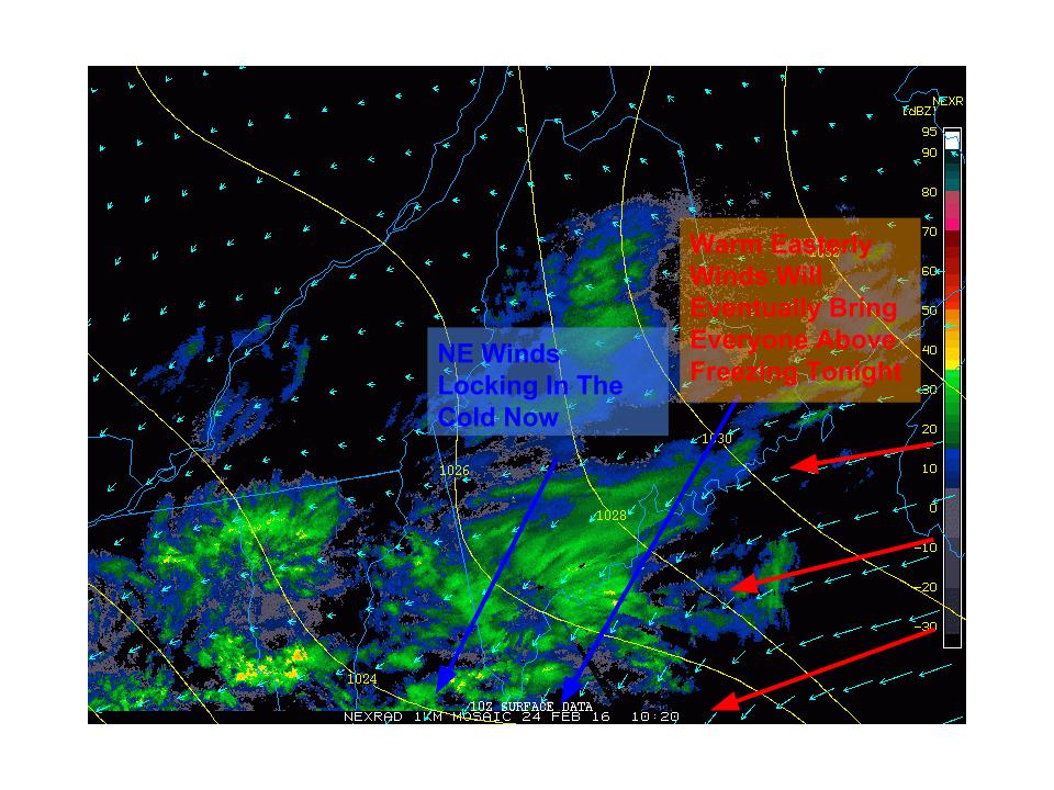
Today will feature the first round of our messy storm as cold air tries to remain locked in this morning. Winds are out of the north-east at the surface and everyone, all the way down to the coast, is below freezing. Snow is falling across the area as of 5:30 but warm air is about to punch in aloft as winds at about 2,500 feet are out of the south-east. Warm air is just starting to punch into the midcoast at that level as of 5:30 and the rest of the coast will soon follow.
Current Obs At 5:30 Show The Situation At The Surface This Morning. Image Credit: COD
Taking a look at surface obs, NE winds are evident across the entire region which is helping to lock in the cold. This is expected to continue this morning even for the coast and a Winter Weather Advisory has been issued for the entire region which was just expanded to include the coast. Notice easterly winds over the Gulf of Maine. These are warm winds and will eventually cause temps to rise above freezing from SE to NW this evening.
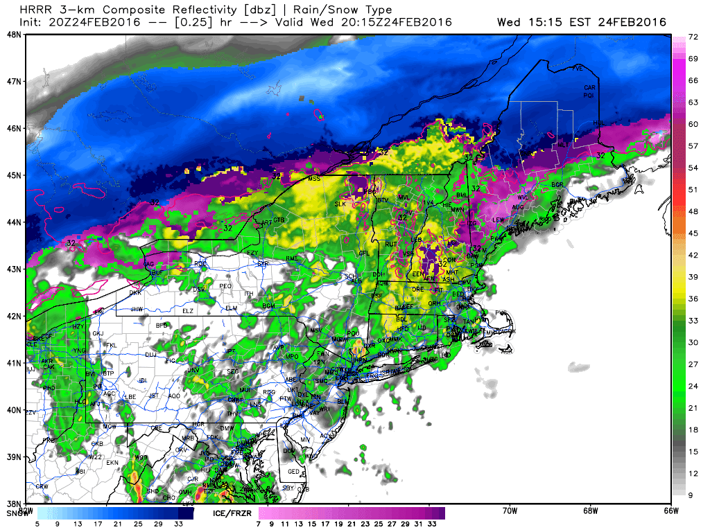
HRRR Showing Snow Slowly Going Over To Freezing Rain Then Rain. Credit: Weatherbell
Snow will slowly go over to freezing rain this morning which will slowly go over to rain this afternoon as shown above. Notice the pockets of freezing rain still holding on in the mountains even this evening. Some of the mountain valleys and some of the higher elevations of the coastal plain could hold onto the rain through around 7-9 PM this evening. In places still below 32 around that time, around a half inch of ice is possible which is more than enough to cause tree damage.
Heavy rain and wind move in tonight, I’ll have another update more focused on that this evening.