
Hello everyone!
Today will feature the first round of our messy storm as cold air tries to remain locked in this morning. Winds are out of the north-east at the surface and everyone, all the way down to the coast, is below freezing. Snow is falling across the area as of 5:30 but warm air is about to punch in aloft as winds at about 2,500 feet are out of the south-east. Warm air is just starting to punch into the midcoast at that level as of 5:30 and the rest of the coast will soon follow.
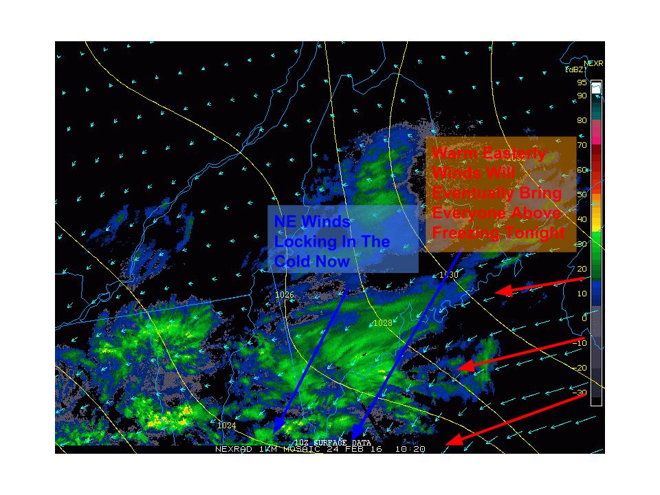
Taking a look at surface obs, NE winds are evident across the entire region which is helping to lock in the cold. This is expected to continue this morning even for the coast and a Winter Weather Advisory has been issued for the entire region which was just expanded to include the coast. Notice easterly winds over the Gulf of Maine. These are warm winds and will eventually cause temps to rise above freezing from SE to NW this evening.

Snow will slowly go over to freezing rain this morning which will slowly go over to rain this afternoon as shown above. Notice the pockets of freezing rain still holding on in the mountains even this evening. Some of the mountain valleys and some of the higher elevations of the coastal plain could hold onto the rain through around 7-9 PM this evening. In places still below 32 around that time, around a half inch of ice is possible which is more than enough to cause tree damage.
Heavy rain and wind move in tonight, I’ll have another update more focused on that this evening.
-Jack
