
Hello everyone!
Today will feature a wild day of weather as a decaying storm passes just to our west. Thunderstorms are cranking through the region this morning though they should clear the Midcoast by around 7AM. In the wake of these storms, some partial clearing is possible this morning before we get hit by the back side of the storm. Right now, it looks like this will feature mainly rain showers this afternoon and evening though snow will be mixing in from north to south. I have doubts as to whether the snow line can make it all the way to the coast before precip departs but the mountains will likely see a period of accumulating snow this afternoon/evening mainly in the higher terrain where a couple of inches are possible. The foothills could see a coating especially at elevation and especially in the northern areas while the coast likely escapes any snow. Rain and snow move out late tonight/early tomorrow morning.
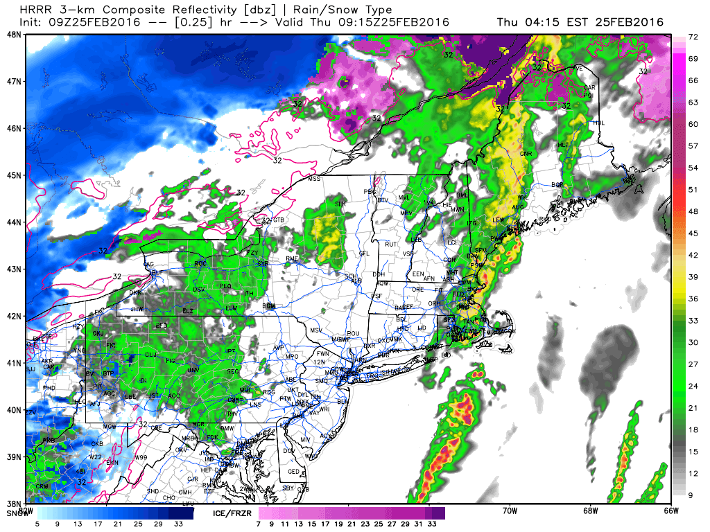
Here’s the HRRR model showing heavy precip moving out this morning followed by lighter precip this evening. Notice the mountains beginning to change to snow at the end of the loop. I expect snow to push as far south as the foothills before precip moves out. Little to no accumulation is expected outside of the higher elevations where upsloping will help enhance precip.
Surface observations indicate some sub-freezing holdouts in the foothills this morning with Bethel, Paris, and Livermore all reporting below freezing conditions. In those areas, watch for slick spots as some black ice is certainly possible. Any remaining pockets of could air could wash out in southerly flow this morning though the cold front is already just west of NYC and racing east so that window is closing. Farther south, record high temps have already been broken this morning as temps jumped into the 50’s. I could see a few more degrees of warming before the sun comes up but after the cold front passes later this morning, expect temps to slowly begin to cool.
-Jack
