
Hello everyone!
A quick shot of wintry mess is incoming tomorrow as low pressure races to our west. Not much in the way of changes from yesterday though I don’t think the mountains will get as much as initially expected. More 3-6″ amounts are likely as opposed to 6-10″ amounts. The main reason for this is the fact that where the cold air hangs on longest is where the least precip falls. Those that see more precip don’t get as much cold. I’ll show that in more detail below.
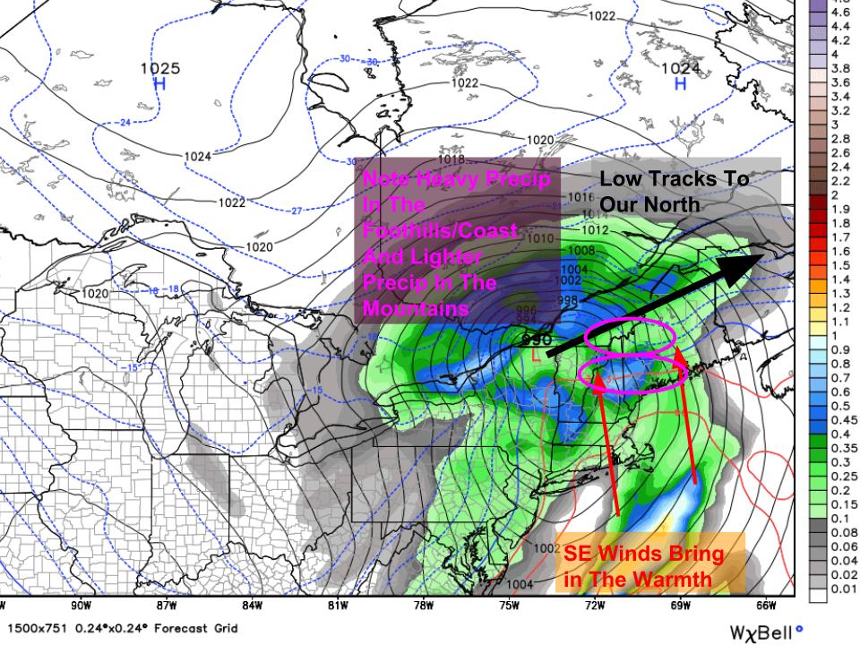
Low pressure that was originally expected to track right over us now looks to pass to our north tonight into tomorrow morning bringing a quick shot of mess especially for areas in the mountains. The GFS map at left shows the low tracking west, the strong SE winds setting up, as well as an interesting feature in the total precip field (solid colors in picture). It looks like the areas that hold onto the cold stay stuck in between two areas of heavy precip. The areas that see the precip get the cold scoured away. This is why I’ve toned down my snowfall map a bit. I don’t think there’s a very good overlap between the precip and the cold. That being said, where there is even modest overlap, around 6″ of heavy wet snow is likely.
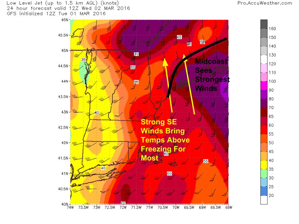
Winds will be out of the SE and could get gusty especially for the midcoast tomorrow morning as a narrow tongue of high winds moves overhead. Winds this time around will be no where near as strong as the last two events but gusts to 30mph are likely. No major impacts are likely. These strong winds will help to push nearly everyone above freezing at least for a time tomorrow morning. The mountains see the shortest above freezing window before a cold front sweeps through tomorrow afternoon.
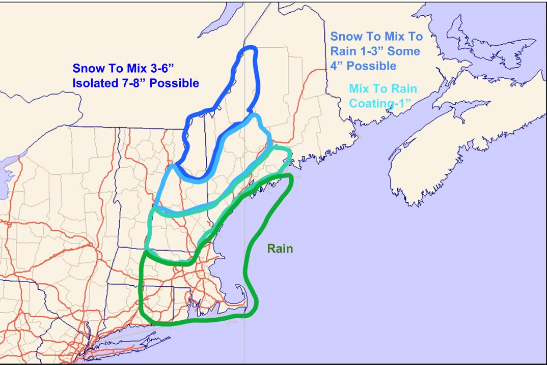
Here’s what I’m thinking for precip type and accumulation. The most snow falls in the north closer to the cold air source. Some light icing is likely inland but no major issues are expected. That being said, the AM commute tomorrow could be slick especially north of Fryeburg-Auburn-Augusta.

This winter will try to send a Hail Mary shot our way late week as a storm intensifies offshore. It looks like we see a near miss at this point but any shift NW would bring snow into our area. After this, we’re basically done with winter as temps warm up heading into next week. While the large scale pattern looks toasty, I think we’re on the edge of the true warmth which will be anchored to our west. I wouldn’t be surprised to see a few backdoor cold fronts cool things off in the next few weeks. It’s really hard to get much above 50 in Maine in early/mid March and while I think the coast hangs out around there, I don’t buy the crazy warmth some are showing. However, we definitely do look to warm up solidly above average with temps in the 40’s and 50’s common by the middle of next week.
-Jack
