
Hello everyone! Precip is moving into the area this evening ahead of the first in a series of weak but messy storm systems that will impact the region in the coming week. This evening, I will focus on the storm moving in tonight and lasting through tomorrow and will save the other storms for updates later this week.
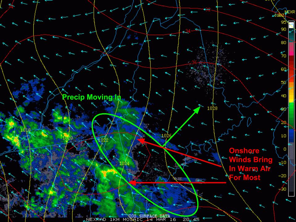
Precip is currently moving into the area from the west this evening as shown on radar pictured here. The air at the low levels of the atmosphere is quite dry which is resulting in lots of the precip evaporating before it hits the ground. The main impact of the dry low levels is on temps. As the air saturates, the temperature will drop through a process known as wet-bulbing which occurs when falling precip enters a dry airmass and evaporates resulting in some heat energy being removed from the air. The net result is temps that crash towards the dew point as precip arrives. Temps currently are in the 30’s and 40’s but dew points are in the 20’s and 30’s. Away from the coast especially in the mountains, wet bulbing looks to be enough to allow for a period of mix and snow this evening into tonight. North of route 2, this mix and snow will last through early tomorrow afternoon before precip tapers and temps warm.
Snow and sleet accumulations in the north will be generally in the 1-3″ range with some areas at elevation seeing up to 4″. Freezing rain will be a concern as well with up to .1″ of ice potentially causing some slick roads tonight and tomorrow morning. The greatest threat for freezing rain will be north of route 2. Coastal areas will see mainly rain.
We get a brief break tomorrow evening and Wednesday morning before more rain/mix moves in Wednesday and Thursday. A larger storm with significant snow and rain is possible heading into next weekend.
-Jack
