Hello everyone!
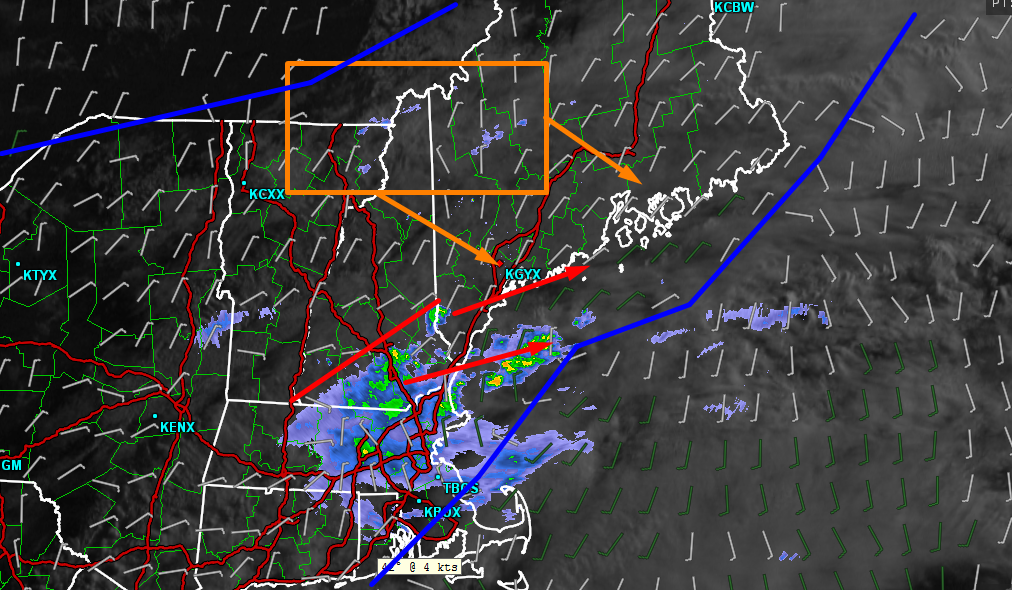
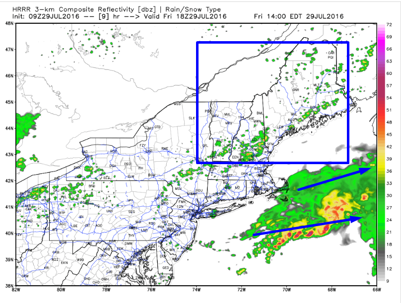
A leftover shower is possible tonight as another cold front rolls offshore but other than that, the next 24-48 hours look to be a continuation of our recent dry pattern. Highs tomorrow will be in the upper 70’s to low 80’s under partly to mostly sunny skies. Cooler temps are expected for Sunday as more clouds and possibly showers are expected to roll in. How many people saw rain today? Not a lot. The drier GFS scenario worked out as a cluster of thunderstorms south of Southern New England kept any significant moisture too far south for tropical deluges in Southern New England and too far south even for light to moderate rain for Southern Maine. Some parts of Southern NH did get a period of much needed rain this morning but much more will be needed to erase the current rainfall deficit which is in the 3-6″+ range. Will we get another chance at rain here in Maine and New Hampshire? Guidance is hinting at more rain Sunday into Monday but I’m skeptical for the same reasons I was about this morning’s event. Most of these doubts stem from the pattern we are currently in across North America.

The general pattern across North America is dominated by upper level low pressure from the NW Territories to Northern Quebec/Labrador. A heat dome is located over the SW US and a subtropical ridge extends to the east of that into the Atlantic and west into the Pacific. The reason that low pressure in the Yukon and High pressure in Arizona is important to us in Maine is that in between those systems, the winds are primarily out of the WNW (black arrows). The disturbance to be watched for Sunday/Monday is the blue line over the central US. Guidance indicates that it will drift NE and intensify as it approaches us. I don’t fully believe the degree to which the models are amplifying it because the pattern indicates that it will tend to zoom south and out to sea just like the disturbance before it did this morning. Now, I do believe we have a better chance of rain Sunday/Monday than we did this morning because of the little pocket of calm winds this disturbance is currently sitting in (red lines). The NW flow is being diverted around the disturbance and so it won’t feel the full effects of the NW winds. This makes me think that we have a better chance to get at least a little moisture up here, perhaps enough to drop a quarter or half inch of much needed rain in the form of widespread showers or possibly even some steady rain.
More details will become available in the coming days and this remains a fairly uncertain forecast so if you have outdoor plans Sunday or Monday, I would simply keep an eye and ear out for the latest info in the coming days before making a decision.
-Jack