
Hello everyone!
A cold front has moved offshore this evening and drier air is working into the area on NW breezes. That dry air will stick around through Sunday and will be accompanied by warm, but not hot, temps. The dry weather will come to an end as tropical moisture streams north Sunday ahead of a cold front due to arrive Monday. Heavy rains are likely to accompany this front before it moves out Tuesday ushering in cool, dry air. This relief sadly looks temporary though as a building ridge looks to bring more heat into the mix by the end of next week.

Today’s forecast worked out fairly well. Skies were mainly clear but some clouds did develop along with a few isolated showers. As expected, an abundance of dry air limited the coverage and intensity of showers. The one issue with the forecast was temps which rose several degrees above the forecast into the upper 80’s in southern NH. This was driven by slight downsloping with WNW winds as well as sunny skies. Overall, a fairly good forecast with, of course, a minor error or two.
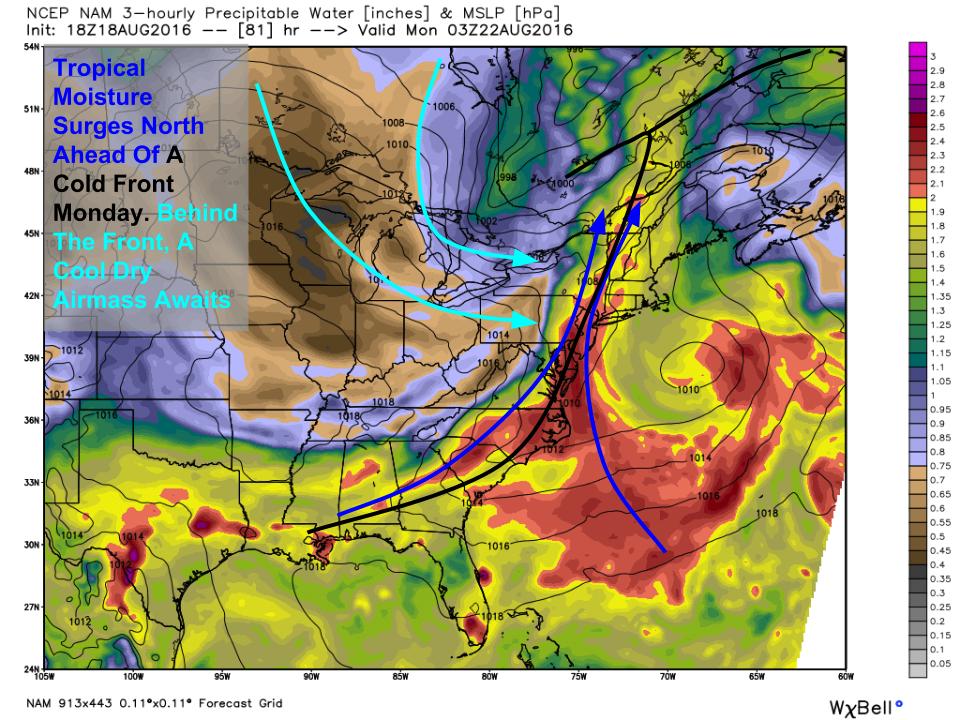
A stretch of quiet weather is likely from now until Sunday evening when a cold front will begin to approach from the west. It will drag a plentiful supply of tropical moisture northward into our area with the cold front separating that tropical moisture from refreshing NW winds which will bring cool and dry air into the region for Tuesday. The biggest question I have regarding the heavy rain threat for this time is how quickly the front can progress east. There is little doubt that cool Canadian air pushing tropical moisture out of the way will result in heavy rains but how long can those heavy rains sit over a particular area? That question can be addressed in the upper part of the atmosphere .

The whole forecast for how much rain we get Monday revolves around the strength of a ridge of high pressure located over the Atlantic ocean. The stronger that high is, the slower the front will move east and the longer the heavy rain will sit over any given location. The trend with recent guidance has been for this ridge to not build to full strength until after the front clears our area. This would indicate a faster front and thus less rain which fits the pattern of disappointment this pattern has brought with regards to drought relief. Also shown in this upper air plot is a digging trough across the Pacific NW which is likely to build a ridge downstream bringing an end to our refreshing weather by late next week.
More details as we get closer.
-Jack

