
Hello everyone!
Quick update this evening as I’m at the USM track for an indoor track meet. I’ll focus this update on the light to moderate snow tomorrow, leaving our Monday blizzard for when I have more time.
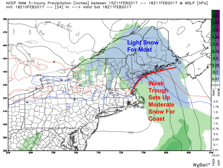
Light snow will develop early tomorrow morning for most. Light snow will continue through the day away from the coast where moderate snow will develop in the early afternoon as a coastal front sharpens up just offshore. Temps will rise slowly into the mid 20’s north and the low 30’s south. The precip should remain all snow and it should be of the fluffier nature.

The weak nature of the precip will be a result of the weak nature of the energy aloft. Notice the lack of deep reds/oranges along with only a weak dip in the height lines. This indicates forcing for precip will be limited at best and most of it will come outside the dendritic growth zone in the lower levels. So how much snow should we expect?
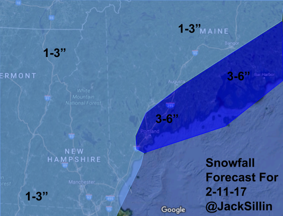
Here’s the current forecast. The heaviest amounts will be across the midcoast where a few 5 or 6″ amounts are possible. Most will see 1-3″ with 4-5″ amounts along the coast NE of Portland.
Our next storm will arrive Sunday afternoon and crank away into Monday. An early look at amounts shows 1-2 feet are likely for many with a few midcoast spots possibly eclipsing the 2 foot mark. I’ll refine and explain these amounts tomorrow evening. In addition to the snow, winds will crank up behind the low pressure system resulting in blizzard conditions along the coast. Another storm could bring significant snow to the region again late in the week. Welcome to winter!
-Jack
