I’m a third-year atmospheric science student at Cornell University who has been blogging about the weather since 2011. While I’m not officially a meteorologist, I have accumulated a bit of experience forecasting both local weather (in western Maine and New Hampshire) as well as national/international weather during my time writing for weather.us and weathermodels.com. I also have experience programming in Python, teaching concepts in weather forecasting, and communicating forecast information to general audiences.
Today will feature warmer temps as we get into this year’s Indian Summer which is formally defined as a period of above-average temperatures after the first frost/freeze. Most of Maine and New Hampshire as well as parts of Vermont and Massachusetts has met the criteria with last week’s cold spell. For RI and CT, it’s not formally an Indian Summer but it will feel like it after last week.
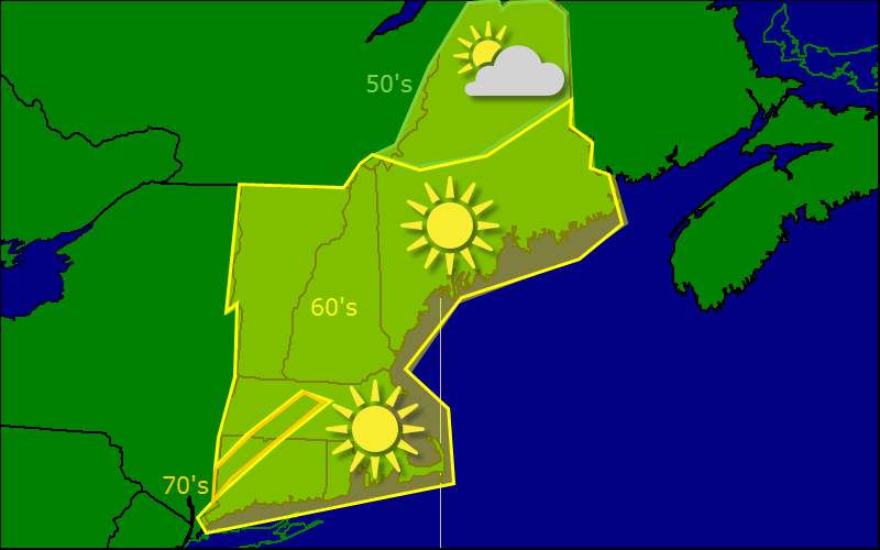
Temps today should rise into the 70’s across much of the region with coastal areas and northern Maine getting up into the 60’s. Sunny skies are expected for all today with the possible exception of the early morning hours when some patchy fog is possible. Also look for some high clouds down in coastal CT and RI as low pressure moves north.
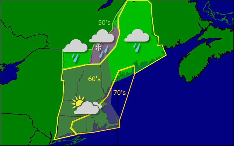
Beyond today, a coastal storm is likely to affect SNE tomorrow with a soaking rain and some wind. Expect the rain to be centered south of I-90 but a few showers could straggle a little farther north.
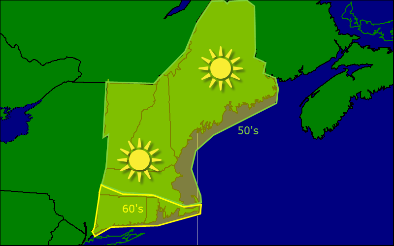
Today will feature cool and dry conditions as high pressure settles in over the region. Expect mostly sunny skies with temps in the 60’s fr the most part. Gusty winds from yesterday should be mostly gone although one can still expect a light breeze which should weaken with time.
I’m watching the possibility for a coastal storm late week. The most likely scenario, as always, is out to sea but models have consistently been getting farther and farther north so it is something to watch.
Today will feature mostly cloudy skies across the region as a cold front works its way offshore and an upper level trough moves in behind it. Expect a sprinkle or shower east of Brunswick/Farmington and in the higher terrain. It is with great excitement that I tell you that wet snow could mix in at the highest elevations. This afternoon should feature more clouds with the chance for a sunny break as well as increasing westerly winds. Reminder: Fall officially arrives at 10:29 PM tonight.
Today will feature brilliant sunshine and chilly conditions ith the majority of the region not making it above 60. Temps this morning were so cold, Sunday River and Sugarloaf were both making snow.
Today will feature continued cool temps as well as an increase in cloud cover as a weak front moves through (no, it’s not a warm front). A deep cold pocket behind the front will bring us the first hard freeze for inland areas tonight with lows dipping into the 20’s. Patchy frost may in fact reach the coast although that remains to be seen.
Warmer temps are on the horizon next week. More details to come but for those who prefer warmth, next week shold reward at least to some degree.
Today will feature mostly sunny skies along with continued cool temps. Highs will range from the 50’s in the far north of Maine to 70’s in southern New England. Some high clouds should move in from the NW later on today and overspread the mountains but precip should hold off until tonight if it comes at all.
Expect a sprinkle tonight along with the front and then bitter cold temps for this time of year Thursday night with 30’s reaching all the way to the coast!
Very sorry I could not update yesterday; WordPress was having quite a few issues (i.e. not loading, crashing out, etc.) and despite a solid hour of trying, I could not get through.
Today will feature mostly cloudy skies with rain for pretty much everyone. Expect mostly light rain and drizzle although there could be a brief period of moderate rainfall. All shower activity should clear the coast tonight.
Very cool temps move in for the end of the week and into the weekend. Friday looks to be the coolest day when temps might not make it above 60.
Today will feature dry and almost chilly weather as highs won’t get out of the 60’s for most. Some spots in Southern New England will see 70 and in the wilds of NW Maine, high’s won’t even get to 60. A gusty wind will make this morning even colder. Winds subside in the afternoon but even under full sun, there will not be much warmth.
Cool and dry today. Bundle up as NW winds gusting over 20 mph will make it feel even colder. Winds relax in the afternoon.
Today will be not so nice as we have a cold front moving through. The word ‘raw’ comes to mind in association with today’s weather compared to what we’ve had the past 4 months. We will wake up this morning to areas of drizzle and fog and showly transition to rain showers and maybe a rumble of thunder. A wind off the water should keep us nice and cool with temps likely not getting above 70.
Another extended strech of nice weather looks to start tomorrow with an even bigger cooldown arriving sometime next week.
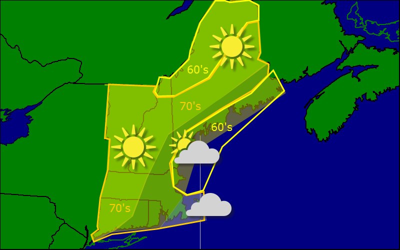
Today will feature a similar temperature scheme as the past few have (great for running intervals!) with highs in the 60’s along the coast of Maine and the mountains. everyone else is stuck with 70’s (still not bad!).
The one main difference between today and yesterday will be the increase in clouds. An unusually strong coastal low is churning well to the south of the region and moving up the coast (don’t worry, we have a strong ridge of high pressure in place to defend us). While the low will move offshore without any precip, it will bring some more clouds to the region.
There is some morning fog present both at the coast and in the valleys but that should burn off by midmorning.