Rain and snow this weekend

Hello everyone!

Today will feature periods of rain and snow depending on your location. Coastal areas will start as rain and snow but go over to all rain around 11. Inland areas start as all snow and go over to freezing rain around noon and rain around 1. A trace of ice is possible. For the foothills, Expect mostly snow with a period of freezing rain. Snow could accumulate 2-4″ along with .1″ of ice. For the mountains, all snow is expected with 3-6″ of accumulation.

All precip moves out tonight leaving mostly cloudy skies for Saturday morning. Saturday, things cloud up again ahead of a much more significant storm. Precip with this one should start Saturday around 3.

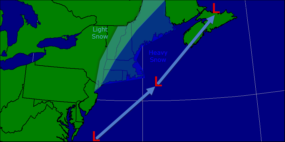
Precip type is where things get very tricky with this storm. each model run has varied wildly between heavy rain, snow storm, or ice storm. Right now, I expect heavy rain along the coast with a myriad of p-types as you head inland.

Snow map 3-28

Click to enlarge.

Above is my best guess of what will fall and how much this weekend. I will update this tomorrow. Flooding could become a big issue at the coast where 3-5″ of rain is expected. Keep in mind, ice jams are still in place from January’s thaw. Up north, more snow will be added to the pack and when it all comes flooding down, it will not be pretty. Thankfully, only more snow is in the 7 day up there. Ski resorts will be very happy.

More rain/snow early next week and another potential for a significant rain/snow storm arrives later next week. Expect light precip Tuesday in the form of rain at the coast and snow inland. Heavy precip makes a return Thursday into Friday next week.

-Jack

Wind subsides today, spring arrives tomorrow

Hello everyone!

Today will feature sunny skies, cool temps, and a lot less wind. Winds gusted over 50 mph at Portland and Augusta. One buoy in the Gulf of Maine gusted to 115 mph on several occasions. 115 mph is major hurricane strength.

Highs today will reach the mid 30’s as winter continues for one more day. Tomorrow, showers are likely mainly in the afternoon hours. Temps could hit 50 under cloudy skies. Winds could become breezy out of the south.

Saturday is the best day out of the weekend with just a chance for a passing shower. Greatest chance before 8 am and after 6 pm. Temps will be in the low 40’s.

Sunday is when things get interesting. Models are handling a developing low pressure are very poorly as it intensifies off the coast. There are 3 probable scenarios that we will have to watch with this one.

Scenario 1: Snow storm. Yes, there is a reasonable possibility that the precipitation will fall as snow possibly leading to hefty accumulations. The greatest chance for this is over inland areas. Likelihood: 45%

Scenario 2: Rain storm. There is definitely a possibility, and a good one at that, that this falls as rain which could cause major flooding concerns. The area would generally see about 1″ of rain, which, falling on a foot of water locked up in snow, could cause problems. Likelihood: 50%

Scenario 3: No storm. Although this seems unlikely at the moment, there is always a possibility this just goes right out to sea and doesn’t bother us. I wouldn’t count on it though as it currently has no model support. Likelihood: 5%

Monday looks to be pleasant with temps in the mid to upper 40’s and full sun. Next week features more rain Wednesday and Thursday with less than pleasant temps.

-Jack

Windy today

Hello everyone!

Today will feature very windy conditions as an extremely intense low moves to our east. Winds could gust to hurricane force over Downeast Maine while everyone else sees tropical storm force winds. Winds will decrease over inland areas. Highs today will not get above freezing for the third day in a row. Temps will only make it to about 30 under cloudy skies.

As for snow, expect any steady snow to be to our east with showers and squalls here in Southern and Central Maine. A dusting is possible.

Tomorrow, we clear out and warm above freezing sunder sunny skies with highs reaching about 35. Winds will be calming down as well as the storm heads east and weakens.

We have a warm and rainy weekend ahead with several storms moving along a slow-moving front. One will arrive Friday with heavy rain and fog. Showers are expected Saturday with another storm Saturday night into Sunday.

We will have to watch out for flooding as almost a foot of water is locked up in the snow pack up north and some of that could suddenly flow into rivers with ice jams left over from the January thaw.

SWE 3-26


How much water is in the snow or Snow Water Equivalent.

More rain is in the forecast for next week. Temps could hit 50 for the first time this season on Monday.

-Jack

Nor’easter barely misses

Hello everyone!

Today will feature continued cold with temps again struggling to hit 32. Clouds will increase as  the day goes on as a monster ocean storm approaches from the south.

Tomorrow, light snow and extremely high winds impact the area on the fringes of a monster storm. We really dodged a bullet as Atlantic Canada will pick up 2-3 FEET with even higher winds.

I want to take some time to break down the wind threat as it is not something to be ignored. Winds along coastal Maine will gust over 50 mph. This alone would be worrisome as trees are still brittle from our ice storms this winter. However, our road crews have diligently spread mind boggling amounts of salt and sand on our roads that lies there right now. 50 mph winds will cause this to blow around quite a bit which would really hurt if you happened to get hit. The NWS has outlined the likely possibility of a High Wind Warning for coastal areas due to this.

As for snow, a wind-blown coating to 2″ is likely for Brunswick, Portland, and Augusta. Midcoast sees 2-6″ while Downeast Maine sees over a foot. We really dodged a bullet here in Southern Maine as this could have been really bad.

Spring arrives Friday, Saturday, and Sunday with heavy, flooding rains and temps in the 40’s. Monday features our first shot at 50 this spring. Enjoy!

-Jack

January-like cold today

Hello everyone!

Today will feature very, very cold temps with lows sitting at between 10 below and 10 above this morning with wind chills solidly blow 0. Highs today could break records as the coldest high temperature for March 24. Highs won’t get above 30 today.

Tomorrow will feature more extreme cold but the air will modify slightly so it will not be AS cold as today. Highs will struggle to break freezing tomorrow under sunny skies gradually clouding up.

Wednesday will feature the potential for a big storm. With this, about 50 miles separates a windy few inches from a 12″ blizzard. If the storm tracks as currently forecast, winds at the coast could gust to 40 mph with inland winds reaching 30. If the storm moves just 50 miles west, much higher winds can be expected.

Just for kicks, winds out over the Gulf Of Maine will be howling at over 100 mph with 35-40′ seas. Nova Scotia will be battered with more than 2 feet of snow and hurricane force winds. So please don’t complain about more snow, because we could have had it a lot worse.

As for accumulations, I will not post a map today, that comes tomorrow as usual, but a dusting to an inch is a good bet for inland towns while the coast is a lot harder. Coastal York county will see 1-3″, Coastal Cumberland will see 2-4″, and anything to the east of Brunswick will likely get more than 6″. Again, the distance from Portland to the 6″+ amounts is only 25 miles. Only a 25 mile westward shift is needed to bring that 6+ to Portland.

-Jack

Colder weather arrives today

Hello everyone!

Today will feature the passage of a strong cold front bringing in cooler temps this afternoon and much colder temps for tomorrow. Highs get into the low 30’s at the coast and mid to upper 20’s inland.

Tomorrow will feature extreme cold for this time of year with lows near 0 and highs struggling to get to 30. Tuesday will be more of the same although by them the air mass will have moderated slightly.

Wednesday features the possibility for a major storm. There are 3 different scenarios that I will break down below.

Scenario 1: Storm goes E out to sea giving Cape Cod and SE MA heavy snow but nothing here in Maine. Eastern CT and Eastern Mass would also get some snow. Likelihood of happening: 20%

Impact map 3-23

Scenario 2: Storm comes closer to the coast but does not hug the coast. Coastal areas would see heavier snow while inland areas would see light snow. Likelihood of happening: 50%

Impact map 3-23 v2

Scenario 3: Up the coast over or just barely east of the benchmark resulting in a major storm for the area. Heavy snow falls over much of the area and high winds become a problem as well. Likelihood of happening: 30%

Impact map 3-23 v3

In a few hours, new models will become available with much more accurate info. I will have another update this afternoon if anything changes with this storm. I will be continually breaking down updates on twitter @Jacksillin.

Late week features a warming trend and also some wet weather. Highs will reach the 40’s with rain falling. Flooding may be an issue as inland areas have close to a foot of water locked up in snow. Coastal areas have 3-6″ of liquid in the snow pack. When this is released, there could be flooding especially in areas with ice jams left over from the January thaw.

This storm this week could be the pattern-breaker meaning this wintry pattern goes out in a spectacular display of power before being broken down. Think of the storm January 1-2 before the weeks long thaw. That is a perfect example of a pattern buster. Only time will tell when winter’s spell will break, but this could be it.

-Jack

Snow/rain on the way today

Hello everyone!

Today will feature a mix of rain and snow depending on your location. Precip will arrive in the next hour or two and stay only until early afternoon. Accumulations will be in the 2-4″ range for most with 3-6 in the mountains and a dusting to an inch along the coast. Temps will be in the low 30’s inland and upper 30’s at the coast.

Tomorrow features the passage of a strong cold front bringing with it the potential for some flurries as well as much cooler air.

Cold is locked in place Monday and Tuesday ahead of our next storm arriving Wednesday.

This storm will be a very, very close call as current forecasts have it scraping our area with only moderate snow. IF it shifted farther west, we would have a very big storm on our hands. If it shifted east, we would get nothing more than a cold, windy day and some flurries.

Based on the current forecast track, I think a moderate snowfall of 3-6″ is most likely. I will have a map out later this weekend or early next week. This would likely be a heavy, wet snow as temps are not that cold.

Strong winds and coastal flooding could also become an issue IF the storm tracks right.

For those who want a change in seasons, rain and warmth are in the forecast for next weekend.

-Jack

Mild and breezy for the first day of spring

Hello everyone!

Today will feature mostly sunny skies and mild conditions as temps rise into the 40’s along the coast and 30’s inland. Breezy west winds will be the only issue today gusting over 20 mph at times.

Tomorrow our next storm moves in spreading snow across inland areas and snow, sleet, and rain at the coast. While amounts likely will not reach the 12-16″ reported in some areas yesterday, it will be similar to yesterday’s setup.

Sunday features a return to below normal temps in the morning and then an intense cold front bringing in a very, very cold air mass for early next week. Highs will not get above 30 Monday or Tuesday and lows will be near 0.

That will set the stage for our next potential storm mid next week. Right now, I am leaning towards a glancing blow with several inches along the coast. That can an will change as this is a low confidence event. Follow me on twitter @JackSillin for more constant updates. I may post an afternoon update here if necessary.

-Jack

Un-springy welcome to the new season

Hello everyone!

Today will feature the arrival of the spring season at 12:57 PM. Here in Maine, the town of Waterford received 12″ of new snow. Madison NH picked up a whopping 13.5″. In Yarmouth, we got 1.5″ as well as some sleet, freezing rain and rain.

The rest of today will feature continued snow inland and continues rain at the coast. Highs inland will rise into the low 30’s and highs at the coast will jump into the mid 40’s! A stiff east wind will also make it feel raw this morning.

The passage of the front or “fropa” will occur at around 11 this morning. After this time, expect a few sunny breaks as well as a drier west wind and an end to precip.

While the calendar says it’s spring, Mother Nature has no such thoughts for the next 2-3 weeks. Look for more snow Saturday accumulating 1-3″ and more on Sunday accumulating less than an inch.

Sunday will also feature the passage of a strong cold front which will drop temps a good 10-15 degrees to start the week. Monday morning will be a cold one with lows in the double digits below 0.

Our next chance for a big storm arrives in the middle of next week. Unlike our weekend events, confidence is very low on this one but it looks like at the very least, the coast gets brushed with several inches.

While it is still far out, and there is still lots of uncertainty, the pattern is ripe for a big storm to form and ride up the coast. We have a fresh invasion of arctic air coming in and basic meteorology says to look for storms on the leading edge.

-Jack

Sunny but cool today

Hello everyone!

Today will feature full sun for most of the day with the exception being later in the afternoon when some high cirrus clouds will filter in from the west. Temps will be cool but not cold with highs in the low 30’s not unlike Yesterday.

Tomorrow will feature a spring-like welcome to the new season with a cold rain, temps in the 40’s and a stiff east wind. Snow, sleet, freezing rain, and rain move in Saturday and we’re back in the icebox Next week with the chance for a larger storm midweek.

-Jack

Reliably hype-free weather info for Western Maine and New Hampshire from amateur forecaster Jack Sillin