As a cold front passes through this morning, rain/snow showers will push through however, most will be dry by mid-morning. Behind the front lies the coldest air of the season and some breezy conditions to transport this air from Canada. The remainder of the week looks storm free and cool before a warm up late in the week.
A cold front will cross the region tonight with a few snow/rain showers even at the coast. Here in Yarmouth, we have yet to see our first flakes. Tomorrow morning may just present that opportunity. With sparse moisture and warm ground temps, I expect little accumulations. Below is a map detailing my thoughts on accumulations.
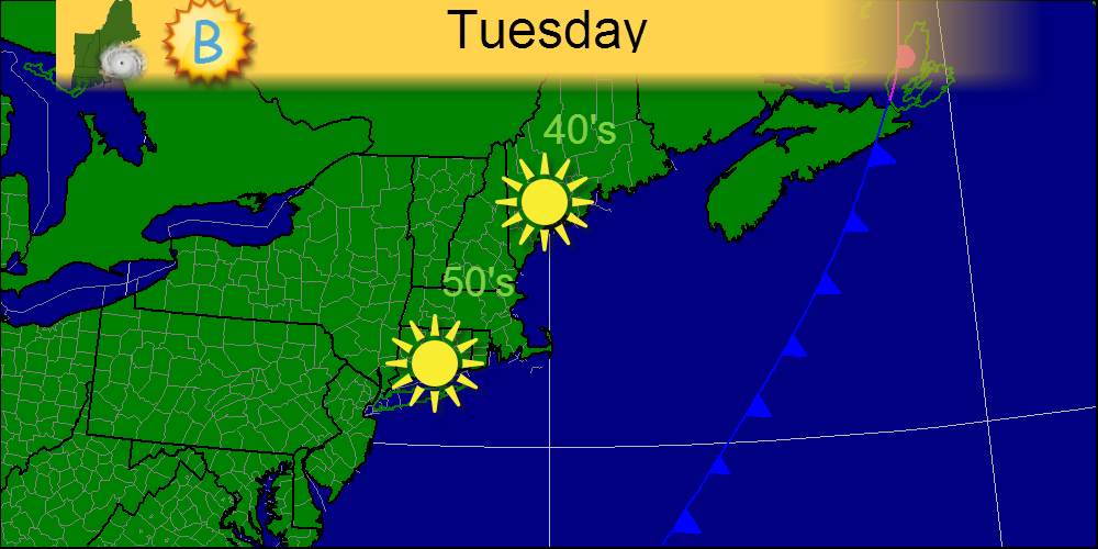
Today, a departing high pressure system will bring warmer temps to the area. Areas in far northern Maine will likely only top out in the 40’s but elsewhere, it looks like 50’s are a safe bet. Tomorrow, 60’s return along with some rain. Enjoy!
Today, we will see very cold temps this morning anywhere from 15 or so in far northern ME to around freezing in southwestern CT. Sunny skies will dominate today and tomorrow as a VERY strong high pressure area dawdles around the region. Enjoy!
For Halloween, we have cloudy skies and cool temps. A warm front moving out of the Mid-Atlantic states will bring some showers to the area right around trick-or-treating time so look out for that. Otherwise, look forward to a stormy day tomorrow!
Today, high pressure shifts offshore and a storm system in the Southern Plains will start to spread clouds into the region today. Temps will still be cool with morning temps in the 20’s and 30’s. Looks like Halloween night will be wet with periods of rain, more frequent as the night progresses.
Yesterday, windy conditions prevailed due to the passage of a cold front. Today, winds have relaxed but the cold air is in full control with the high temps struggling to get out of the 40’s. Full sun is expected with the exception of a few clouds over far northwestern Maine. Enjoy, rain is slated to arrive for Halloween!
Today, a cold front will move in from the west and ahead of it, high clouds and breezy conditions will be common. Winds will be out of we SW backing to the W at between 15-20mph. Ahead of the front high cirrus clouds will develop as well. The front will pass through tonight with showers in northern ME and the chance for a sprinkle elsewhere.
Over the next few days, cool weather will continue over the region as another cold front passes through the region Monday night. Winds will increase Monday out of the SW ahead of the front and pick up out of the NW Tuesday after the front passes. Top winds will likely be Monday reaching 25 mph in exposed spots. Late-week warm weather returns with the threat of rain possibly arriving Friday or Saturday. Uncertainty is very high here however so I did not include rain in my forecast right now.