There are 2 disturbances in the tropical Atlantic ocean which have potential to develop into tropical cyclones. One is located about 700 miles east of the Lesser Antilles and the other over the farthest western reaches of Africa. Lets start with the one that is closer to home.

This map highlights the NHC‘s OFFICIAL forecast for development. The yellow circle is our first AOI. They gave the wave a 10% chance of development in the next 2 days and a 20% chance in the next 5 days. The orange circle is our 2nd AOI. They give it a 40% chance of development in the next 2 days and a 60% chance of development in the next 5 days.
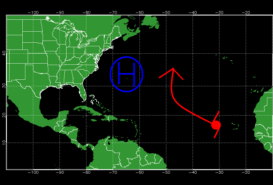
There is a tropical wave located about 700 miles east of the Lesser Antilles. This wave is moving westward at around 10 mph.

This shows our first AOI to look at. The wave will continue to move westward through the Caribbean. When it reaches the Western Caribbean, there is the chance a trough in the upper atmosphere could tug it to the north however, those details are still shady.

This is the GFS ensemble upper air map for Saturday. I’ve marked the position of troughs capable of tugging our disturbance northward. Read more about GFS ensembles and this upper air map. The effects of the trough, however will only be felt if the storm sticks up high enough to get caught by the trough. An equally likely scenario (or probably more likely) is that it stays west, crosses Central America, and enters the Eastern Pacific where it could become a tropical cyclone.
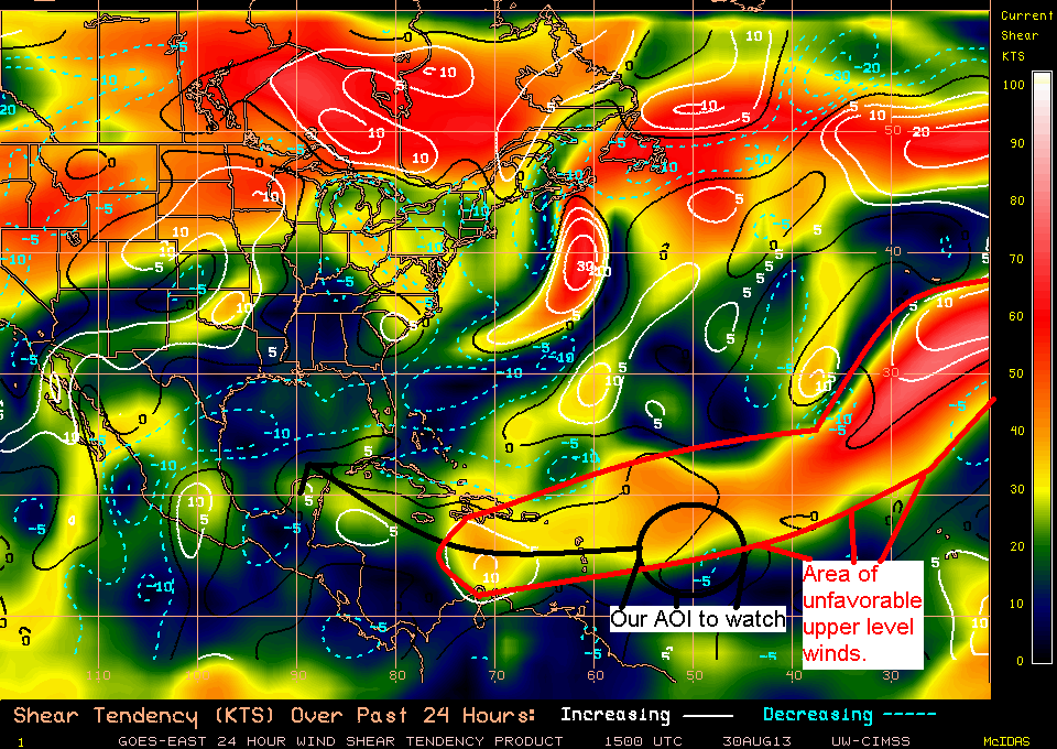
This map shows the main problem for this disturbance-wind shear. This will rip up the thunderstorms which destroys a tropical cyclone. The area of high wind shear is marked with the red line.
The forecast for this disturbance is for little development. I’ll highlight what some of the models think plus my thoughts below.
GFS-Open wave moving west into Central America
NAVGEM-open wave moving NW then re-curving to the NE over open waters.
CMC-The outlier. Has a strong TS/Weak hurricane following a track like Irene through the Bahamas. I doubt this will happen, however it is still a possibility.
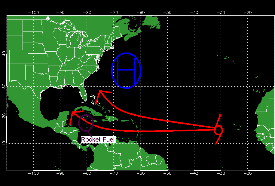
My thoughts- I like the GFS’ idea of an open wave tracking over the eastern Caribbean however, I think instead of going into the Eastern Pacific, I think it will track through the Caribbean and over the Yucatan like several other waves have done this season in similar conditions.

This map shows the track I expect it to take along with the impacts I expect it to have on some of the Islands. Areas outlined in light green indicate lighter rain/wind while areas outlined in darker shades of green indicate higher winds and heavier rain. I do not expect any major impacts to be felt anywhere.
Now to our second disturbance. This one shifted its center slightly east over the farthest western tip of Africa. This wave will move NW into the open waters of the North Atlantic. The models don’t really want to do much with it all developing a weak TD or TS at very best.
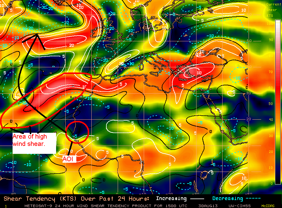
This map shows our AOI and the area of high wind shear it will head into suppressing development. This is the reason that there is little model support for its development.
In other news… There is a strong extra tropical low off the Canadian Maritimes that will give them some rain and wind.
Tropical Depression Kong-Rey in the Western Pacific will bring rain and wind to Japan before swiftly exiting the picture there.
My next post will likely be tomorrow or Sunday.
-Jack