
Hello everyone!
Our midweek heavy rain event is still very much on track for Wednesday afternoon through Thursday morning. Tonight’s update will focus more on specific impacts rather than larger scale setups.
Rain
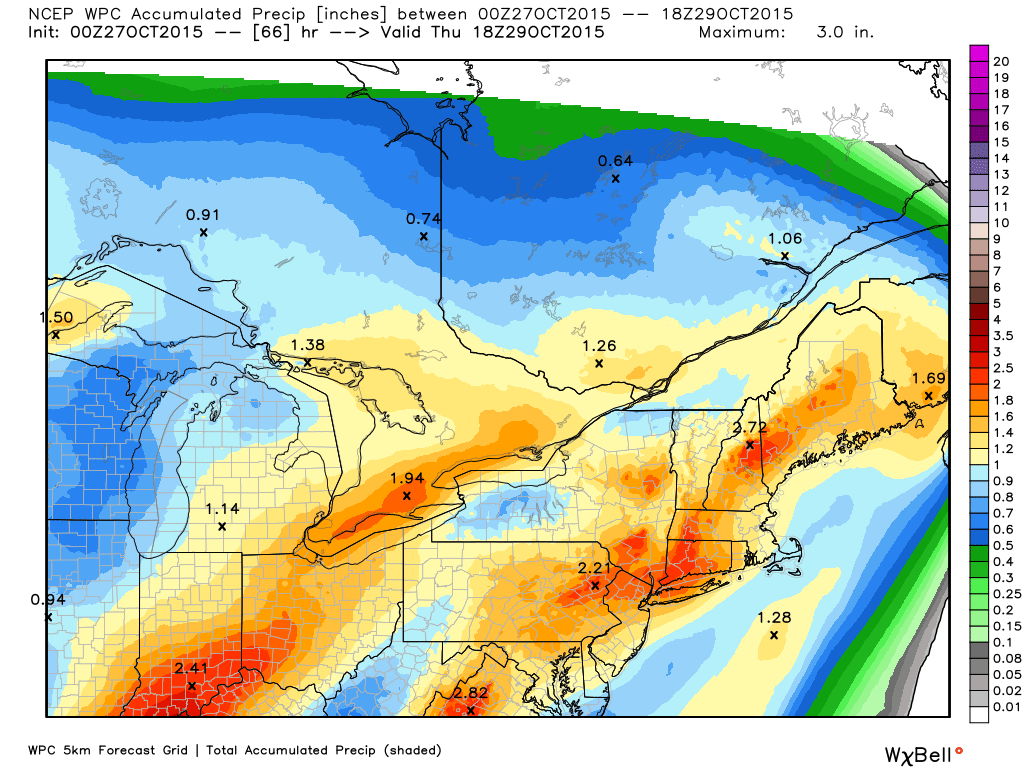
Heavy rainfall is likely to be the main threat from this storm as Patricia’s moisture streams northward and interacts with the approaching cold front. A general 1-2″ is likely (Tan-Orange shadings on the map) with some 2-3″ amounts likely in the favored upslope areas (reddish shadings on the map). The fast moving nature of this system is what will keep precip amounts relatively low and given the quick arrival of dry air from the west Thursday morning, heavy precip should be centered in the 8PM-6AM timeframe which will limit total rainfall. Rain is likely to arrive earlier in the evening Wednesday likely closer to 5 or 6PM. These details will continue to be refined in the coming days.
Wind

With a strong cold front comes strong winds and this time is no different. A SE gradient will sharpen up during the day Wednesday leading to very strong winds by Wednesday afternoon into the evening. On the map above, the yellow line is the mixing layer and the red/green/blue contours are wind speeds. Elevation is the y-axis and time is the x-axis but read from right to left (I didn’t make the graph I promise! (credit to that goes to BUFKIT)). The takeaway is that any wind under the mixing layer is ‘eligible for a ride to the surface in heavy rain. Given the likely heavy rain early Thursday morning which coincides with the strongest winds just above the surface, very high winds are definitely a concern from midnight Thursday to 6-7AM or so. Expect the highest winds along the coast 20-30 mph with gusts to 55 mph or so. Lesser winds are expected elsewhere. With this kind of wind, saturated ground from the heavy rain, and some leaves definitely still on the trees, scattered power outages are likely especially along the coast.
The tides don’t look to line up particularly well for coastal flooding but some minor splashover is possible in the usually suspect areas.
I’ll follow today’s update pattern again tomorrow with daily weather in the morning and then a storm update in the evening.
-Jack

