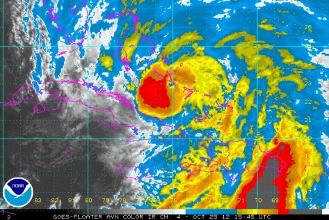
There is a complex weather situation at play now as Hurricane Sandy moves up the Eastern Seaboard. The latest advisory puts Sandy as a 105mph Hurricane with a lowest pressure is 964mb. Sandy has just moved off the northern coast of Cuba.
Sattellite imagery of Sandy moving off of Cuba.
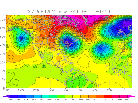
Now Sandy will continue moving north and then the second factor comes into play. This second factor is a trough of low pressure moving in from the west. This trough will pull in sandy towards the US. Sandy will then “bomb out” off of the NJ coast. Pressures will fall like a rock bottoming out near 949 mb. This is the general consensus of the numerical models. (These are super computers located around the world that take in weather data from around the world. Then this data is fed through a prisim of equations that produce graphs that we weather geeks/ meteorologists then interpert and make forecasts from).
Sandy will then be a Nor’Easter on steroids. This super-noreaster will then move into the coast south or on top of New York City. Surge flooding will be of great concern. There is a 5 foot seawall protecting the financial district from New York Harbor. This storm will be over 2500 miles wide and close to 3500 miles long. This huge storm will generate a 9-12 foot surge on top of the astronomical high tide caused by the full moon on Monday. This would most likely cause flooding in lower Manhattan.
There will be a snowy side to this storm as well. This will be the tropical moisture from Sandy moving up the coast meeting the arctic airmass behind the trough. Pennsylvania and Western New York State as well as the mountains from the Allegheny Mountains in Pennsylvania to the mountains near Mt. Katahdin, Maine could see snow.
CMC Numerical model plot for Mega Noreaster Sandy.
Snow amounts will be on the order of 4-8″ for lowland Pennsylvania to over 28-36″ on the higher peaks.
Rainfall will also be greatly enhanced by the warm moist air hitting the cold air from Canada causing the heaviest October rains in history. Rainfall amounts could reach over 20″. 12″ is expected over most regions.
Winds will be on the order of potentially 80mph in NYC where the worst of the storm will be. 55-70mph will be widespread with higher gusts. The coast of ME, MA, RI, CT, NY, NJ, and DE will see highest winds peaking around 50-65mph in many places. Exposed areas could get even higher gusts.
Timing will be Saturday-Monday for areas south of VA beach area, Sunday-Tuesday for CT to VA beach area, and Monday-Wednesday for New England.


