
After an inactive start to the season, we are about to turn over a new page in the tropics. The main driver will be the Madden-Julian Oscillation, a pattern of shifting winds that increases thunderstorm growth that returns to the same area every 30-60 days. This pattern will make itself known later this week into this weekend and will continue through mid September. For those of you who follow tropical weather, we saw this pattern in the Central Pacific and the Eastern Pacific these past few weeks which was why there was so much activity there. (2 storms in a week in the Central Pacific is VERY active) We already have a few interesting African Waves to look at…

Our 2 African waves that need to be watched. More are expected to arrive from Eastern Africa over the course of the next few weeks.
Another unusual thing about this particular MJO pulse if there have only been 2 of this extreme caliber in recent memory. In those 2 cases, 68% or 21 out of 31 depressions formed into hurricanes. The models are already excited showing nearly every wave evolving into a system. Most of which will recurve due to a high pressure system that usually steers it into the Caribbean being too weak to have the westward effect on storms.
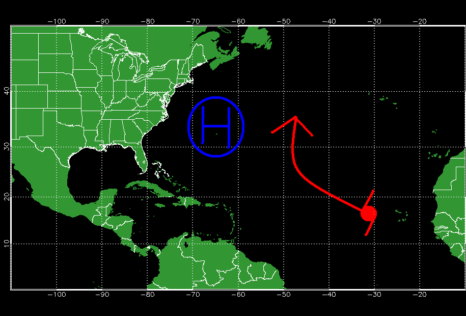
The position of the Bermuda high is further westward and weaker allowing strong storms to recurve easily out to sea.
However, if a storm is weak enough it will continue westward into the Caribbean where so called “rocket fuel” is located allowing for rapid intensification under the right circumstances.
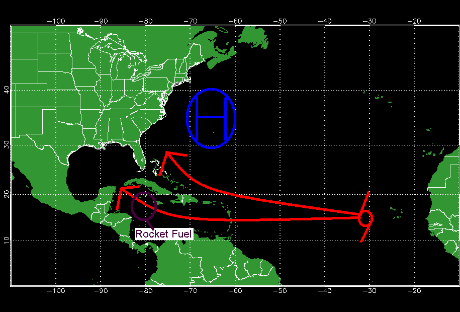
This map depicts a possible track for a weak storm that can continue westward despite the position of the high.

This map shows where the most possible energy is for a tropical system to feed on.
I believe the last time a storm traversed this area was in 2008, 5 years ago when Gustav moved from the Western Caribbean into Cuba. This is also the same area where Wilma intensified into a monster 882 mb, 180 mph, cat 5 hurricane. The other danger that lies here is that any storm that forms and intensifies WILL affect land and has a 95% chance of making landfall somewhere. The good news is that no model currently forecasts a storm to develop here however its an important area to watch nonetheless.
A further update on the tropics can be expected in a few days or when a system develops or is a threat to develop.
-Jack
