Hello everyone!
Our nor’easter is getting going quite nicely over the region tonight. Winds are cranking across the area with gusts approaching 50 mph offshore. Anything above the trees will see very intense winds this evening as the low to our south really gets going.
As of now, the best rainfall is over the mountains but expect the folus to shift back towards the coast this evening. Storm totals of 2-4″ with locally higher amounts along the coast and in the mountains still looks on track.

Expect bands of moderate to heavy rain to continue to rotate onshore this evening into tonight. This trend will continue through tomorrow morning before tapering off tomorrow afternoon. Expect high winds to continue as well slowly backing to the N tonight and evenually the NW by tomorrow afternoon.
-Jack
Hello everyone!
Today will feature a glum day two of our coastal storm which is still barely developed. Yes, over an inch of rain has already fallen in some areas and the storm hasn’t even formed yet. Today the storm begins its strengthening and as a result, the rain gets heavier and the winds stronger. Expect 20-25mph sustained winds with gusts exceeding 30 mph. As far as temps go, they will have to work HARD to get above 50 today in Portland. I don’t think the mountains make it to 50 and stay in the upper 40’s. Southern New England will make it comfortably into the 50’s.

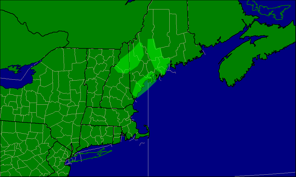
We’re still on track for a widespread two to four inches but upwards of five inches could fall in one of three “bullseye” areas.
The three areas highlighted in green are where 5+ inches of rain could fall.
The rain is starting out light this morning but expect it to pick up as the day goes on. Tonight will be a wet one for sure as the storm pushes band after band onshore. Tomorrow morning looks similar but rain should taper off tomorrow afternoon.
Expect a repeat of today tomorrow with showers still hanging around on Friday.
-Jack
Reliably hype-free weather info for Western Maine and New Hampshire from amateur forecaster Jack Sillin