Day one of nor’easter today

Hello everyone!

Today will feature clouds and showers as day one of our nor’easter gets going. Even now, rain (and snow if you happen to be on Mt. Washington) is falling across the area in scattered shower form. This should how things go this morning, but by afternoon, a coastal front will set up and steady rain will overspread the area with heaviest amounts over southern coastal ME where the front sets up. Winds should remain light today as the cyclone itself is still undeveloped.

today 10-21

As far as the rest of the week goes, expect the heaviest rain to be tomorrow and tomorrow night but keep the umbrellas handy until Friday. Rain stays in the forecast until Thursday, clearing Friday, and back to bright Saturday. Check out the 7 day forecast here.

-Jack

Clouding over today

Hello everyone!

Today will feature the last chance this week for sun as we have a cut-off nor’easter to look forward to. More details on that below. Today however is shaping up to be pretty nice with NW winds slowly subsiding and temps rising into the upper 50’s. Clouds though will be on the increase with fully overcast conditions expected by sundown.

Today 10-20

The seven-day forecasts can be found in our new maps section.

——————————————————————————-

As for the Nor’easter slated to hit this week, expect periods of rain starting Tuesday evening and lasting through Thursday evening. Winds will also be gusty at times from the NE.

hpc qpf

Here is the official HPC QPF forecast for the next seven days (this storm is the only one forecast for the next seven days). I agree with them in that the bullseye should be in the NE corner of our forecast zones however I think 5″ is a little overdone. For now, expect widespread 2-3″ amounts with 4″ possible in NE zones and the favored upslope areas.

Rain moves out Thursday evening/Friday morning and clearing begins Friday evening. Saturday should be bright and clear with breezy conditions possible once again.

With such a long period of onshore winds, coastal flooding is always a big concern. While tides are astronomically high now, they are low by astronomical standards which should prevent significant coastal flooding. With that in mind, some splashover is likely at exposed areas. Also of concern will be beach erosion as wave action will be high during this period. Again, not something to be overly worried about but it is good to keep in mind.

-Jack

2014-2015 Winter Outlook

Hello everyone!

It is finally time for the 2014-2015 winter outlook to be released. Remember, as with all seasonal forecasts, confidence is low and nothing is etched in stone so to speak. Below, I will go into more detail as to the factors that are pointing me in the direction of the final forecast. I’ll try to keep it as non-geek friendly as possible but there are some parts that will be a little technical.

ENSO

One important factor in determining what conditions any given winter will bring is something called the El Nino Southern Oscillation which refers to the temperature of the water off of the Pacific coast of South America. When this area of the ocean heats up more than normal, an El-Nino event takes place. When this area doesnt heat up as much, a La-Nina event takes place. A weak to moderate El-Nino event is nearly unanimously agreed upon by the models for this winter.

enso

Here are the model forecasts for SST anomalies off of South America (SST anomalies are how much warmer or colder the water temps are compared to average).

El-Nino usually means warmer than average temps and less than normal precip over the Northern US and Cooler and wetter than normal conditions over the Southern US. Keep in mind however that warmer than normal temps doesn’t mean we will be basking in 50’s all winter long. The average temperature for the months of December, January, and February in Portland is 25.5F. Even a temperature of 25.6F would be above average. Same goes for snowfall. The point is just because it will be a warmer than average or drier than average doesn’t mean that there won’t be cold outbreaks or big snows.

North Pacific SST’s

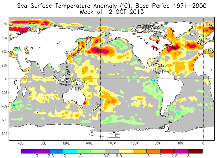
While El-Nino a very important factor in determining winter conditions, it is certainly not the only one. The record cold and snow of last winter was caused in part by warm SST’s in the North Atlantic which caused ridging over Alaska and subsequently pushed cold air into the Eastern US.

SST 2013

Here are the SST anomalies for October 2-9th 2013. Notice the pool of warm water in the North Pacific east of Japan. This pool of warm water moved slowly east and spent most of the winter sitting off Alaska. This winter, a similar setup is underway except the warm pool is already firmly parked off of Alaska and is much greater in size and strength.

SST 2014

SST anomalies from October 8-15th 2014. Notice the expansive area of warmer-than-normal SST’s near Alaska. I see this as a big red flag that supports cold outbreaks this upcoming winter.

Current Snow Growth

Believe it or not, it is already snowing hard across the high latitudes of the Northern Hemisphere. Lets take a look at the snow growth this year compared to years past.

snow growth

These maps represent October snow cover over the last six years. Notice that we are WAY ahead of schedule this year. Compare that to years past and notice that last year’s snowy winter was preceded by similar snow growth over the Northern Hemisphere. The warm and not snowy winter of 2011-2012 was preceded by well below normal snow growth.

smow growth anomoly

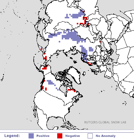
Here is the snow growth anomaly for 10-17-14 (the latest image available). Notice the above normal snow growth over Siberia and west-central Canada and below normal snow growth over Alaska. Also important to note is the below normal snow growth on either side of Greenland (Greenland isn’t shown because, for now, there is still snow there all year round). This pattern, along with the SST anomalies we talked about earlier favor western ridging like last year and a blocking high over Greenland (What prevented last winter from being even snowier was the quick storm motion caused by lack of blocking). The setup outlined here does in fact favor a snowy winter for New England.
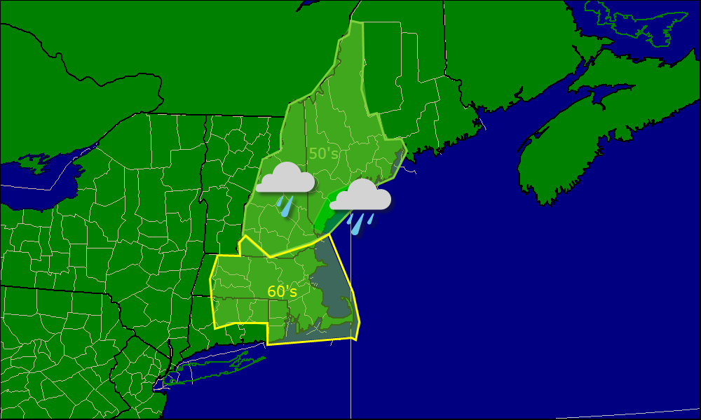
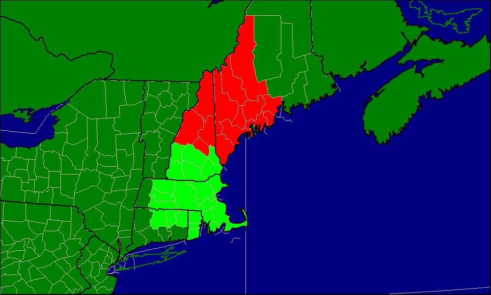
NOAA’s Take

noaa temo

NOAA precip

I want to end with the official forecast from NOAA’s Climate Prediction Center. I agree with them for the most part however I think they are basing their forecast too much off of El-Nino. While at least a weak El-Nino looks likely now, remember, it wasn’t too long ago when forecasts called for a ‘Super El-Nino’ to develop this winter.

My Forecast

Based off of the information I have presented above, I think that we will see a near normal winter in terms of temperature – El-Nino should keep the bitter cold mostly in Canada – and a slightly above average winter in terms of snowfall. The CPC outlined their concern for an active Atlantic storm track in their precip outlook and I wholeheartedly agree. While I doubt this winter will be a record-setting one for our area for cold temps, I equally doubt its potential to be warm and snowless.

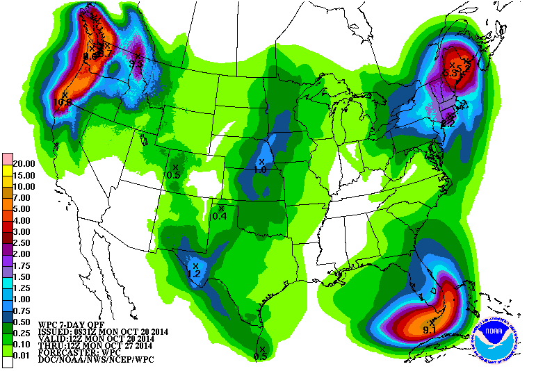
The active Atlantic storm track and the blocking pattern is already kicking into high gear with a nor’easter on tap for most of this upcoming week. I’ll try to get an update out tonight but if not, count on it tomorrow morning.

-Jack


Showers clearing out

Hello everyone!

Today will feature a wet start for some areas mostly North and East of Portland but all should dry out by midday or a little after. Temps will not be much cooler on the backside of the front so highs today will be near 70 – even at the coast. Sunny skies is expected over southern areas this morning slowly spreading northward.

Today 10-17


Rain has moved out of the Western half of the area but there is definitely some more to come for Eastern areas.

Friday morning forecast map 10-17


7 day 10-17 n


7 day 10-17

-Jack


PM storm update

Hello everyone!

The storm system that has been discussed for the past few days is well underway across the region this afternoon. One big change from this morning is that due to more moisture than expected being advected into the region as well as a slightly slower than anticipated forward motion of the front, rainfall amounts have been increased to widespread 2-3″ with isolated 4″ possible. With the increase in expected rainfall, flooding will also be more of an issue than anticipated. For this reason, the NWS has issued a flash flood watch for the GYX CFO (Southern Maine and most of NH). Flash flood warnings are also up for parts of NH.

gyx warnings 10-16


Watches and warnings from GYX as of 4:45PM Latest: http://www.weather.gov/gyx/


bog warnings 10-16

Watches and warnings from BOX as of 4:45PM Latest info: http://www.weather.gov/box/


PM update 10-16


Radar as of 4:45PM. Eastward progression of rain has been behind schedule on both ends (onset and finish) and combined with slightly more moisture than anticipated, 2-3″ of rain is expected vs this morning’s 1-2″ forecast.

-Jack


Getting ready for rain today

Hello everyone!

Today will not be the most pleasant of days here in New England as a front approaches from the west. Precip is already falling in western parts of NH and MA. Out ahead fo the main line, drizzle and fog can be expected along with a cool onshore wind.

The main line of storms should take most of the day to work in from the west but when it does, heavy rain and gusty winds are likely with embedded thunder possible as well.

7 day 10-16


7 day 10-16 n

Some snow-yes, snow showers are possible in the mountains on Sunday. Winter is coming!

precip onset

Here is a map showing when I expect precip to overspread the area from the main line.  As you can see, it will take quite a while for the line to reach eastern areas but when it does, it will rain very hard.Today 10-16

Here is the radar image from this morning. Notice the ares of precip circled in red, that is drizzle that will be affecting the area until the main line comes.

Thusday morning forecast map 10-16

-Jack

More clouds and a tad cooler today

Hello everyone!

Today will feature mostly cloudy skies across much of the region with some drizzle possible in CT and RI. Some extended sunny breaks are possible in the Maine mountains. For the rest of us, lots of clouds are expected. A sunny break or two cannot be ruled out but more clouds than yesterday for sure.

7 day 10-15 n

7 Day forecast for Northern zones (see below for which areas are North and which areas are South)7 day 10-15

7 Day forecast for Southern zones (see below for which areas are North and which are South)N vs S

This map shows which areas are covered in each respective forecast. Green is covered in the ‘South’ forecast and Red in the ‘North’. Wednesday morning forecast map 10-15

Forecast map for today: Note lots of clouds and the chance for a sprinkle or two in CT and RI.

-Jack

Temps warm as SW flow takes over

Hello everyone!

Today will feature Mostly cloudy skies across the region as a weak warm front crosses the area and brings more clouds and warmer temps. As you head out the door this morning, you will find the temperature to be several degrees warmer than Sunday’s high temperature. Current temps are in the 60’s now and for that reason, we should have not problem reaching 70 today across most areas even without the help of the sun.

Today is the debut of the new graphics I have been working on however the operational functionality is still being tweaked. I expect to do two 7 day forecasts one for northern areas and one for southern.

7 day 10-14

Here is the 7 day for the region. If you think the temps are a little vague, I expect that doing two forecasts for the region should help.Today 10-14

Here is a more detailed look at today. I expect this to replace the map feature soon.

Tuesday morning forecast map 10-14

Here is the map feature for the new geographical area.

Here is a recap from Yesterday on the new area I will focus on for forecasting this fall and likely beyond.

I have always been a little vague in terms of which areas I have been forecasting for. With the addition of the map feature, I have narrowed things down to New England. This fall, I will narrow things down even more to the NWS WFO’s of Gray and Boston.

Sillin WFO


-Jack

Warm and humid this week

Hello everyone!

We have an interesting week weather-wise to look forward to as a slow-moving storm system approaches from the west. We will be stuck in the warm flow ahead of the storm so expect above average temps and humidity.

Expect rain to overspread the area from west to east Thursday into Thursday night. Heavy rainfall and embedded thunder is expected as deep tropical moisture surges north from Hurricane Gonzalo.

Only a slight change in terms of air mass is expected Friday before another front brings a seasonable air mass into the region for the weekend.

More updates tomorrow AM.

——————————————————————————-

Experiments this fall:

I have been working hard on a new graphics system which will debut tomorrow morning. This means that the current map system will go under review this fall and I may decide to do away with that system if the new graphics prove to be better.

I have always been a little vague in terms of which areas I have been forecasting for. With the addition of the map feature, I have narrowed things down to New England. This fall, I will narrow things down even more to the NWS WFO’s of Gray and Boston.

Sillin WFO

Here are the areas I will be forecasting for this fall. If things work out, no changes will be made going into winter.

-Jack

Fair weather day today

Hello everyone!

Today will feature reasonably nice weather with varying degrees of cloudiness. The mountains will see the most clouds, and the coast will see the fewest. Temps will be cool for everyone with highs only getting into the 50’s for a good chunck of the area.

Friday morning forecast map 10-10

-Jack