
Hello everyone!
Lots to talk about this morning as low pressure works its way through the region. Expect a rainy day across coastal areas with a brief period of snow right about now. No snow accumulations are likely at the coast although 1-2″ of rain is expected along with winds gusting over 30mph. Anywhere south of Kittery Maine with the exception of the Berkshires sees all rain and parts of SE MA could see over 2″ of rain. A rumble of thunder is possible on the Cape with wind gusts near 60mph.
Inland areas are where things get trickier. Cold air is firmly in place as we saw with yesterday’s cold temps and light north winds at the surface will cause even more cold air to drain southward. Overhead, this pattern doesn’t exist. Warm air is free to surge into the region a few thousand feet above our heads and turn the snow over to sleet, freezing rain, and then eventually rain. Snow accumulations of 1-3″ are likely before things start changing around.
For the Mountains, a good period of snow is expected this morning before warm air infiltrates this area. Expect 3-6″ of snow this morning before changing over to sleet, freezing rain, and eventually rain. After the cold front moves through tonight, expect much colder air to arrive along with upslope snow showers.
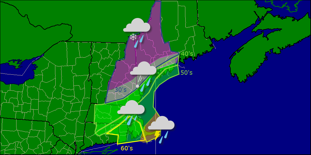
30’s and snow and 60’s and thunderstorms within a hundred and fifty miles of each other. Only in New England.
-Jack
