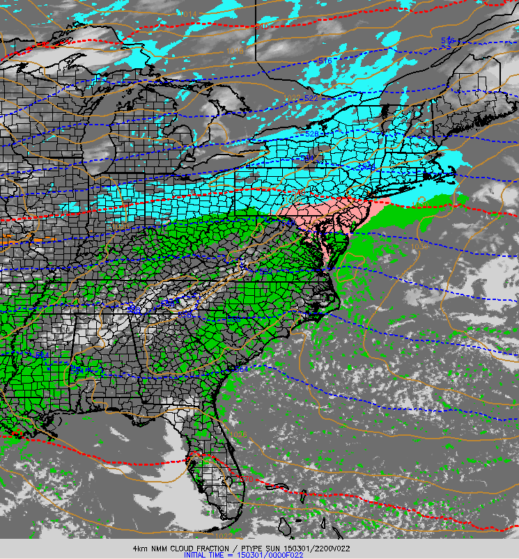
Quick update this evening on our light snow event that is beginning across the region currently and will continue through early tomorrow morning. Light snow is beginning across southern and western areas right now and will continue to spread east this evening. Since the atmosphere is quite dry at the moment, expect some of the radar returns shown below to not be making it all the way to the ground.
Expect snow to continue through the night tonight before ending early tomorrow morning. Clearing skies can be expected tomorrow along with NW winds and cooler temps. Details on tomorrow’s forecast will come in tomorrow morning’s forecast update.
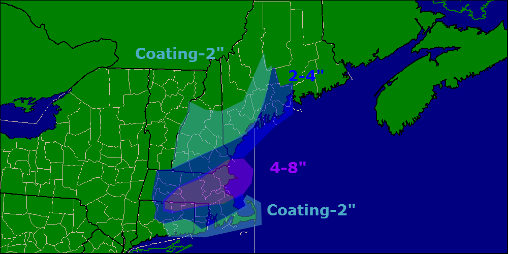
Just a few minor changes to the snow map this evening, highest snow totals look to be south and east with this one yet again. Another storm heads our way midweek with a warmup too.
Happy meteorological spring!!* Today will feature increasing clouds in the morning followed by clouds and increasing snow in the afternoon/evening hours. Expect all areas to see clouds by around 9 this morning while snow should wait until after 3 this afternoon.
Temps this morning are anywhere from the 10s below zero to single digits above zero warmest where light breezes still blow. Check out yesterday’s post for an explanation on why that is. Temps will rebound quite well today into the lower 20’s north and higher 20’s south.
NAM Model Showing Precip Moving Into The Area At 5 This Evening
Total snow accumulation thoughts have not changed much since last night and it still looks like the Boston area will pick up the most snow. Last night’s snow accumulation map still represents what I think will pan out in terms of total snowfall.
Another batch of precip arrives Wednesday, more details later.
-Jack
*Rules and restrictions apply, see Florida for details 🙂