
Hello everyone!
We’re still on track to receive a sizeable storm tomorrow as low pressure moves up the coast. The trends this afternoon have been towards low pressure being slightly farther east which would mean slightly cooler temps along with slightly less total precip. Overall, this leads to little shift in terms of how I think things play out but there are a few important differences. These differences mainly revolve around how things play out at the coast and just inland.
Looking at observations this evening, the forecast mainly looks good. A coastal front is forming across York County and will continue to sharpen up as low pressure develops offshore. The GFS shows this well. Keep in mind, models have had a very difficult time with this storm so don’t take any of the model graphics I post verbatim. They’re just to illustrate an idea not an exact figure or forecast.
Temps on the warm side of the coastal front are already above freezing over Coastal York county. Winds are off the water there and thus temps will continue to rise through the evening. Wherever that sets up, look for rain on the SE side and snow/freezing rain on the NW side. As always, snow amounts could be bumped up a few miles NW of the front as clashing warm and cold air will increase lift/forcing.
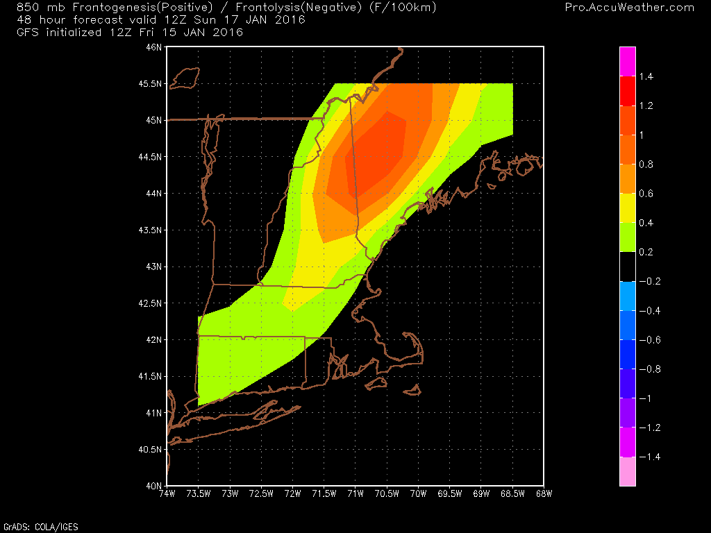
While dynamics don’t look crazy for this event, there is modest forcing for heavy precip tomorrow morning through midday. As this map shows, bands are likely to extend well into the mountains. Don’t worry at the coast, precip will be moderate to heavy there too but driven by different factors. The heavy precip will assist in dynamic cooling which will further assist cold air in moving southward tomorrow midday. I think everyone sees accumulating snow tomorrow afternoon/evening even areas that see rain for most of the event.
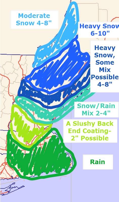
I’m sticking with my snow map for now as I don’t have the flexibility for adjustments and it still looks good. The jackpot will fall in the southern mountains and northern foothills with lesser amounts north and south. The one area to watch for higher amounts will be the southern end of things towards the coast. There is more liquid available at the coast but less cold air. If the cold air can show up, that extra QPF (Quantitative Precipitation Forecast) could allow for bust potential.
I’ll have updates when I can this evening on Twitter and another blog update will arrive tomorrow morning.
-Jack
