
Hello everyone!
A powerful storm is bombing out over the ocean near the Carolinas this evening and we will be on the far western edge. At the same time, a complex upper low is diving SE across the upper Midwest. They will form a connection of sorts that will transport warm moist air over the cold air moving in tonight following today’s cold front.
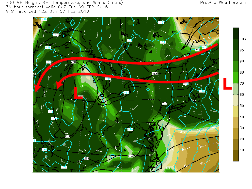
The coastal monster will stay mainly offshore but it will throw a ton of moisture back to the NW. There is a clipper to the NW which is ready to receive this moisture and will help draw it back NW. Bottom line: there will be a feed of moisture over the area tomorrow as moisture from the coastal low gets pulled back into the clipper. If you watched my video discussing the Friday storm, you know that we need three things for snow: moisture, cold, and lift. We got the cold today with that Arctic front and above is the moisture. The problem though is the lift.

As the warm air providing the moisture rises up and over the cold air at the surface we got today, it will rise, cool, and condense into precip. Sometimes, this mechanism for forcing (getting air to rise) can be quite effective in producing heavy precip. Not so much this time. If you’ve followed along for a while, you’ll know that I use Vertical Velocity to show how much air is rising and thus how heavy precip will be. In the big storms, you’ll often see bright purples and reds (notice scale on right of image). This time, we see yellows and oranges. This is indication that there will be less mesoscale banding and more broad lighter precip. Therefore, look for lighter snow though it will last long enough for fairly heavy accumulations.
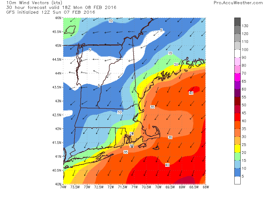
This snow will be light and dry which is nice for shoveling but will be unfortunate because the gusty winds will have no problem blowing around the light, fluffy snow. For this reason, expect blowing and drifting snow to cause visibility issues especially tomorrow afternoon (map valid 1PM tomorrow). Winds are likely to range from near calm in the mountains to over 30mph at the coast.

Here’s what I expect in terms of total snowfall. Keep in mind, this falls over a near 30 hour period from late morning tomorrow through Tuesday afternoon. Slow and steady is the name of the game for this one.
I’ll have more updates tomorrow.
-Jack

Thanks for the update