Bitter Cold This Weekend With Snow Threats On Either Side

Hello everyone!

The coldest air so far this season and the first real Arctic airmass arrives in Maine this weekend and on either side of it we have storm threats. Lets start with the first one which is on Saturday as the bitter cold moves in.

12Z GFS Showing The Setup For Possible Snow Saturday. Image Credit: Weatherbell
12Z GFS Showing The Setup For Possible Snow Saturday. Image Credit: Accuweather

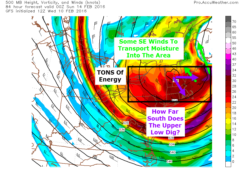
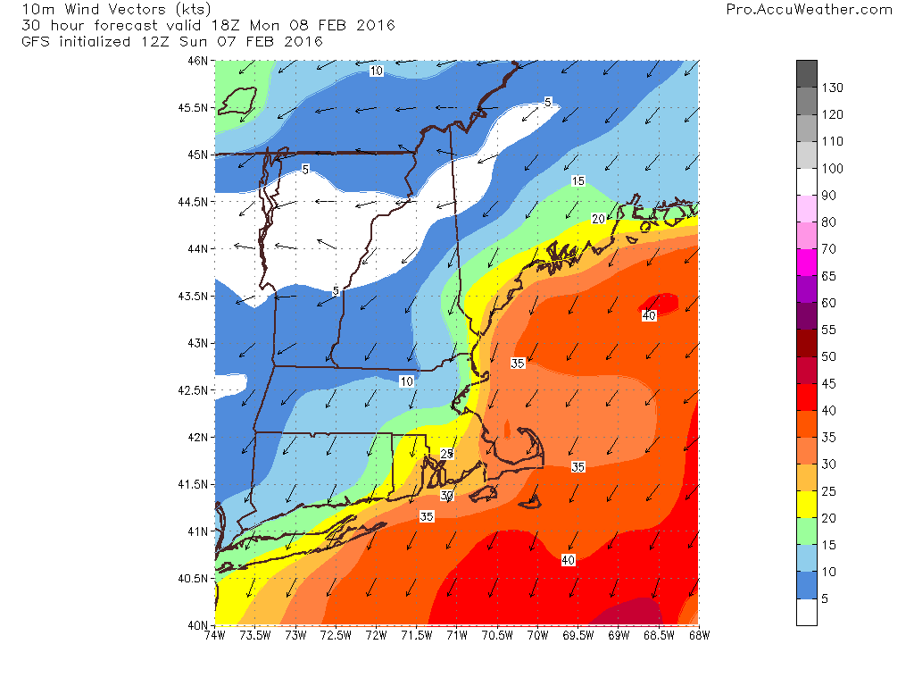
The cold front that actually delivers the bitter cold air moves offshore Saturday morning and sets up cold NW flow over the area Saturday. Meanwhile, warmer air (relatively speaking) lurks offshore. This boundary will wrap around the eastern side of a powerful upper low that moves to out south. How far west that boundary gets and exactly where it sets up are the two big questions with the forecast this evening. Right now, the midcoast has the best chance to see a solid snowfall out of this event. 4-8″ are possible there. Amounts drop off sharply to the west where a coating-2″ is likely with squalls similar to those today though probably more widespread (Portland likely shares the goods with the rest of us more evenly). Winds will be busy though the whole event so blowing, drifting, reduced visibility, and all the other standard impacts for wind-driven fluff are likely.

18Z GFS Showing Dangerous Cold Sunday Morning. Credit: Weatherbell

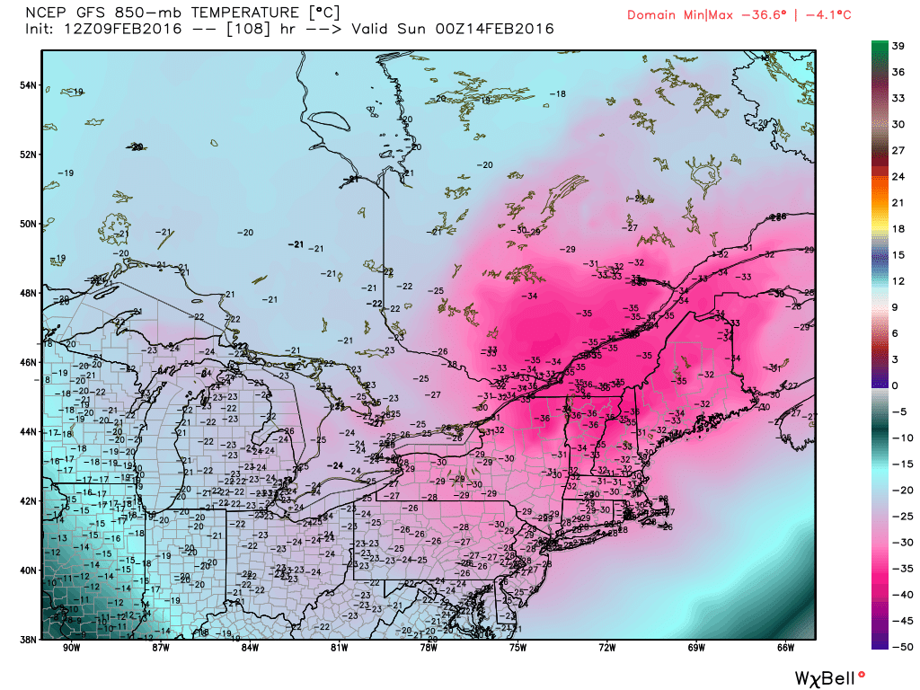
Following this storm, bitter cold arrives for Sunday. Wind chills of 50-60 below are possible in the mountains Sunday morning as temps fall well below zero and NW winds howl. More blowing and drifting snow is likely during this time. For the first time on Sunday, it will truly feel like winter in Maine. For those winter haters out there, don’t worry, El-Torcho comes back to some extent on Tuesday as low pressure either passes over us or to our west.

gefs_slp_lows_nwatl_23
12Z GEFS Showing An Inland Track Is Currently The Favored Solution. Credit: Weatherbell

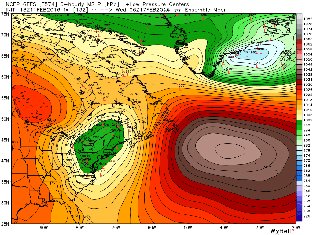
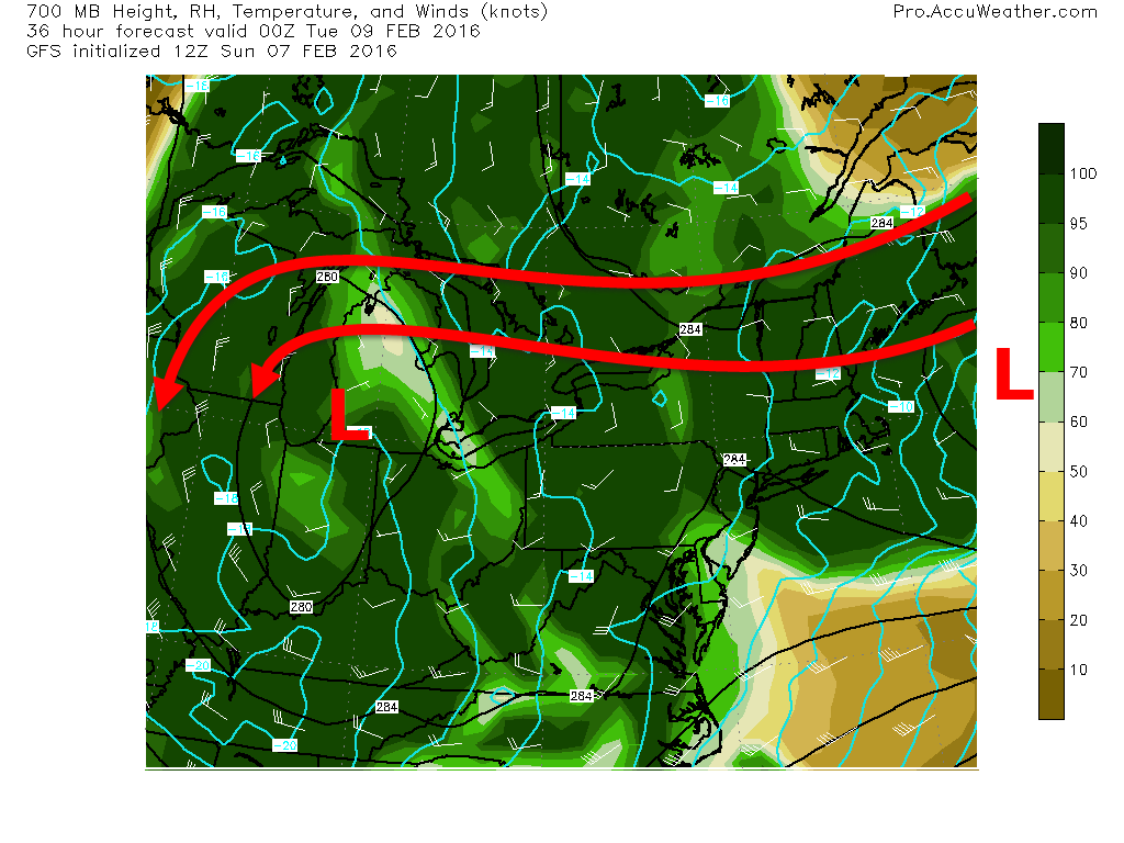
The current thinking is that a storm forms on the back side of the bitter cold and moves either over us or to our west, leaving us with a messy storm rather than straight snow. However, notice the individual solutions (little red ‘L” markings) range from out to sea (the one by Nova Scotia) to snow (the cluster off the coast) to a mix (the ones over us) to rain (the cluster well west). All possibilities remain on the table at this point though some sort of mix is most likely.

I’ll have more updates tomorrow.

-Jack

A Tale Of Two Cold Fronts Today

Hello everyone!

Today will feature a mainly sunny start with fairly mild temps as cold front number one clears the coast, removing the moisture from last night (not that there was that much of it). Cold front number two blasts south today bringing the chance for heavy snow in the form of snow showers and squalls. A coating to as much as 2″ of accumulation is possible where these squalls form.

HRRR Model Giving A General Idea Of What To Expect In Terms Of Squally Weather This Afternoon. Credit: Weatherbell

Here is the general idea of how things play out this afternoon. Don’t take this too literally in terms of exactly who gets a burst of snow but know it’s definitely possible especially in southern areas. Heavy snow could briefly cause low visibility and slick up roads for the evening commute.

-Jack

Bitter Cold Moves In This Weekend, Snow Possible Out Ahead Of It

Hello everyone!

Another update this evening looking at a bitter cold blast this weekend which will be bookended on either side by snow threats. Let’s start with the snow threat on the front end of the cold air which arrives Saturday.

Saturday Snow

12Z GFS Showing Saturday's Setup
12Z GFS Showing Saturday’s Setup. Image Credit: Accuweather

Saturday’s storm threat really hinges on how far south an upper low digs and how fast its attendant surface low develops. Right now, Downeast areas look best in terms of everything pulling together in time for a sizeable snow event. Here in Western Maine, I think this is more of a one and done blast where a quick several inches are likely to fall. The timing on this would be later in the day on Saturday though the details are still to be ironed out.

Sunday Cold

12Z GFS Showing Dangerous Cold Sunday Morning. Credit: Weatherbell

The core of the bitter cold arrives Sunday with dangerously cold temps on the order of lows around 20 below in the north, 10 below in the south. Highs likely don’t make it to 0 in the mountains on Sunday while the coast struggles to 10 above. Wind chills will remain in the -40 to -20 range region wide Saturday night into Sunday. Yeah, this is the real deal.

Next Week Storm Chance

12Z GEFS Showing The Threat For A Snow Event Next Week
Yesterday’s 12Z GEFS Showing The Threat For A Snow Event Next Week. Credit: Weatherbell

As the coldest of the cold retreats early next week, the door is open for more snow. My thoughts on the threat remain unchanged from Yesterday and current solutions range from ice/rain to out to sea. Here’s the graphic I posted yesterday evening that shows the spread as well as which scenario has the most credibility as of now (the snowstorm scenario). This is still a while away so things will definitely change. Be sure to stay updated as to the latest forecasts.

More updates tomorrow.

-Jack

Scattered Snow Showers/Flurries Today

Hello everyone!

Today will feature mainly cloudy skies and the chance for snow as a weak storm passes offshore and drags behind it an inverted trough. All the storms in play here (clipper, redeveloped coastal, upper level) are quite weak and disorganized so the snow will be as well, arriving in the form of light snow showers/flurries. Accumulations will generally remain under 2″ with the exception of the mountains and possibly the midcoast where up to 3″ could fall. Highs will range from the low to mid 20’s north to the low 30’s south.

-Jack

A Cold And Unsettled Week Ahead

Hello everyone!

I thought I’d take a minute this evening to go over the next week or so of weather taking a quick look at what to expect. This will be a tale of a classic New England winter with snow, bitter cold, and the potential for a sizeable storm. Let’s start with the light snow which arrives tomorrow.

Light Snow Tomorrow 

12Z GFS Outlining The Light Snow Threat Tomorrow. Image Credit: Weatherbell

A storm will pass well offshore tomorrow but an upper low still lurks to our west. Much like with our last storm, there will be a moisture transfer between the two storms. However, both storms will be weaker this time around especially the offshore storm (weak wave compared to powerful bomb). Therefore, the same concept applies but with less snow. Spotty snow showers will impact most but they will be hit or miss. The midcoast could get brushed with a bit of steadier light snow. A coating-2″ is forecast for everyone but 3″ is possible in the mountains and along the midcoast.

Bitter Cold For Valentines Day

12Z GFS Showing VERY Cold Air Over The Region Sunday. Credit: Weatherbell

An Arctic front blasts south Saturday and frigid winds bring in very cold air behind it. Lows Sunday morning are likely to drop well below zero into the 20’s below up north and the 10’s below in the south. The map shows temps at 5,000 feet so don’t panic with the -30C temps across Maine but do realize this is the real deal with dangerous cold on Sunday. Highs on Sunday will struggle to get above zero across Maine and New Hampshire and probably won’t in the mountains. The coldest air arrives just in time for Valentines Day so plan accordingly. Thankfully, the brutal cold moves on heading into next week though it does leave us a parting gift in the form of a storm threat.

Snow Threat Returns Next Week

12Z GEFS Showing The Threat For A Snow Event Next Week

As the bitter cold retreats, a storm will likely try to form somewhere. At this point, all solutions are on the table from Rain to OTS though the general consensus is for some type of snow event. This is too far out for specifics but just know that at some point in the middle of next week, there could be a snow event.

I’ll have more updates tomorrow.

-Jack

Light Snow Departs This Morning, Cold Temps Don’t Go Anywhere

Hello everyone!

Today will feature morning snow as our storm pulls away. Look for only another dusting to as much as an inch more in terms of accumulation. Highs will struggle to hit 20 up north with mid 20’s south. Clouds look to stick around though as another storm organizes to our south and passes well offshore. No impacts are expected from that. Our next chance for significant snow arrives late week into next weekend out ahead of a powerful Arctic blast.

-Jack

Snow Continues Tonight, Departs Tomorrow

Hello everyone!

Snow is currently falling across the region with light to moderate being the dominant intensity. Look for this to continue through the night along with high winds that will blow the snow into a low visibility, drift inducing frenzy. Amounts in your front yard will range from 0-24″ when drifts are included. The actual amount of snow that will fall from the sky is likely to be in the 4-8″ range along the coast and in the 2-4″ range inland though with drifts, amounts will be far different when you look outside tomorrow morning.

HRRR Model Showing The Evolution Of Light Snow Tonight Through Early Tomorrow Morning. Credit: Weatherbell.

Here is the HRRR model with a general idea on the evolution of the snow through tomorrow morning. I suspect it may be a little quick to shut off the snow as the upper low to our west will be eager to continue pulling in moisture. I think mid to late morning is a more reasonable stop time with drying from SW to NE.

Snowfall amounts from last night still look good with 4-8″ for most, 2-4″ in the mountains.

Check out last night’s post and this morning’s post for more info. That information still applies as the storm is progressing as forecast.

Snow showers are possible throughout the week as waves of low pressure develop well offshore. Another chance for respectable snow arrives early in the weekend next weekend followed by a blast of truly Arctic air early next week.

-Jack

Prolonged Light Snow On Track Today

Hello everyone!

Everything is lining up as forecast and a long duration light snow event is likely today. Snow looks to arrive around noon here in Maine, a little earlier along the coast, and a little later inland towards the mountains. Not much has changed since yesterday in terms of expected snowfall. I still think the coast has the best shot at hefty snowfall amounts. Keep in mind, snow will be able to accumulate quite efficiently despite snow never falling that heavily. The good news with the light snow is that it will be easily moved by your shovel. The bad news is that it will be equally easily moved by the strong winds today that will gust along the coast to near or over 30mph. As a result, expect blowing and drifting of the snow not only that is just falling, but also of the 6″+ of snowpack most coastal areas have left over from Friday’s storm. This is likely to cause visibility issues especially for the evening commute.

HRRR Model Showing Heavy Snow Remaining South But Light Snow Impacting Maine Today. Credit: Weatherbell

Here is the HRRR model just to give you an idea of how the storm plays out in general. Don’t take it word for word in terms of individual bands or timing down to 15 minutes but look at it to get the general idea of the heavy stuff remaining south and the light stuff sitting over us for a while.

Temps today will be in the 10’s and 20’s.

Snow winds down tomorrow afternoon though snow showers will continue through Thursday as various pieces of energy rotate around an upper trough to our west.

-Jack

Long Duration Light Snow Event Arrives Tomorrow

Hello everyone!

A powerful storm is bombing out over the ocean near the Carolinas this evening and we will be on the far western edge. At the same time, a complex upper low is diving SE across the upper Midwest. They will form a connection of sorts that will transport warm moist air over the cold air moving in tonight following today’s cold front.

12Z GFS Showing Mositure Connection Between Clipper And Coastal Storm. Image Credit: Accuweather

The coastal monster will stay mainly offshore but it will throw a ton of moisture back to the NW. There is a clipper to the NW which is ready to receive this moisture and will help draw it back NW. Bottom line: there will be a feed of moisture over the area tomorrow as moisture from the coastal low gets pulled back into the clipper. If you watched my video discussing the Friday storm, you know that we need three things for snow: moisture, cold, and lift. We got the cold today with that Arctic front and above is the moisture. The problem though is the lift.

GFS Model Showing Broad But Light Lift Tomorrow Evening
12Z GFS Model Showing Broad But Light Lift Tomorrow Evening. Image Credit: Accuweather

As the warm air providing the moisture rises up and over the cold air at the surface we got today, it will rise, cool, and condense into precip. Sometimes, this mechanism for forcing (getting air to rise) can be quite effective in producing heavy precip. Not so much this time. If you’ve followed along for a while, you’ll know that I use Vertical Velocity to show how much air is rising and thus how heavy precip will be. In the big storms, you’ll often see bright purples and reds (notice scale on right of image). This time, we see yellows and oranges. This is indication that there will be less mesoscale banding and more broad lighter precip. Therefore, look for lighter snow though it will last long enough for fairly heavy accumulations.

12Z GFS Showing Gusty Winds Tomorrow Afternoon. Credit: Accuweather

This snow will be light and dry which is nice for shoveling but will be unfortunate because the gusty winds will have no problem blowing around the light, fluffy snow. For this reason, expect blowing and drifting snow to cause visibility issues especially tomorrow afternoon (map valid 1PM tomorrow). Winds are likely to range from near calm in the mountains to over 30mph at the coast.

2016-02-07_18-36-01

Here’s what I expect in terms of total snowfall. Keep in mind, this falls over a near 30 hour period from late morning tomorrow through Tuesday afternoon. Slow and steady is the name of the game for this one.

I’ll have more updates tomorrow.

-Jack


Final Mild Day As Arctic Front Lurks

Hello everyone!

Today will feature more clouds especially north as an Arctic cold front powers through the region. To our north, Northern Maine has seen some fairly intense snow squalls with up to an inch of snow falling in under an hour. Dynamics in our area aren’t quite that impressive but low visibility or even brief whiteouts are possible in the mountains today with accumulations of a dusting to as much as 2″. Flurries could make it to the coast but as north west winds puck up, I expect downsloping to dry the air out enough so that flurries would be the most expected. Temps will range greatly across the region with the northern mountains not getting much above 25 as cold air drives south. Southern areas however are likely to see temps rise into the balmy category with highs in the low 40’s. Snow arrives tomorrow as a massive storm brushes by to the east. I’ll have an update on that this evening.

-Jack