
Hello everyone!
Today will feature mainly cloudy skies, warm temps, and gusty winds. Highs will rise into the mid to upper 50’s south and upper 40’s to low 50’s north. SW winds will be gusty today at times gusting to near 40 mph. A shower or two is possible this afternoon with the greatest threat being up north.
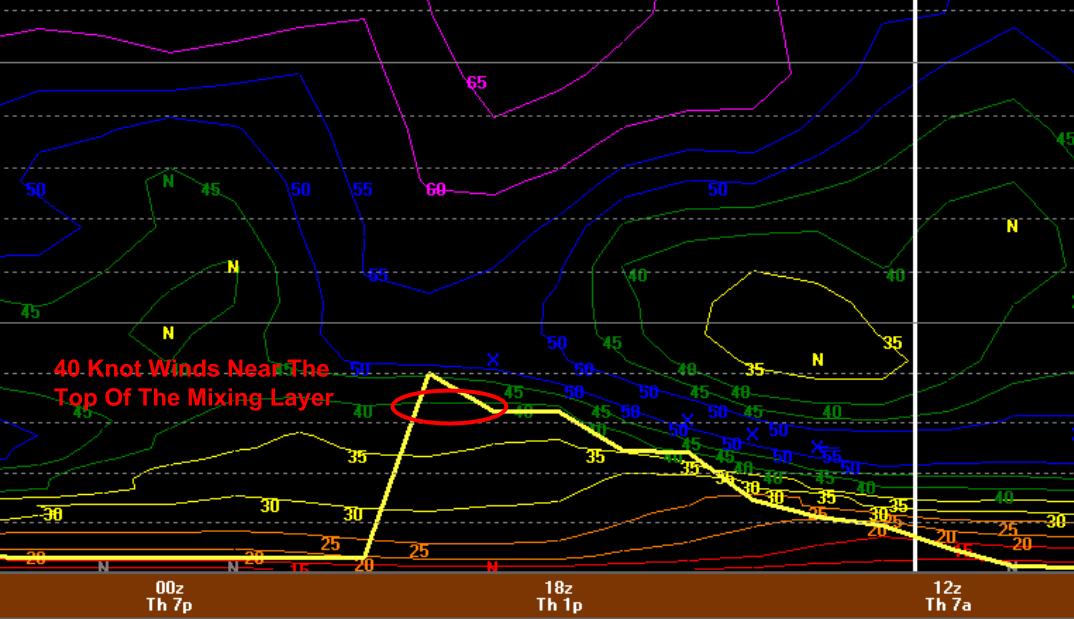
Here’s a quick look into wind forecasting. The yellow line marks the mixing layer. Any air below the yellow line is eligible to make it to the surface. The air at the top of the mixing layer this afternoon is moving at about 40 knots. Being in the mixing layer, this air (wind) could very well make it to the surface. A raw estimate using just this method indicates gusts to between 40 and 50 mph today. However, it’s hard to get full wind potential when the wind has been travelling over mountains and trees and buildings for the last thousand miles. Therefore, the forecast calls for 35-40 mph gusts.
-Jack
