
Hello everyone!
Today will feature mainly cloudy skies as we sit in between two fronts. The front from last night is stalled just offshore and a low is developing on its southern end just offshore of NYC. That low will scoot ENE today and we will be on its far northern fringe. It will bring the chance for showers this morning especially along the coast and across the southern half of NH. It will be moving out by early afternoon if not before.
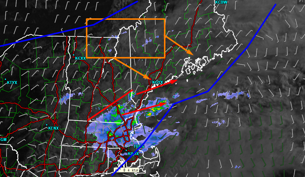
Here is the 7 AM observed satellite/radar along with surface winds to show the fronts. As you can see, there are showers across southern NH and far SW ME associated with the southern front/surface low. Also note, however, that there are a few sprinkles popping up ahead of another cold front that is drifting in from the west. These sprinkles will become more numerous as the day goes on with a few full fledged showers and possibly an isolated thunderstorm expected by afternoon.
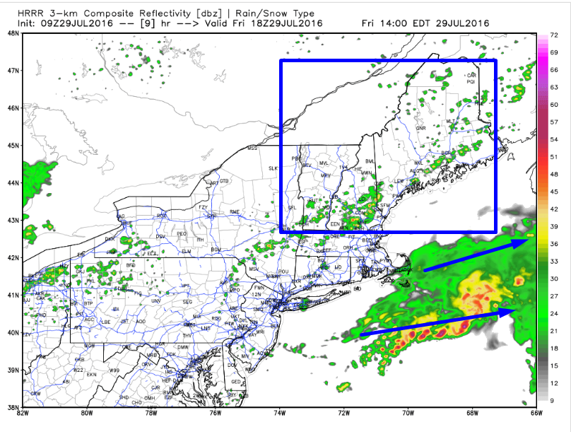
The HRRR model does a good job of showing the general setup this afternoon with scattered showers and storms across the area at 2 PM. Don’t look at models like this to determine exactly which town a storm will hit (that’s impossible), but do look at them to get an overall idea for what the setup is. In this case the setup favors scattered showers possibly with a rumble or two in the stronger cells developing mid morning and slowly drifting towards the coast by mid to late afternoon. Some sun is also possible this afternoon and into this evening especially in NW areas.
Highs will be sitting a few degrees on either side of 80 with fairly uniform temps across the area today.
More rain is possible at some point either late in the weekend or early next week. More on that as we get closer.
-Jack
