Hello everyone!
I will be embarking on a brief trip to the deep woods of Northwestern Maine this afternoon through Wednesday morning, so the next three days of weather information (today, tomorrow, Wednesday) can be found in this post as opposed to one per morning.
Today
Today will feature warmer temps, higher humidity, and the chance for some more pop-up showers and thunderstorms as a weak disturbance crosses the area ahead of a much larger frontal system over the Great Lakes. Expect high temps to range from 80 in the far north and along the Midcoast to a little above 90 in the typically warm spots of the interior. Dew points this morning are in the upper 60’s, which means this is officially a muggy airmass. As a result, heat index values will rise into the mid 90’s for southern areas, high enough to be concerning if you’re particularly sensitive to the heat.

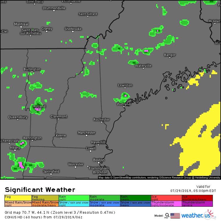
The muggy and warm airmass will provide fuel for some thunderstorms to pop up this afternoon/evening. As the model forecast above shows, not everyone will see precipitation, but those that do will receive a brief downpour and potentially a clap of thunder. Overall though, most places stay dry.
Tomorrow (Tuesday)
Tuesday will be the hottest day of the week as the cold front gets closer and pulls more warm air north ahead of it. Look for sunshine in the morning to heat things up well into the upper 80’s/low 90’s for all but the tips of the peninsulas (which will sit around 80-85). Dew points will remain in the mid to upper 60’s, which means more humidity and uncomfortably high heat indexes (likely 95-100 in southern areas). It also means more afternoon thunderstorms, though these are likely to be confined to the far NW mountains as well as western parts of New Hampshire that are closer to the front itself.
Wednesday
Wednesday will feature the passage of the cold front across the region, which means a reduction in the heat but a bump to both the humidity and our chances of thunderstorms. Dew points on Wednesday likely crack 70 along the coastal plain as temps rise into the upper 80’s/low 90’s. Farther north, the front will pass through earlier in the day meaning that temps will be lower than Tuesday. Highs in the mountains likely won’t get above 75-80.
Storms will develop in the north during the late morning hours and will slowly work their way southward through the afternoon. At the moment, it looks like there will be plenty of instability (fuel) for the thunderstorms, but not enough in the way of mid/upper level winds to be concerned about widespread severe weather. That said, all thunderstorms are capable of flooding downpours and dangerous lightning regardless of their capacity to produce severe criteria hail (1″ in diameter) or wind (gusts >58mph).
I will be back on Thursday morning with normal morning updates. If you’re looking for a sneak peek at the late week/weekend weather, it looks pretty great behind the front.
-Jack
