Hello everyone!
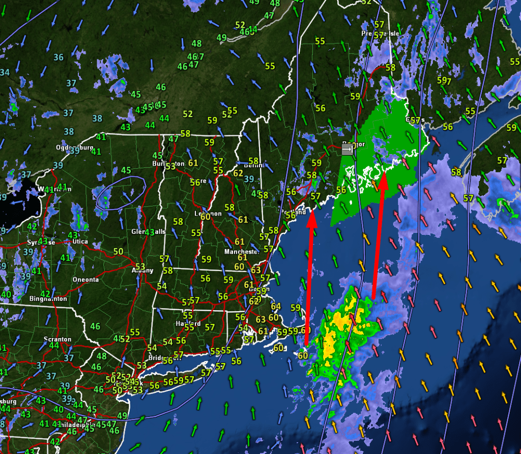
The storm that brought heavy rain to the region yesterday evening and knocked power out for nearly 100,000 of us last night is still producing unsettled weather across the area this morning. Winds are still gusty from the southeast, though not nearly as strong as last night. Rain is still falling, especially away from the coastline but is not nearly as heavy as yesterday afternoon. Temperatures this morning are anomalously warm, ranging from the upper 50s in much of Maine to the low 60s in NH. As an interesting footnote, this makes us the second-warmest part of the nation this morning, narrowly beating out southern California (low 50s) and coming in just behind the Florida Keys (upper 60s).

Radar imagery this morning shows light showers in progress over our area while a batch of steadier/heavier rain lurks east of Cape Cod. This rain will be pulled north this morning and may even try to retrograde back to the west a bit thanks to some interesting dynamics aloft.

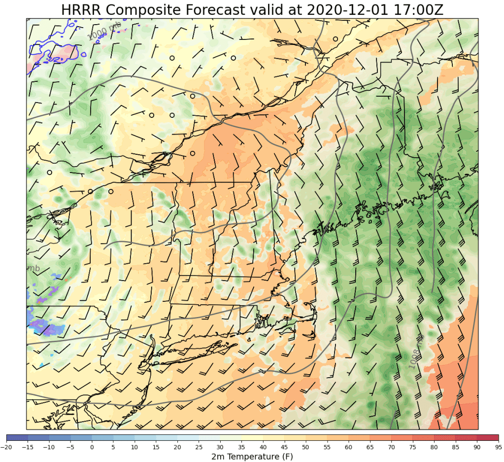
This forecast map does a pretty good job sketching out who will see the heaviest rain late this morning into early this afternoon. Points northeast of Brunswick/Augusta will get the steadiest and heaviest rain which will add up to another 0.5-1.5″. This is where the strongest winds will be found too, though gusts around 40-45 mph will do a lot less damage than last night’s 55-65 mph gusts. As you move farther west, winds will be considerably lighter and rain will take the form of more scattered showers rather than a steady soaking.
High temps today are pretty much happening right now, though temps might jump another couple degrees over the next couple hours before colder air arrives from the southwest. By 7 PM, temps will be falling into the mid 30s over NH, mid 40s over western Maine, and low 50s over eastern Maine. Much of the western half of the area will dip below freezing by tomorrow morning which could produce some slick spots on the roads as leftover moisture freezes up.
-Jack
