First Winter Storm of the Season Arrives Today

Hello everyone!

It won’t be a blockbuster blizzard, but the first real winter storm of the season is arriving today as low pressure tracks along I-90 from Buffalo to Boston. Precipitation will arrive in southwestern NH early this afternoon before spreading northeast into Maine closer to sunset. While temps will start out around or above freezing in most places, evaporational cooling should start just about everyone off with snow as a precip type except perhaps for the NH Seacoast.

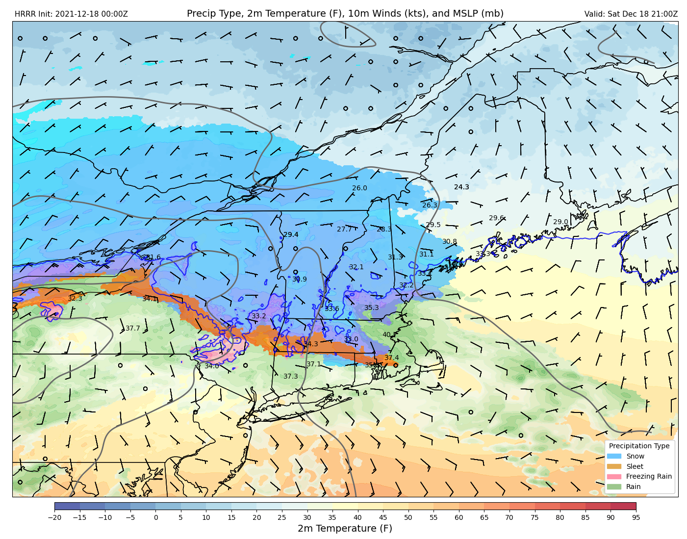
Here’s a forecast map valid at 5 PM showing snow falling across much of the area with just southern NH experiencing some rain as winds are a bit more onshore.

The steadiest and heaviest snow will fall early in the overnight period as the storm passes just to our south before beginning to taper off tomorrow morning.

This forecast map valid at 11 PM shows moderate to heavy snow falling across much of the area while a coastal front sets up south of Portland, introducing some sleet, ice, and rain.

As the sun comes up tomorrow, light snow will linger across most of the area and mixed precipitation over SE NH/coastal York County will change back over to snow. Not much additional accumulation is expected, but roads may remain slick until midday.

So how much snow are we talking?

Here’s a quick look at what I’d expect from this event in our area. The jackpot will, as usual, be the mountains of western ME and NH where colder air and better lift will set up more favorable snow to liquid ratios. Most of the ski areas should get a solid 8-12″ though if it were me I’d pick Sunday River over Sugarloaf for this storm.

For the rest of us, it’s looking like a general 4-8″ with lower totals in southern NH where sleet/ice will mix in and especially along the immediate coast where rain will enter the picture.

All in all this won’t be a big storm by our standards, but it will provide some much-welcomed snowcover as we get closer to Christmas.

-Jack

Colder Air Starts Returning Today

Hello everyone!

The mild air that invaded yesterday is taking a while to retreat, but westerly winds will be working hard all day to get the job done. With downsloping and sunny skies southeast of the mountains, temps will once again peak in the low to mid 40s, but temps will drop quickly after dark. Up in the mountains, overcast skies and closer proximity to cold air aloft will hold temps in the low 30s with scattered snow showers. Westerly winds will be quite gusty today especially in the foothills and mountains where some spots will make a run at 50mph. West is as good a direction for strong winds as it gets around here (it being our prevailing wind direction, trees have grown to be stronger in the face of westerlies) but a few isolated power outages are still possible.

The cold air moving in today will set the stage for the first plowable snow of the season tomorrow afternoon/evening. I’ll likely post a special update on that system tonight, but if not, details will be available in tomorrow morning’s update. Right now, it’s looking like most folks end up with around 4-6″, possibly a bit more in the hills of NH and far western ME, likely a bit less as you move farther north and east.

-Jack

Turning Milder Today

Hello everyone!

Today will feature warming temps and some unsettled conditions as a powerful storm moves well to our northwest. It’s starting out near freezing inland this morning where a mix of sleet and freezing rain continues to fall. If you’re out and about west of Augusta/Lewiston, leave some extra time to take it slow. Southwest winds pick up midday and should do a decent job scouring out the low-level cold, though there’s always the cold spots that hang onto near-freezing temps longer than any model expects. Most of us outside the foothills should top out in the upper 40s to mid 50s by this afternoon. Skies will be mostly cloudy though a few breaks of sun are possible in the west. After this morning’s round of rain/mixed precip things look fairly dry, though another line of showers will approach from the northwest this evening.

-Jack

Brighter and a Bit Cooler Today

Hello everyone!

Today will feature brighter skies and cooler temps as a weak cold front moves offshore. Look for highs ranging from the mid 20s up north to the mid 40s in SE NH. You’ll notice NW breezes especially this morning, but nothing should rise to the level of power outage concerns. A few clouds may advance into southwestern areas this evening but overall it will be a sunny day, unlike yesterday’s sneaky mid-level cloud deck.

-Jack

Mild and Mainly Clear Today

Hello everyone!

A weak storm system moving through central Quebec will place us once again in a warmer airmass today. With southwest winds and clear skies, look for temps to rise into the mid 30s up north and low to mid 40s down south. A stray snow shower is possible up in the northern mountains this evening but overall we should remain mostly dry.

-Jack

Freezing Rain Slowly Changes to Rain Today

Hello everyone!

A strong storm is once again advancing through the Great Lakes this morning which puts us once again on the wrong (warm) side of the circulation. Precipitation is moving in from the west this morning in the form of freezing rain/sleet away from the NH Seacoast where temps are warm enough for rain. The general idea is that everyone but the immediate shoreline will start off with enough ice to make travel slick this morning before the freezing line creeps slowly inland this afternoon.

With cold air damming setups like this, the safe money is on a slower-than-modeled transition from mixed precip to rain, and today appears to be no exception. With that in mind, I think the I-95 corridor probably won’t get above freezing until the early afternoon while the foothills likely retain subfreezing air and ice until the cold front approaches overnight. Total ice accretion amounts appear to range from a trace near the coast (still enough for slick travel!) to about 1/4″ in the foothills. That isn’t quite power outage territory, but as winds pick up overnight, a few folks could see the lights go out especially in the foothills.

Drier air will return for tomorrow.

-Jack

Quick Round of Morning Snow Gives Way to Generally Quiet Weather Later Today

Hello everyone!

Today will feature a round of light snow which is ongoing this morning before generally quiet weather takes over for the afternoon. Everyone saw some flakes this morning and precip has now tapered off southwest of Lewiston/Bath/Fryeburg. Any remaining accumulations will be on the order of a dusting to maybe an inch on colder surfaces. The disturbance powering this snowfall will depart to the northeast midday leaving quiet but mostly cloudy weather for this afternoon. Temps will rise into the low 40s over southern NH but as per usual the warm front will hit the brakes in the NH Foothills and at the Maine border. Most of Maine will see high temps in the mid to upper 20s (some parts of the Midcoast could burst into the 40s too) while the northern mountains stay locked near 20.

Another powerful storm will track to our west tomorrow bringing rain for the coast/CT Valley and freezing rain that will only ever so slowly change over in the foothills/mountains.

-Jack

A Bit Cooler Today

Hello everyone!

It’s hardly the bitter cold we’d hope to see this time of year but modestly chillier air is moving into the region this morning behind yesterday’s light snow event. Look for high temps ranging from the upper 10s up in the mountains to around freezing in far southeastern NH. Northwest breezes will keep the mountains under cloudy skies and some snow flurries today while the coast sees a mix of sun and clouds.

-Jack

Cooler and Quieter Today

Hello everyone!

Cold air is returning to the area today as westerly winds pick up behind last night’s cold front. Skies are mostly sunny across the area this morning, but mid/high clouds will return this afternoon ahead of our next disturbance. Temps will be seasonably cool, ranging from the low 20s up north to around 35 along the southern coast.

That next storm will arrive tomorrow with light snow, generally less than 1″ outside a few lucky towns right at the coast which may be able to scrape together 2-3″ if everything comes together just right.

-Jack

Messy Inland, Mild and Breezy Elsewhere Today

Hello everyone!

A seasonably strong storm is advancing up the Saint Lawrence Valley today which means we’ll dust off our inland cutter playbook including everyone’s least favorite hits “Baby It’s Icy Outside”, “Let it Rain”, and “It’s Beginning to Look a Lot Like April”.

The first will be most applicable inland this morning where reports are coming in of freeing rain, sleet, and even a little snow northeast of Farmington. Accumulations won’t amount to much, but your morning commute will be slow and slick regardless.

A break in the action arrives midday while southwesterly breezes pick up and lift coastal areas into the mid 50s. As per usual, warm fronts go to die over the hills of Northern New England this time of year so the foothill and mountain cool spots will crawl above freezing ever so slowly and probably won’t get much above 35. Warmer locales west of the higher summits will get into the mid 40s.

By sunset it will be time to let it rain as the storm’s cold front sweeps in from the west. Rain will arrive in western NH around 5 PM before moving into Maine around 6-7 PM. Embedded in this rain will be a line of decaying thunderstorms that could mix down some gusty winds and will finally scour out the low-level cold leftover from this morning in the foothills. A rumble or two of thunder is possible as well.

Winds flip around to the west behind these storms and the mountains will see rain change over to snow before drier air moves in. The higher summits could pick up a couple inches as upslope flurries continue into tomorrow.

-Jack