Hello everyone!
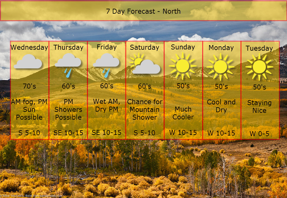
We have an interesting week weather-wise to look forward to as a slow-moving storm system approaches from the west. We will be stuck in the warm flow ahead of the storm so expect above average temps and humidity.
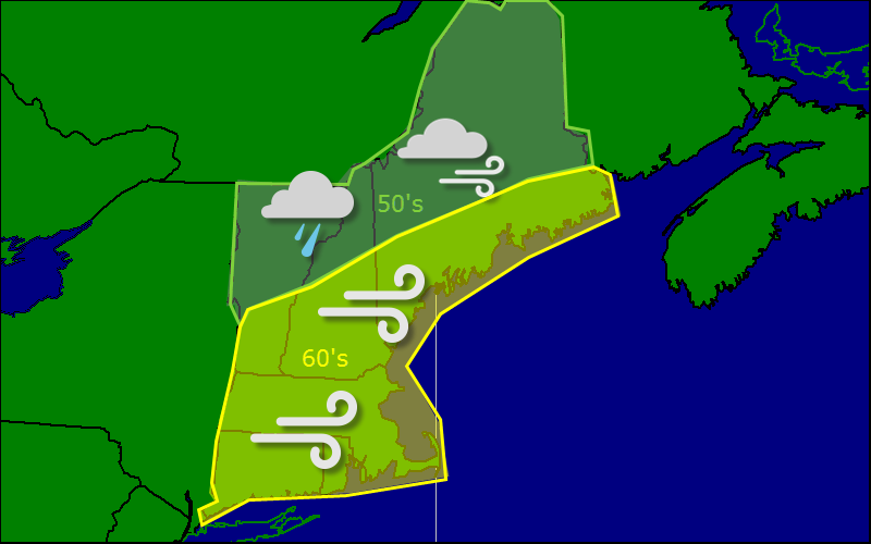
Expect rain to overspread the area from west to east Thursday into Thursday night. Heavy rainfall and embedded thunder is expected as deep tropical moisture surges north from Hurricane Gonzalo.
Only a slight change in terms of air mass is expected Friday before another front brings a seasonable air mass into the region for the weekend.
More updates tomorrow AM.
——————————————————————————-
Experiments this fall:
I have been working hard on a new graphics system which will debut tomorrow morning. This means that the current map system will go under review this fall and I may decide to do away with that system if the new graphics prove to be better.
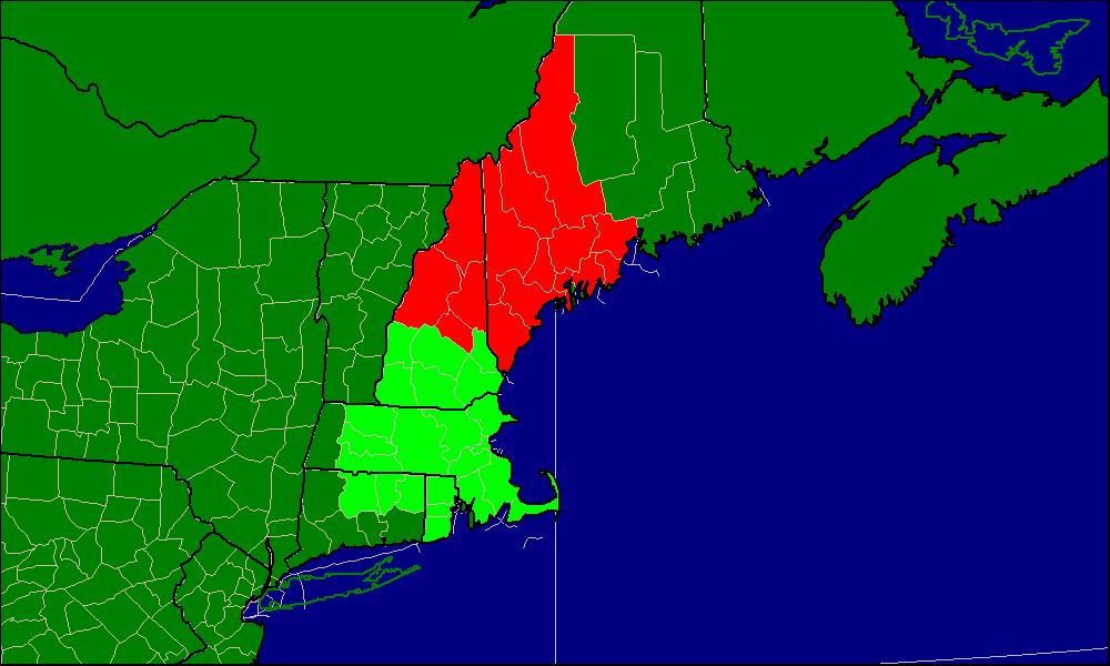
I have always been a little vague in terms of which areas I have been forecasting for. With the addition of the map feature, I have narrowed things down to New England. This fall, I will narrow things down even more to the NWS WFO’s of Gray and Boston.

Here are the areas I will be forecasting for this fall. If things work out, no changes will be made going into winter.
-Jack