
Hello everyone!
After last night’s explosive storm, we have an active pattern setting up for the next week and possibly beyond. The first storm will be a weak clipper tomorrow night that will bring light snowfall accumulations. The next storm will arrive Tuesday and will feature primarily freezing rain. After that, attention will turn to a potential coastal storm late week.
Saturday Night/Sunday Morning Clipper

Light snow will begin late tomorrow evening as a clipper approaches from the west. This will be a mainly snow event except for the midcoast where some raindrops are likely to mix in. Snowfall accumulations are likely to range from 1-3″ across most of the area with a little less (coatings) along the immediate midcoast and a little more in the mountains and across the Augusta region where 4 or even 5″ is possible. Snow and rain will move out Sunday morning with temps a few degrees on either side of freezing during the day Sunday.
Inland Runner- Tuesday
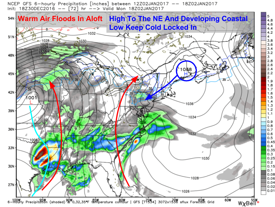
Our next system will arrive from the west on Monday night as high pressure begins digging in to our NE. Look for a brief period of snow at the onset especially away from the coast before freezing rain sets in. The exact duration/extent of the freezing rain is still TBD and those details will determine if we escape with just some minor icing or a more significant ice event. Both options are on the table given the placement of the high and the climatology of the area. More details should make themselves available soon. That storm will move out Tuesday night or Wednesday morning and may end as some snow if a coastal low develops like some guidance indicates.
Coastal Potential- Late Week

The final storm on the horizon at the moment is one that may impact the region late week. The details on this remain very uncertain as it is 7-8 days away but since it has the potential to be fairly impactful, I figured I’d give the heads up now that there’s something on the horizon. While my schedule will once again become very busy this week with school, I’ll do my best to get updates out on this system should it continue to look impactful.
More tomorrow.
-Jack
